Chance of thunderstorms on Monday in Philadelphia region; more storms come later this week
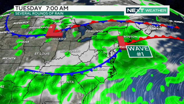
The chance for scattered showers and thunderstorms will increase Monday afternoon with periods of heavy rain possible.
Watch CBS News
The chance for scattered showers and thunderstorms will increase Monday afternoon with periods of heavy rain possible.
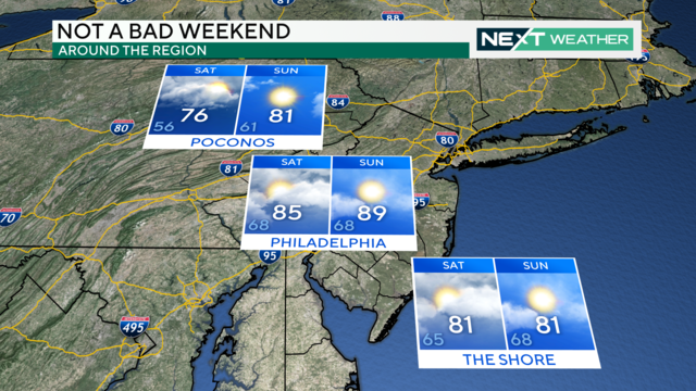
Saturday will feature cloudy skies with peaks of sunshine and the chance for isolated showers.
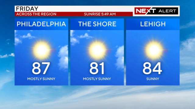
Friday is shaping up to be a magnificent July day in the Philadelphia region with comfortable temperatures and lower humidity.
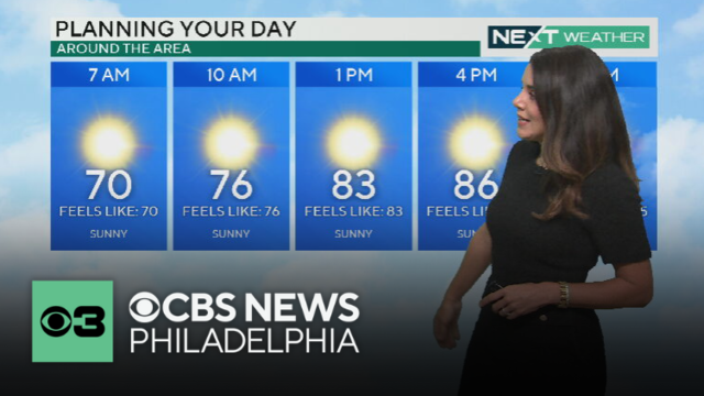
NEXT Weather meteorologist Kate Bilo says to expect low humidity and warm temperatures Friday afternoon across the Philadelphia region.
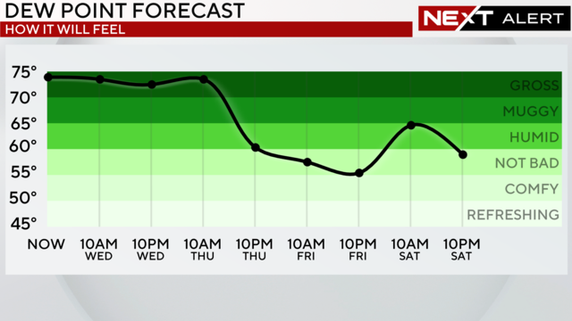
Severe weather is moving into the Philadelphia region Wednesday evening.
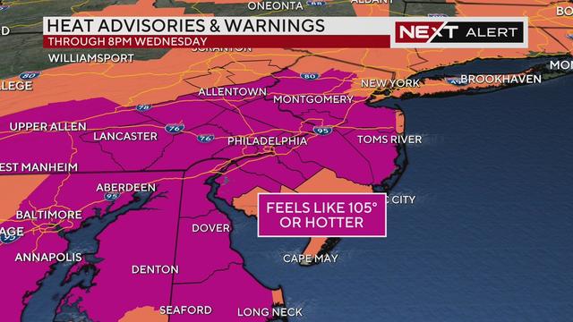
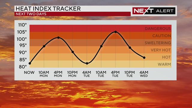
Tuesday will likely be the hottest day so far this year, and the air temperature itself may get to 100 degrees. There's also a chance for severe storms.
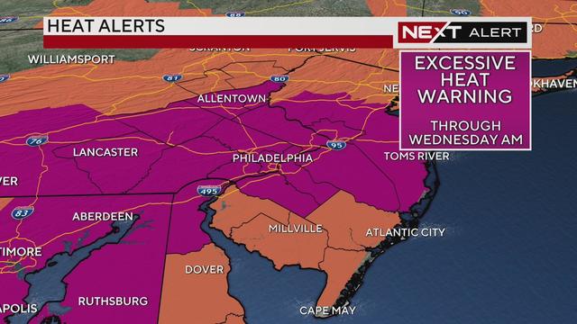
With high temps in the upper-90s and increased humidity, an excessive heat warning is in effect through for Philadelphia and the surrounding suburbs until Wednesday morning.
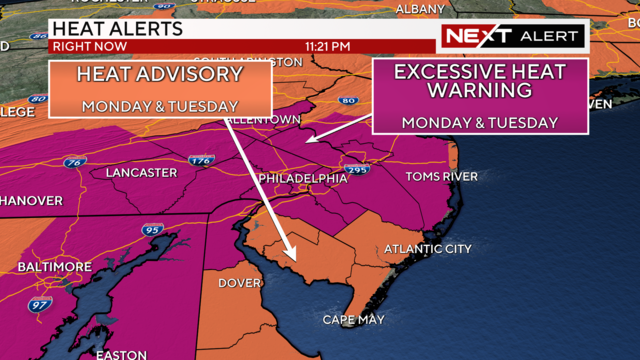
The searing heat is back again, with highs on Monday in the mid and upper 90s.
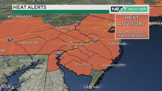
A heat advisory is in effect for the Delaware Valley until Tuesday morning. Temperatures during that time will feel like 98 to 102 degrees.
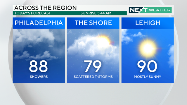
Saturday is off to a wet start with a flood watch in effect into the afternoon. But the Philadelphia area won't be totally washed out.
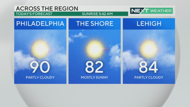
The heat wave will continue in the Philadelphia region on Thursday with another 90-plus day in the city.
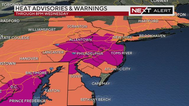
An excessive heat warning and heat advisory in the Philadelphia region ended on Wednesday night, but there's still a marginal risk for severe weather for parts of the Delaware Valley.
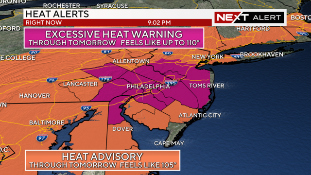
Tuesday will be the sixth day of the ongoing heat wave in the Delaware Valley. Highs will reach the mid-90s but the heat index will get up to 105 degrees.
A heat advisory is in effect through Tuesday, meaning the heat and humidity will combine to make it feel between 100 and 102 degrees across the Delaware Valley.
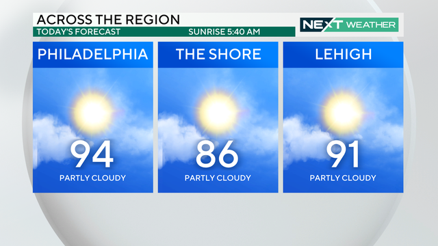
Sunday starts muggy with a slightly less humid afternoon in store. Then the week starts off hot and humid, and the remnants of Beryl could bring several days of rain to the region.
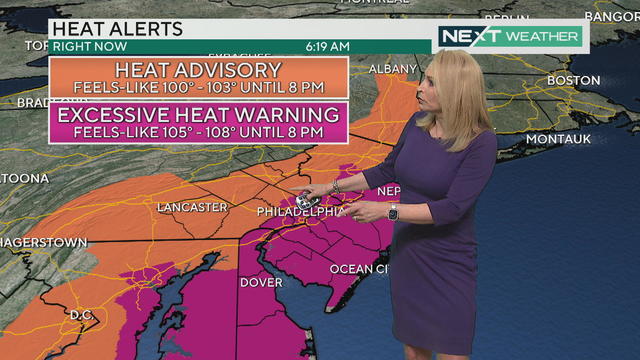
Today's dangerous hot weather around the Philadelphia region has triggered an Excessive Heat Warning, which is the highest level of heat alert

The National Weather Service has issued a heat advisory for all counties along the I-95 corridor and the Lehigh Valley both Friday and Saturday, as temps will top out between 90 and 95 degrees, with feels-like temps over 100 degrees.
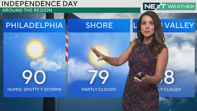
After a few gorgeous days, things change on the Fourth of July in the Philadelphia region as showers and storms will develop, mainly during the afternoon and evening.
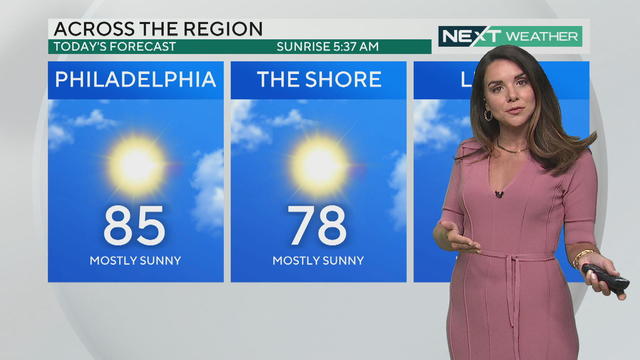
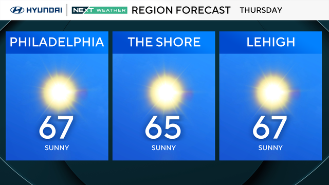
Low humidity, sunny skies and seasonably mild temperatures are once again in the weather forecast on Tuesday in the Philadelphia area.
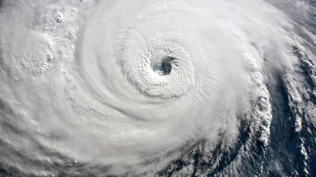
The full list of hurricane names for the 2024 Atlantic hurricane season include Beryl, Joyce and Kirk.

Streets in Ocean City, Margate and Sea Isle, New Jersey, flooded after torrential rain early Sunday morning, and another round of potentially severe storms later in the evening could create more flooding.

The CBS Philadelphia weather team has declared Sunday a NEXT Weather Alert Day as severe storms impact our area.
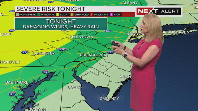
Potential severe storms could roll through late Saturday night and again Sunday afternoon into the evening.
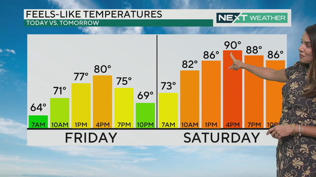
Be sure to spend a ton of time outside today as the dew point is low and the temperature is just right for early summer.
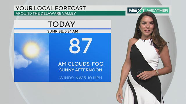
Get ready for a brighter, calmer end to the weather week in the Philadelphia region, with humidity dropping to pleasant levels.