Flash flood warnings continue in Philadelphia area as strong storms pass. Here's the forecast.
Thursday is a NEXT Weather Alert Day as showers and thunderstorms pass through the area.
The severe weather threat is beginning to wind down after an active afternoon and early evening that saw tornado and severe thunderstorm warnings pop up throughout the area. All tornado warnings in the Philadelphia region have expired.
Tornado warnings in Atlantic, Cape May and Cumberland counties in New Jersey and in Chester and Delaware counties in Pennsylvania have expired.
A tornado watch remains in effect in Atlantic and Cape May counties in New Jersey until 10 p.m. Thursday, but the risk appears to be tapering off.
Flash flood warnings remain in effect across much of the Philadelphia region.
The main severe and flooding threat should wind down later Thursday night.
NEXT big change
Friday provides a break for most of us with partly sunny skies and highs near 80. Unfortunately, the front stalls just offshore rather than completely leaving the picture. Waves of low pressure riding along it could bring another period of rain Friday night into Saturday, especially along and east of I-95. Another round of showers is possible Sunday before high pressure finally brings quieter weather early next week.
Here's your 7-day forecast:
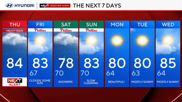
Thursday: NEXT Weather Alert. High 84
Friday: Sun and clouds. High 83, Low 67
Saturday: Showers. High 78, Low 70
Sunday: Slow, clearing. High 83, Low 70
Monday: Beautiful! High 80, Low 64
Tuesday: Mostly sunny. High 80, Low 63
Wednesday: Mostly sunny. High 85, Low 64
Get the latest weather info on the CBS News Philadelphia app.


