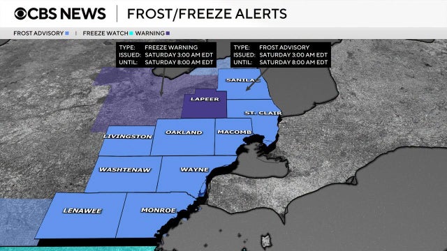
Frost advisory issued for Southeast Michigan early Saturday morning
A drop in overnight temperatures threatens to damage or kill unprotected crops and tender vegetation.
Watch CBS News
A drop in overnight temperatures threatens to damage or kill unprotected crops and tender vegetation.

A new record high was set in the Detroit area on Tuesday at 87 degrees. The old record was 83 degrees, set in 1975.
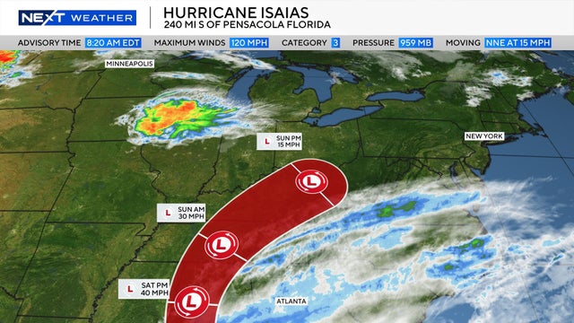
Hurricane Isaias, which strengthened into a Category 3 storm on Friday, has a forecast track that will send its remnants toward Southeast Michigan.
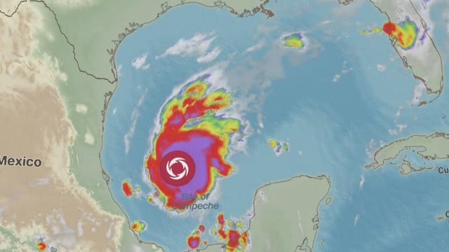
Tropical Storm Isaias is forming, and its forecasted path sends it northward. As the rain moves along, it could affect the weather in Metro Detroit. Here's when.

If you're looking for sunshine in Metro Detroit, Friday is the day to seek it out.
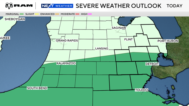
Most of Metro Detroit is included in a marginal risk area for severe thunderstorms on Tuesday.
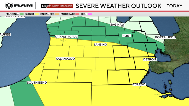
The National Weather Service has placed Southeast Michigan region in a marginal risk or slight risk zone for severe weather on Friday.
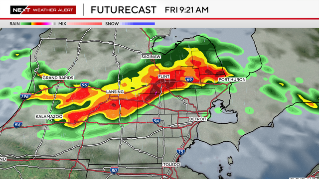
While some unstable air remains, the overall expectation is more baseline storms, with only isolated severe weather possible.
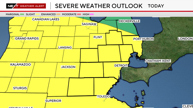
Tornado warnings were issued for most of Southeast Michigan on Thursday, late afternoon and evening, as strong storms moved through the area.
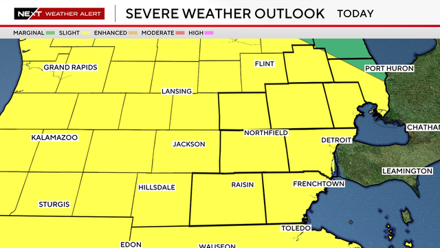
Metro Detroit is in a slight risk area for severe weather on Thursday, following up on a stormy Wednesday.
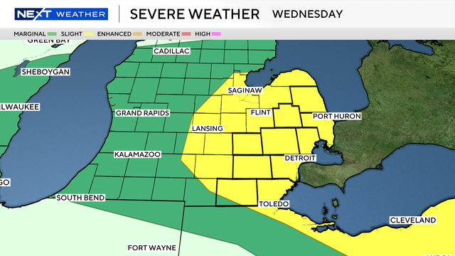
With heat and storms moving through Southeast Michigan on Wednesday night, storms are expected to roll in overnight into Thursday.
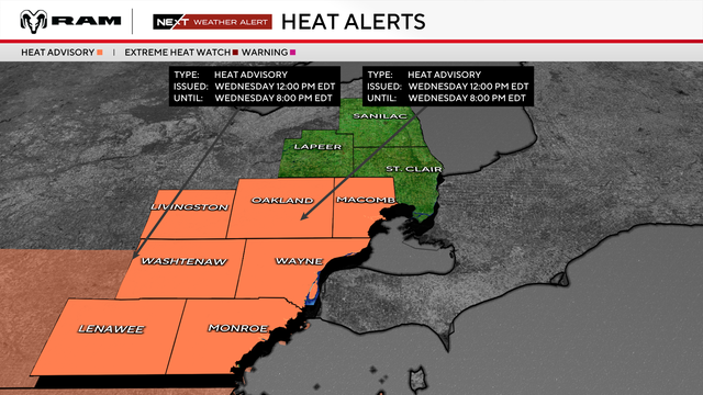
Much of Metro Detroit will be under a heat advisory on Wednesday afternoon and evening, with severe weather also possible.
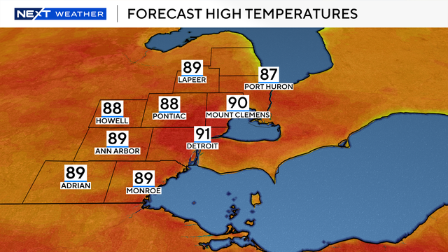
Southeast Michigan is in for a hot, humid day on Tuesday, with afternoon temperatures climbing to around 90 degrees and heat index values reaching the upper 90s to near 100 degrees.
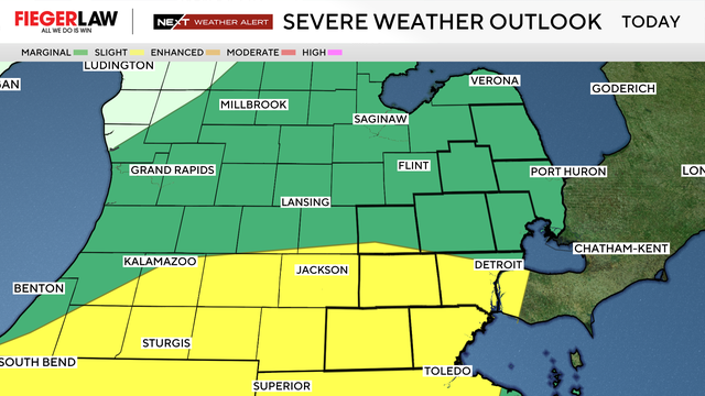
Severe thunderstorms are expected to develop on Wednesday afternoon and evening as a cold front moves through Southeast Michigan.
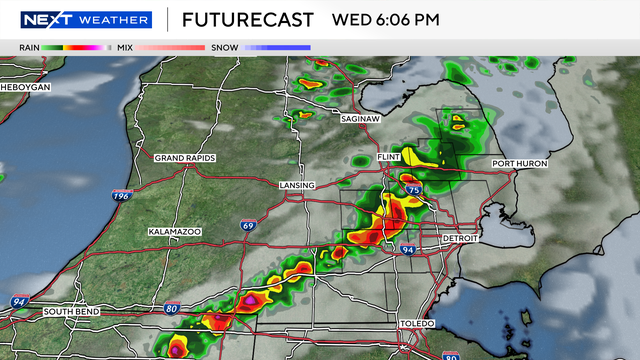
Strong-to-severe storms are possible again this week in Southeast Michigan, with a focus on Wednesday evening.
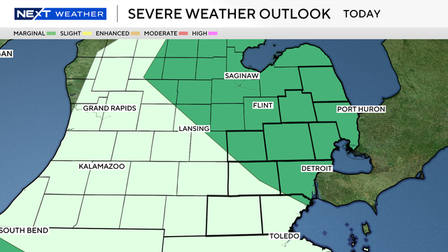
Weather models are in disagreement, and the word to hang on to Wednesday is "chance."
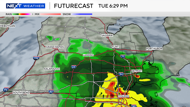
Once again, Southeast Michigan is on the cusp of a storm risk, with a marginal chance highlighting our southern counties.

Showers and storms were expected to move into Southeast Michigan on Sunday evening and bring heavy rainfall and gusty winds to some locations.
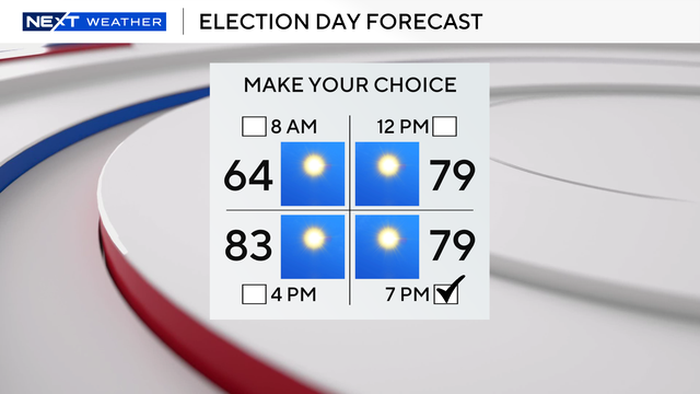
It's a winning start to the workweek as high pressure settles in, bringing lots of sunshine, dry conditions, and average temperatures.
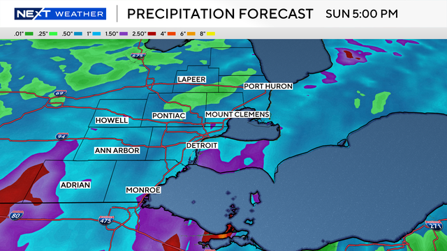
After a prolonged dry stretch, Southeast Michigan is looking at some much-needed rainfall this weekend.

Severe "convective" storms account for roughly a third of global natural disaster economic losses, a new study finds.
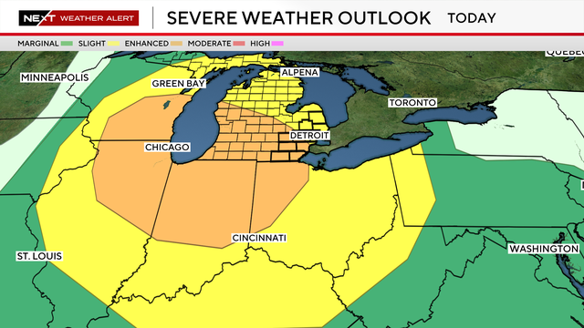
Monday is a NEXT Weather Alert Day in Southeast Michigan as CBS News Detroit tracks a low-pressure system moving across the northern Great Lakes.
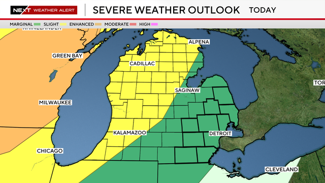
A line of storms will move through the Great Lakes region, approaching Metro Detroit overnight Monday into early Tuesday.

Southeast Michigan faces smoke and storm chances to start the week, but it ends sunny and seasonal. Here's what to know.

A statewide air quality alert for Michigan is in effect through Monday due to wildfire smoke, according to the state's Department of Environment, Great Lakes, and Energy.