Storms possible on Thursday with warm temperatures remaining in Southeast Michigan

Temperatures remain warmer on Thursday, bringing another chance at strong to severe storms later in the day.
It's important to note that this risk is much lower than last week, but with some heavy rain and gusty winds, chances are all the same. A marginal risk (1 out of 5) from the Storm Prediction Center covers Southeast Michigan for the latter part of the day.
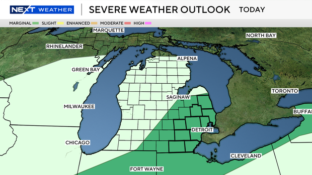
Storms will begin to pop in the afternoon and into the evening hours. While rain will scatter through the area, actual stronger storms should be more isolated.
Heavy downpours and gusty winds are the main concern for any cells that strengthen. The most likely area for storms at the moment appears to be mainly south of Interstate 69.
Keep a close eye on the radar through the afternoon and early evening hours before our rain chances end.