Storms and heavy rainfall to move through Southeast Michigan Sunday evening; additional rounds possible Monday


Showers and storms were expected to move into Southeast Michigan on Sunday evening and bring heavy rainfall and gusty winds to some locations.
The risk for severe weather remained low, but some stronger gusts or even low-level flooding were possible as the line moved through.
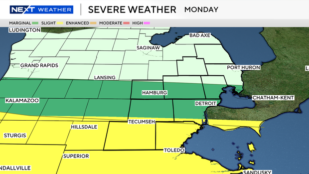
Scattered showers and storms are possible again late overnight toward Monday morning, but this risk also remains lower and primarily south of the state line.
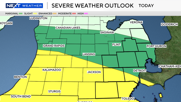
Monday evening's severe risk continues to be a focus for areas along and south of Interstate 94 in particular, and some changes are expected if the storm risk pushes closer to the state line and further south.
Another concern is that heavy rainfall could lead to some localized flooding. Parts of Southeast Michigan will be under either a marginal or slight risk for excessive rainfall on Sunday and Monday.
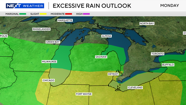
Between the two days, Monday carries a higher risk.
Stay with the CBS News Detroit NEXT Weather team for updates.


