Strong storms possible in portions of Southeast Michigan on Tuesday


Showers and storms rolled through early Monday morning, bringing some much-needed rainfall to Southeast Michigan.
Additional rain chances exist on Tuesday afternoon.
While there is a risk that some isolated strong storms may remain in the southern parts of the area, the primary concern is west and south of us.
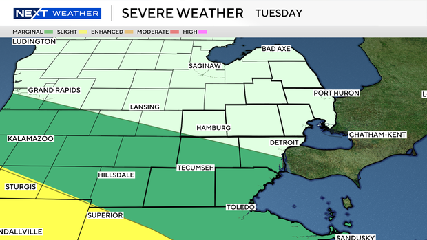
This is denoted by a marginal risk from the Storm Prediction Center.
The primary window for storms is this afternoon into early evening, roughly 3 to 8 p.m., as a cluster of thunderstorms moves into the region.
Most storms should remain sub-severe, but a few stronger storms could produce damaging wind gusts, large hail and locally heavy rainfall, with the better potential focused south of I-96, especially from the I-94 corridor toward the Ohio border.
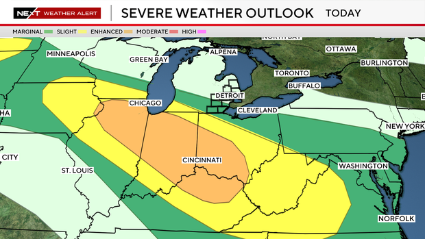
Heavy rain and localized flooding may ultimately be the more widespread concern, particularly in areas that received significant rainfall on Monday.
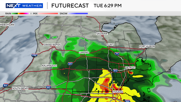
A glancing blow of rain and a few storms is once again possible in the afternoon and early evening on Tuesday in that corridor.
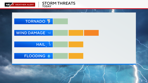
In both instances, overnight tonight and on Tuesday, wind and heavy rainfall are the primary concerns for any storms that can make it into southeast Michigan.
For your latest NEXT Weather forecast, watch on air on CBS Detroit, online at CBSDetroit.com, or streaming on the CBS Detroit app, Paramount+, or PlutoTV.