Storms rolling into Wednesday night in Southeast Michigan following excessive heat

With heat and storms moving through Southeast Michigan on Wednesday night, storms are expected to roll in overnight into Thursday.
Storms are causing power outages in the area. According to DTE, more than 42,000 customers were without power as of 11:45 p.m.
Weather forecast on Wednesday afternoon
Our heat on Tuesday continued to roast us, or steam, since it's humid, but we do have some storm chances mixed in as well.
Showers and storms may roll in overnight into Wednesday, particularly between 2 a.m. and 6 a.m. in Southeast Michigan.
While the risk is low, there remains a chance of stronger wind gusts or an isolated severe storm overnight.
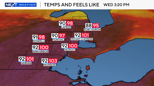
We began with afternoon highs in the 90s and a heat index near 100 degrees. That alone is enough to cause issues on Wednesday.
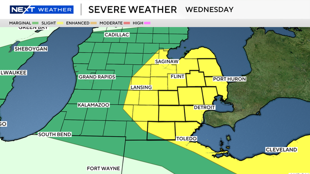
Most of Southeast Michigan and the Thumb were in a slight (2/5) risk of stronger storms on Wednesday as well. This was highly dependent on morning rainfall and on whether highs can build enough during the day.
We have all the pieces; they just need to come together at the right time.
At the moment, the strongest instability is actually in the Thumb just to our north. However, it's close enough that all of us are at the same risk for storms during the afternoon and evening hours.
The NEXT Weather Team is keeping an eye on things, and we will let you know of any changes.