Severe thunderstorms moving across Metro Detroit area


Warm, humid air, along with wind shear, gave Southeast Michigan a chance of another round of severe weather on Thursday, even as power outages linger from Wednesday night's storms.
First round of severe weather alerts
About 10:45 a.m., severe thunderstorms started to move into the Metro Detroit area. A severe thunderstorm warning was issued for parts of Wayne, Oakland and Livingston counties at 10:50 a.m., with the hazards including wind gusts up to 70 mph.
A severe thunderstorm warning was issued at 11:04 a.m., along with another one at 11:07 a.m., for parts of Oakland County.
A severe thunderstorm warning was issued at 11:23 a.m. for parts of Macomb and St. Clair counties.
A severe thunderstorm warning was issued at 11:56 a.m. for part of Oakland County.
The National Weather Service Storm Prediction Center placed much of Southern Lower Michigan into a slight risk zone (2 of 5) for severe weather for Thursday. The slight risk zone ranges from Wisconsin to Maryland.
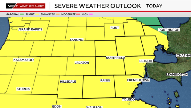
The cause is a nearly stationary frontal boundary that is providing a focus for thunderstorm development amid warm, humid air, atmospheric instability and wind shear.
Second round of storms
Storms also were expected to develop in the afternoon and evening hours. The risks include damaging wind gusts around 70 mph, large hail, localized heavy rainfall and possibly an isolated tornado.
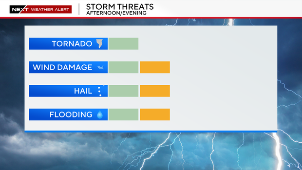
The CBS News Detroit weather team has declared Thursday to be a NEXT Weather Alert Day, stepping up forecasts and announcements as needed.
Watch vs warning
The National Weather Service says a severe weather watch means "be prepared." It is possible that the weather will reach severe levels during the time frame specified.
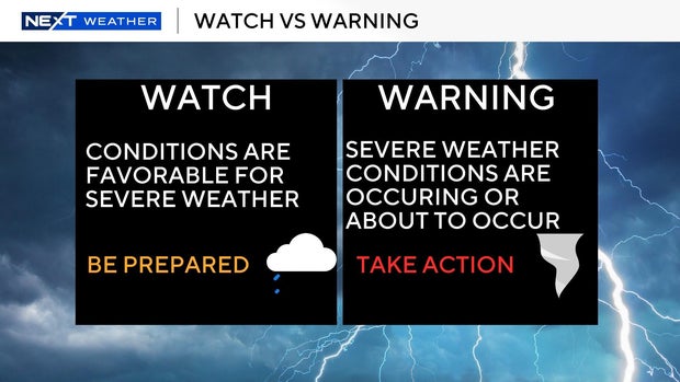
A severe weather warning means "take action," that severe weather conditions have been reported by spotters or can be detected on radar. People are asked to take shelter indoors, away from windows.
It is possible for a tornado warning to be issued without a tornado watch already in effect. This is the scenario that happened Wednesday night in St. Clair County.


