Watch CBS News

Possible potent storms on Monday prompt NEXT Weather Alert Day in Southeast Michigan

Monday is a NEXT Weather Alert Day in Southeast Michigan as CBS News Detroit tracks a low pressure system moving across the northern Great Lakes. 
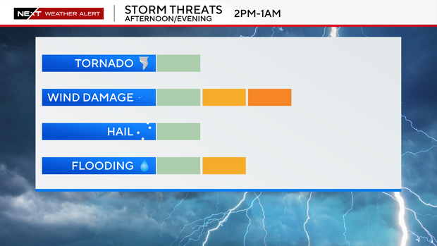
The chance of storms continues to increase in coverage and intensity with the system, especially ahead and along the cold front Monday evening, moving from northwest to southeast.

Monday's storms are partially dependent on the progression of Sunday night's storms over the western Great Lakes. 

With the Sunday night storms looking to remain closer to Lake Michigan, storm activity may not reach Southeast Michigan until later Monday evening, and may limit the development and/or the intensity of the storms. However, there is a possibility of scattered showers and storms moving through the area earlier in the day.

hrrr-conus-3k-high-res.png
Michigan futurecast for July 27, 2026, at 11 a.m. CBS News Detroit

Isolated to scattered storms are likely Monday evening. 

hrrr-conus-3k-high-res2.png
Michigan futurecast for July 27, 2026, at 10:14 p.m. CBS News Detroit

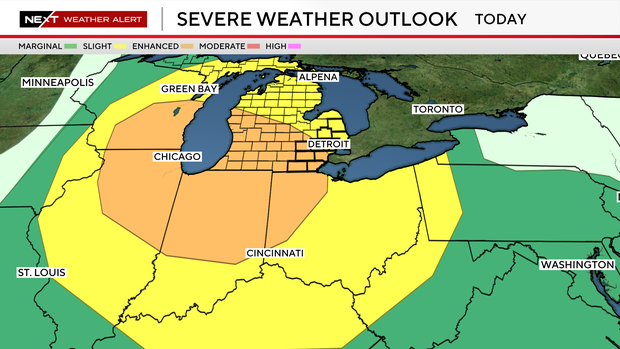
The entire state will be under a slight risk of storms turning strong to severe, with severe gusty winds and locally heavy rainfall being the primary threats.

spc-outlook-d2.png
 Michigan severe weather outlook for July 27, 2026. CBS News Detroit
mi-swody2-wind.png
Severe wind outlook for July 27, 2026, for part of the Midwest. National Oceanic and Atmospheric Administration

Tuesday is expected to be mostly cloudy with a high temperature of 82 degrees, followed by a high of 81 degrees on Wednesday.
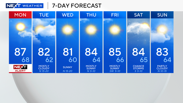
pm-7-day-bug-safe-holiday.png
Seven-day forecast for Southeast Michigan for July 27 to Aug. 2, 2026. CBS News Detroit

The NEXT Weather Team is monitoring this system to keep you updated. 

Changes in the forecast are possible, even into Monday. Be sure to have multiple ways to receive warnings and the latest weather updates.

View CBS News In
CBS News App Open
Chrome Safari Continue