Wonderful weather for the end of the weekend in North Texas
Expect high clouds to dissipate throughout the day, mild winds from the southeast, and temperatures to top out in the low 70s in the afternoon.
Watch CBS News
Expect high clouds to dissipate throughout the day, mild winds from the southeast, and temperatures to top out in the low 70s in the afternoon.
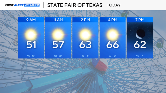
Expect an abundance of sunshine, a slight breeze from the northeast, and temperatures to top out in the middle 60s in the afternoon.
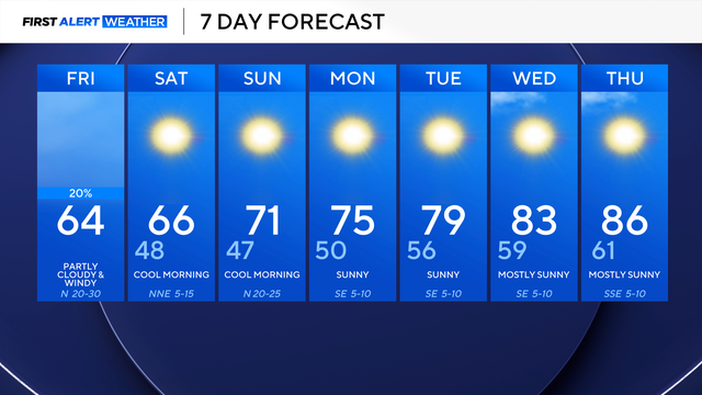
A wind advisory is in effect through 7 p.m. Friday evening, with gusts up to 50 mph possible.
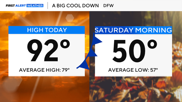
The timing of the front looks to be speeding up, with it moving in late Thursday and pushing south of us on Friday.

A cold front moves through Friday morning, and as this happens, we will see winds gust up to 40 mph.
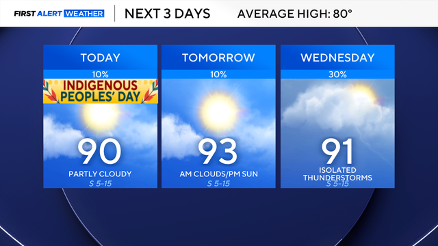
Throughout this week, you'll notice an uptick in our winds.
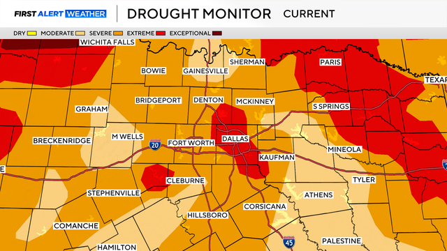
North Texas will stay dry with above-average temperatures through midweek.
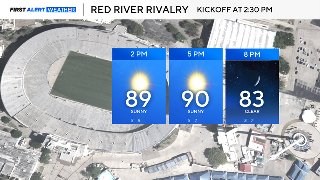
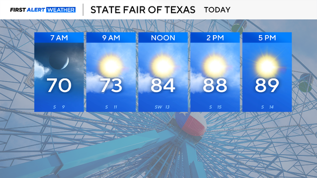
If you're headed outside, dress for the heat and drink plenty of water!
The weather in DFW stays quiet until the middle of next week.
Highs will inch closer to 90° in DFW, while other cities in North Texas are likely to reach that mark by Thursday afternoon.
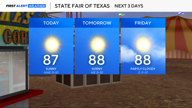
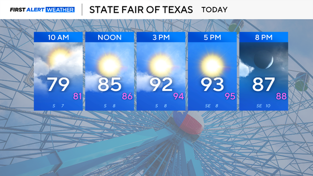
This great stretch of weather will make it perfect to head out to the fair the next few days and even into the weekend.
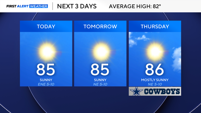
Expect our dry stretch to continue as well.
Some areas will wake up to temperatures in the 50s on Tuesday.

Dry weather takes over Sunday night.
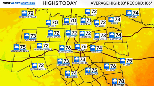
Sunshine returns next week, with high temperatures expected in the mid-80s.
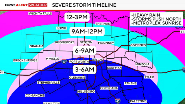
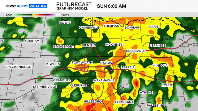
Friday's storms will move in from the south, crossing the I-20 corridor around sunrise.

A flood watch remains in effect through Friday morning for much of North Texas.

Scattered storms are popping up across North Texas, some of which may meet severe criteria.
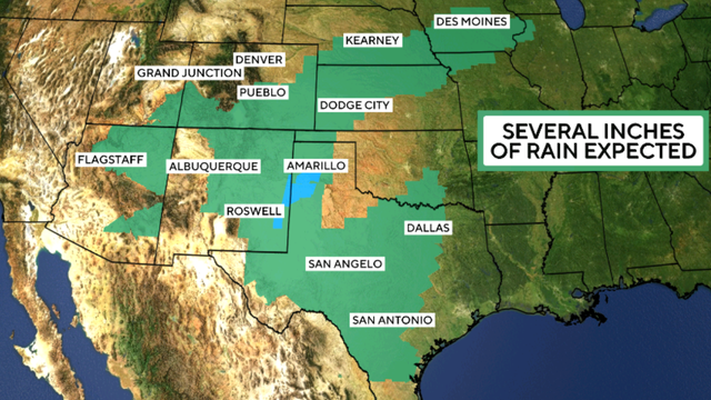
Former Hurricane Polo is expected to bring heavy rain and flooding to parts of the southern and midwestern United States.
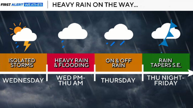
Thursday and Friday are both First Alert Weather Days due to strong storms and heavy rain.
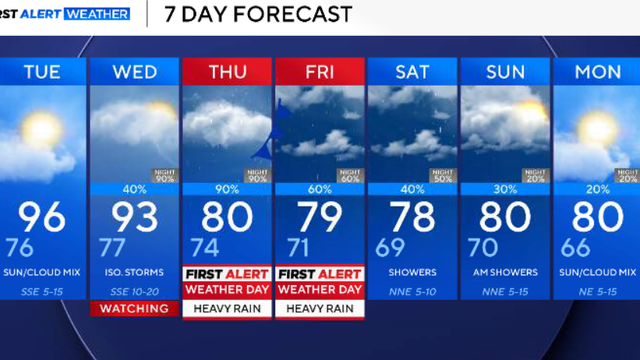
As of Sunday, DFW has had 100 consecutive days at 90° or higher, the longest streak ever. However, some big changes are on the way this week.

Though conditions will be dry during the majority of the day, there is still a chance for an isolated shower or storm later in the afternoon through the evening.
An upper-level trough strengthens, moving from the west to the east.
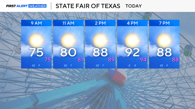
Highs will reach the low to mid-90s on Friday afternoon. Relative humidity will be low today, increasing the risk of fire in the afternoon west of I-35.

Temperatures stay warm this weekend for the State Fair of Texas, with highs in the 90s each day and plenty of clouds.