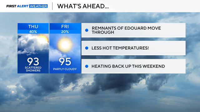
Heavy rain possible for parts of North Texas as remnants of Edouard linger
While temperatures will be less hot, the humidity remains elevated, so feels-like temperatures may reach 100-105°.
Watch CBS News
While temperatures will be less hot, the humidity remains elevated, so feels-like temperatures may reach 100-105°.
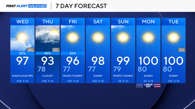
By Thursday morning, some showers will make their way into North Texas.

The moisture and remnants of the system will bring slightly cooler temperatures and a chance of rain to North Texas.

Will we end the 46-day streak without measurable rainfall in DFW? Hopefully, but rain chances aren't looking great.
Temperatures are set to trend upward again for Labor Day.
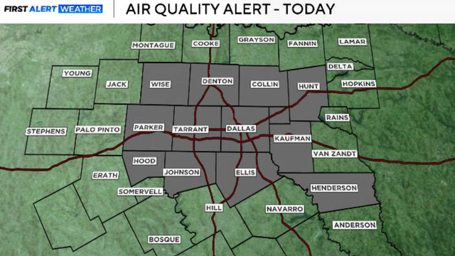
An ozone action day is also in effect.
An air quality alert is in effect, not for smoke, but for the ozone layer.

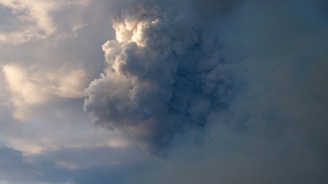
Winds will stay from the northwest at 5 to 10 mph on Thursday, which will cause the smoke and fire trajectories to move southeasterly.
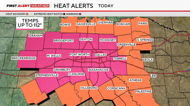
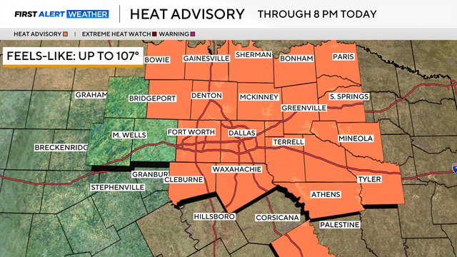
A heat advisory is in place. The heat index could reach up to 108 degrees by the afternoon; DFW's high is expected to reach 100 degrees.

A heat advisory will replace the extreme heat warning on Wednesday until 9 p.m.

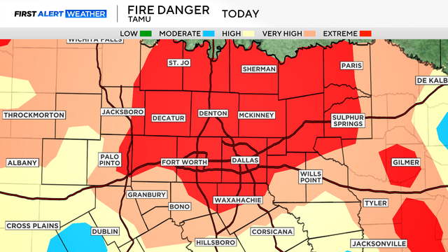
Winds will come from the southwest, gusting up to 20 mph at times, increasing fire danger across the area.

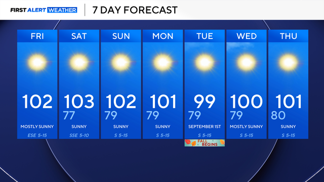
Record-challenging temperatures are also in the cards next week.
Most of North Texas will stay dry and sunny.
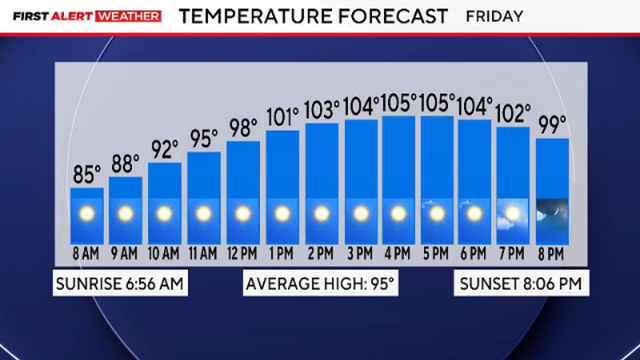
By Friday afternoon, it will be sunny, hot and breezy under an excessive heat warning. Highs are expected to climb above 105 degrees.

An extreme heat warning and a heat advisory are in effect until 8 p.m. Highs could reach up to 108° in some areas.
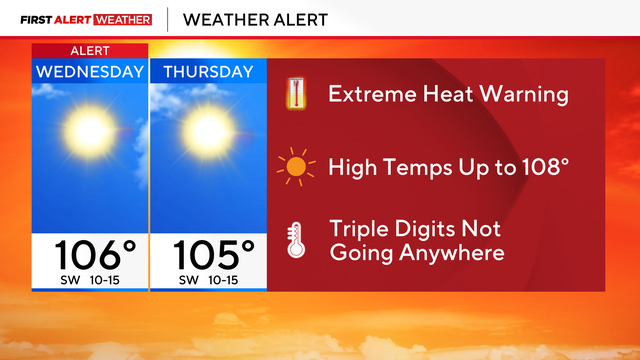
A First Alert Weather Day has been extended through Thursday after the National Weather Service extended the extreme heat warning
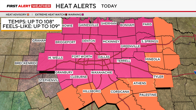
We are past peak heating of summer as our average temperature has dropped to 96°, but clearly, this is an anomalous year.
There's a heat advisory in place for Monday, mainly due to high temperatures.

This upcoming workweek likely will be the hottest week of summer as most days will reach temperatures as hot as 103-105°.
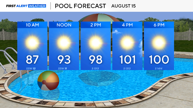
A heat advisory is in effect for Saturday due to the conditions.
The First Alert Weather Team continues to monitor the fire danger area wide as it is once again elevated across North Texas with wind gusts today up to 25 mph.
Feels-like temperatures reach 106° by Thursday afternoon, with actual temperatures between 100 and 102 °.
What you'll notice Wednesday and through the rest of the workweek is an uptick in the wind, gusting up to 30-35 mph at times.

Temperatures will rise to 100° in the afternoon, with the heat index reaching 106°. A heat advisory is in effect from 1 p.m. to 8 p.m.
The heat index in some places could reach up to 108 degrees.