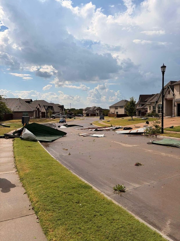
Hot and gusty week ahead after brief thunderstorm hits North Texas, blowing down trees, damaging homes


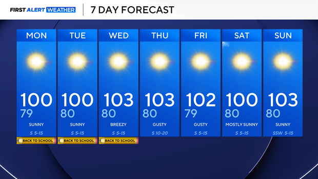
Sunday marked our 17th triple-digit day of the year in North Texas, which puts us closer to our average of 20 triple-digit days a year.
I think we'll get to that benchmark easily this week. And it is a big week! Back-to-school for many students across North Texas, and the heat stretches on.
Please make sure kids stay hydrated, limit outdoor time, and wear sunscreen when outdoors. Our UV index is extremely high all week.
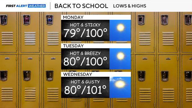
Humidity starts relatively comfortable, but we will start to feel a bit stickier late week. On top of that, our breeze really kicks in starting Wednesday and continuing through the end of the week.
This will bring an elevated grass fire threat to the region with low relative humidity and gusty winds.
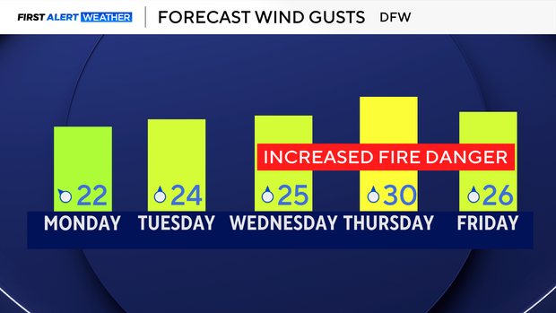
Those will be our biggest talkers this week, because outside of that, we remain hot and dry, very typical of mid-August in North Texas.
Sunday storm damage in North Texas
A microburst thunderstorm hit Royse City in Rockwall County on Sunday.
Just before 4 p.m., residents there saw a sudden rush of rain and strong winds. It was enough to rattle windows and send furniture flying across resident patios, but then, almost as quickly, it was over.
A Royse City resident reported Sunday evening that a large shed was destroyed with debris blown up to 400 yards away, according to the National Weather Service. NWS also said that a few trees were blown down, and a couple of homes suffered minor exterior and fence damage.