Another round of rain for North Texas on Friday
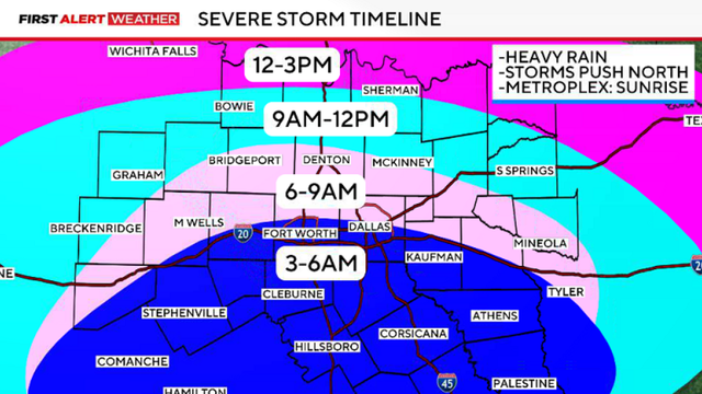
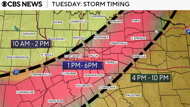
Friday's storms will move in from the south, crossing the I-20 corridor around sunrise.
Watch CBS News
Friday's storms will move in from the south, crossing the I-20 corridor around sunrise.
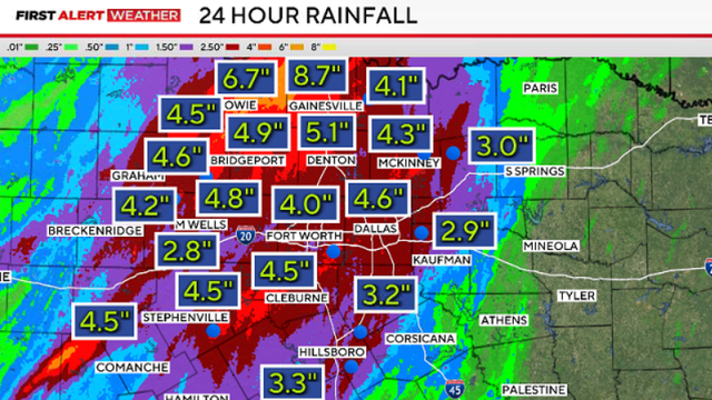
Rain is expected to continue on Friday after heavy rain and flooding on Thursday.

A flood watch remains in effect through Friday morning for much of North Texas.
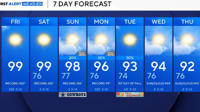
A 20% to 30% chance for showers and thunderstorms develops as early as Sunday evening.

A heat advisory will replace the extreme heat warning on Wednesday until 9 p.m.
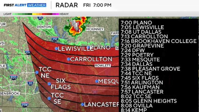
Small hail and strong winds remain possible as the storms track southeast toward the Metroplex.

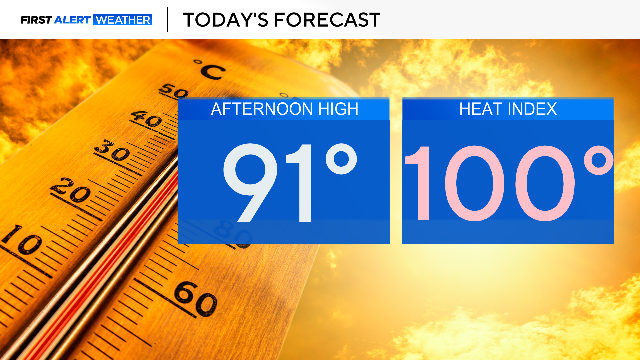
A heat advisory is in place for Friday afternoon.

Air temperatures across the region will range from 98-100 on Thursday afternoon.

Wednesday, July 22, is a First Alert Weather Day as an extreme heat warning remains in place.

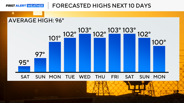
We won't see much of a change in our weather pattern throughout the workweek and into the weekend as the triple-digit heat sticks around.

A heat advisory is in effect Monday from noon through 8 p.m, with feels-like temperatures to soar over 100.
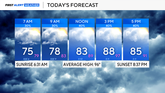
Expect partly cloudy skies on Friday with highs in the lower 90s and feels-like temperatures close to the triple digits.
Temperatures will climb back into the triple digits into next week.
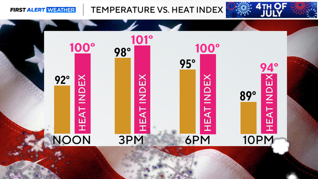
Highs on July 4 will be in the upper 90s, with feels-like temperatures ranging from 100-105 degrees.

The National Weather Service allowed a flash flood warning for parts of Dallas, Collin and Denton Counties to expire at 11:45 a.m.

In Allen, one firefighter was hurt after he fell through the ceiling while battling flames in the attic of a home.
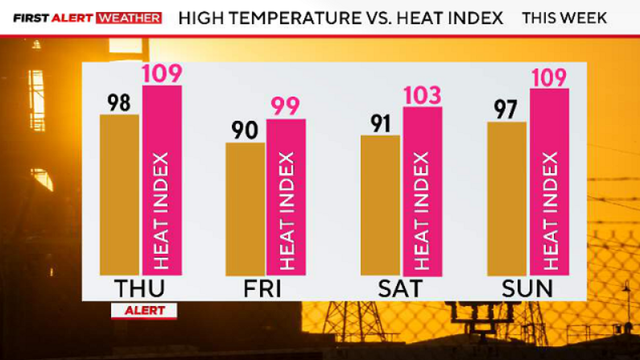
A Heat Advisory is in effect beginning at noon through 9 p.m.

More scattered storms are anticipated across the Metroplex in the late morning and afternoon.

Sunday is a First Alert Weather Day due to the chance of severe weather.
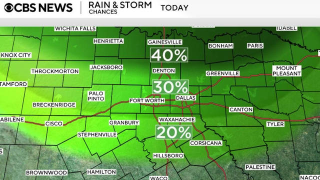
Scattered showers and storms are expected Friday in North Texas, mainly along and north of I-20 through the early afternoon.
On Sunday, Dallas-Fort Worth International Airport recorded 3.55 inches of rainfall, which broke the daily rainfall record.
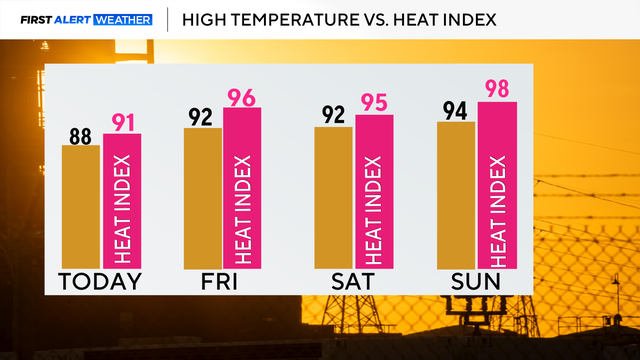
The heat index will rise every day, reaching the upper 90s on Sunday.

There is a level 2/4 risk for flooding from DFW toward the Red River counties.
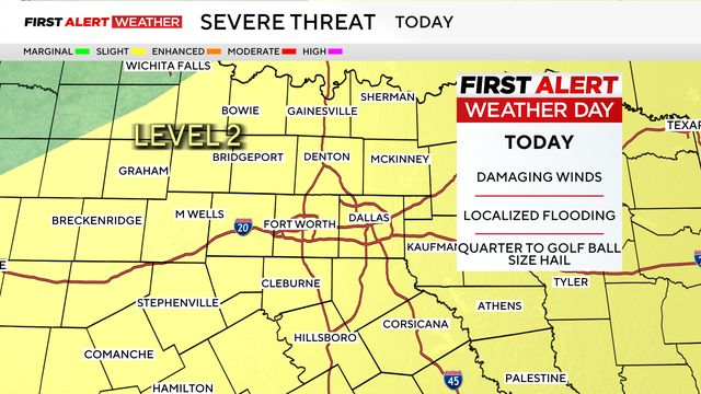
A First Alert Weather Day is in effect for the day, with expected impacts to include damaging winds, localized flooding, and hail.
Monday will be hot, breezy and cloudy.