Heat advisory in effect for North Texas as chance of rain, storms return


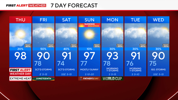
A First Alert Weather Day is in place on Thursday due to extreme heat. Feels-like temperatures will be as hot as 110 ° and possibly hotter at times.
A Heat Advisory is in effect through 9 p.m.
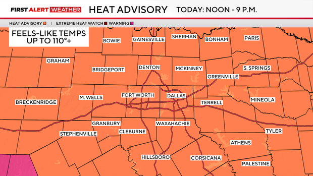
By Thursday afternoon, high temperatures soar into the mid- to upper 90s, and with the humidity, it will feel like 110° or more in some spots.
Looking ahead to Thursday night and the rest of the week, DFW will get a slight break from the scorching heat on Friday, as scattered showers and thunderstorms build in.
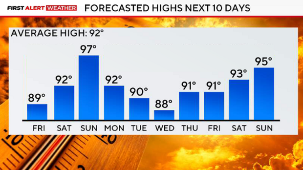
SPC has upgraded much of North Texas, including portions of the metroplex, to a Level 2 (slight risk) for severe weather Thursday evening/night.
The upgrade reflects increasing confidence in thunderstorm development across our northwest counties late this evening, generally from 7 p.m. to 9 p.m. Forecast guidance continues to show strong instability and increasing low-level convergence, which should support storm development.
Recent trends also suggest storms may organize into one or more clusters capable of producing well-defined cold pools. This would increase the potential for damaging wind gusts, particularly across areas west and northwest of DFW. While storms are expected to gradually weaken as they move east overnight, a localized severe wind threat could persist into the late evening hours.
In addition to the severe threat, the very moist atmosphere may support isolated instances of flash flooding where heavier rain occurs.
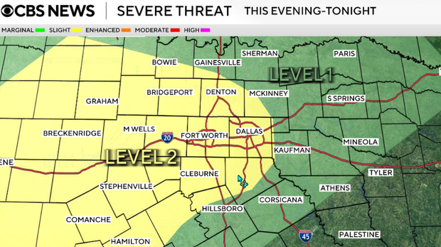
Rain chances linger for the first half of Saturday, and then it heats up and dries out for Father's Day. Feels-like temperatures for Sunday will return to 105°+. Expect temperatures to stay steamy with some rain chances in the forecast next week.