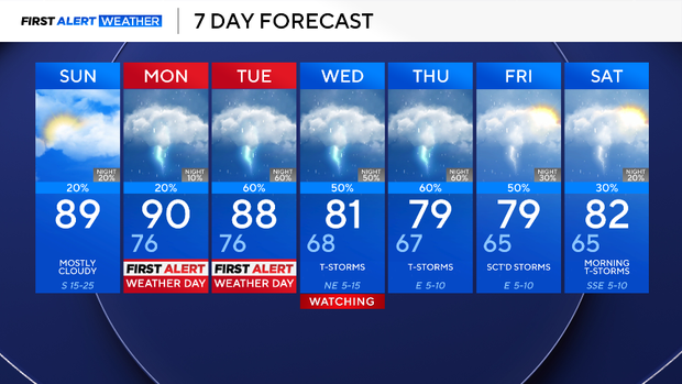
Monday, Tuesday to be First Alert Weather Days for North Texas storm chances

Sunday was another hot, breezy, and cloudy day. Temperatures will quickly climbed into the 80s by lunch and the high temperature around 5 p.m. were in the upper 80s or low 90s. However, since there was a sufficient amount of moisture in the atmosphere, the feels-like value known as the "heat index" was closer to 100 degrees.
Most of North Texas stayed dry on Sunday, but now things change this week: a First Alert Weather Day is in effect on Monday and Tuesday.

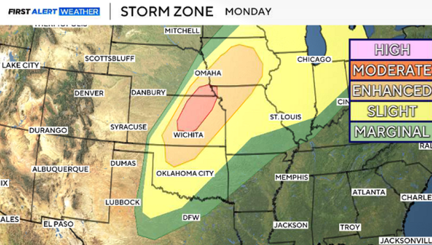
A dryline and shortwave will lead to the possibility of a few isolated strong storms popping up on Monday afternoon. The threat of storms is conditional and very dependent if the storms can break a capping inversion.
Some cities could see the potential of severe weather, while others may not get a drop of rain. Those who do see a storm will likely see it in the late afternoon and early evening; anything that flares up will fizzle out after dark.
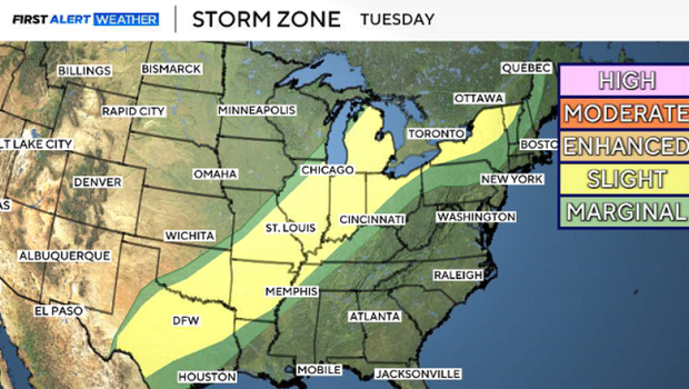
On Tuesday, a cold front will push through North Texas. This will lead to scattered severe potential ahead of the system. As of now, intense winds, hail, and flooding are the main concerns.
More heavy rain will continue on Wednesday. The front will usher a cooler airmass into the region by midweek. More disturbances will be in the forecast through the extended period. Expect an unsettled weather pattern for the next week or so. Stay tuned!