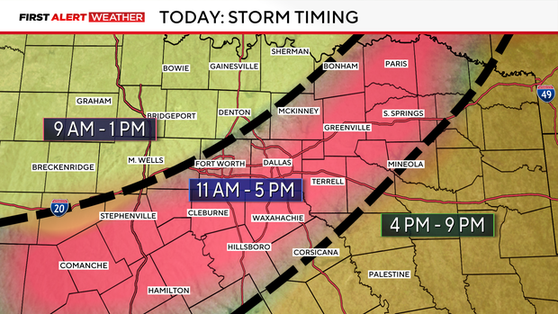
North Texas expecting severe storms late Tuesday morning into the early evening


A First Alert Weather Day is in effect Tuesday as showers and thunderstorms continue to move along a cold front moving into North Texas. A few storms could become strong to severe, with damaging winds and large hail as the primary threats.
Tuesday night, storms shift south through the evening, but the front stalls across Central Texas overnight. Some lingering showers and storms remain possible, mainly south.
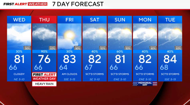
Wednesday will be a quieter day for most of North Texas. The stalled boundary stays south and east, so the best rain chances will be focused there, while much of the metroplex sees only isolated activity or stays dry. Highs remain seasonably warm (near 80F) with continued humidity. Northeast wind 5-7 mph.
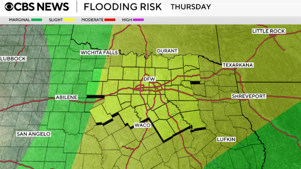
Thursday looks like the wettest day of the week. A moisture-rich atmosphere and another disturbance will bring widespread showers and thunderstorms. Heavy rainfall and flash flooding concerns increase. Current rainfall projections suggest: 1 to 3 inches for many areas. and up to 5 inches in some southern and southeastern counties by late week.
Friday through the weekend
The active pattern continues. Scattered showers and thunderstorms remain in the forecast daily through the weekend. Severe weather risk appears lower after Tuesday, but repeated rounds of rain could lead to additional flooding concerns.