Daily rain, storm chances return to North Texas, with potential for damaging winds and large hail


An active weather pattern returns this week, with our best chance for widespread storms arriving Tuesday as a cold front moves into North Texas. On Tuesday, some of the storms could contain large hail, strong damaging winds and a low tornado threat. As the front stalls out south of our area, it will trigger additional showers and storms in late week. This could lead to some localized flooding.
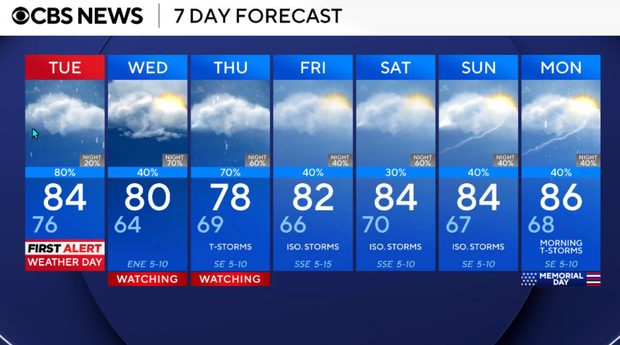
Warm and windy Monday
The story on Monday is the wind, warmth, and humidity. Strong south winds will gust between 30 and 40 mph at times, pulling Gulf moisture northward and making it feel noticeably muggier. Storm coverage stays very low Monday, but an isolated afternoon or evening shower or thunderstorm can't be ruled out.
The dryline where the storms will develop is hundreds of miles west of our area. However, we will keep an eye out for some of our northwestern counties, Cook, Montague, Wise and Jack, in case a few of those storms are available to reach those zones late this evening.
Monday night will be warm, windy, and muggy. Storm chances remain low overnight as moisture continues increasing ahead of Tuesday's cold front. Lows in the 70s.
Tuesday is a First Alert Weather Day
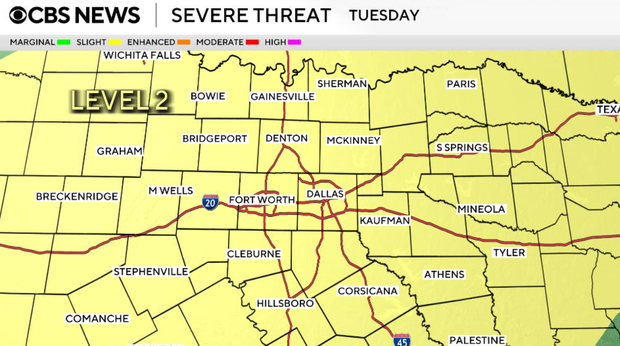
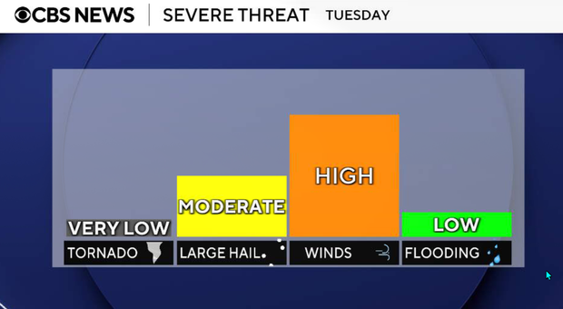
Tuesday is our most active weather day this week. A cold front will move into North Texas on Tuesday, bringing widespread showers and thunderstorms, some of which could become severe.
Timing will vary depending on location:
- Northwestern counties: 10 a.m. to 2 p.m.
- Metroplex: 1 p.m. to 6 p.m.
- Southeastern counties: 4 p.m. to 10 p.m.
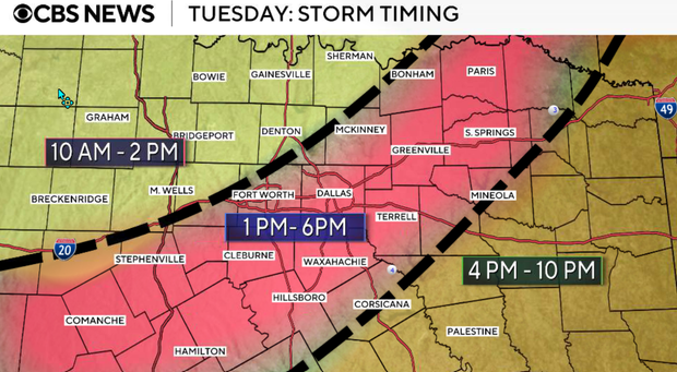
Large hail and damaging winds remain the primary concerns. A wet afternoon and evening commute looks increasingly likely for much of North Texas.
Storms gradually shift south Tuesday night, though activity may linger where the front stalls.
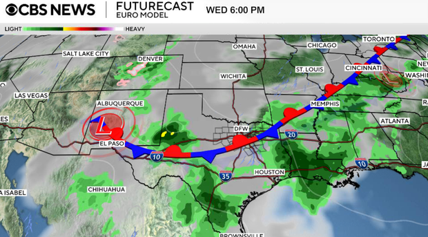
Active weather pattern continues Wednesday
The stalled front keeps the active pattern going. Scattered to numerous showers and thunderstorms remain possible, with the severe threat lower but heavy rain concerns increasing. Locally heavy rainfall and ponding issues may begin to develop, especially where storms repeatedly move over the same areas.
Thursday through the weekend
Daily storm chances continue with an unsettled weather pattern in place. The severe threat appears lower later in the week, but the flooding concern may become the bigger issue as repeated rounds of rain continue. Some locations could pick up several inches of rainfall by the weekend.