Pittsburgh Weather: Rain sticking around through weekend; temperature drop coming
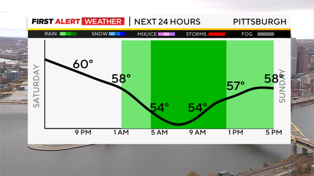
It's a cloudy but still fairly mild Saturday evening, but that warm air will not be able to hold on for very long.
Watch CBS News
It's a cloudy but still fairly mild Saturday evening, but that warm air will not be able to hold on for very long.
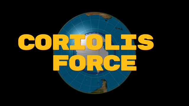
High and low pressures flow in different directions in different hemispheres - so why do they flip-flop?
Yesterday was a pleasant surprise with afternoon highs hitting 62 degrees.
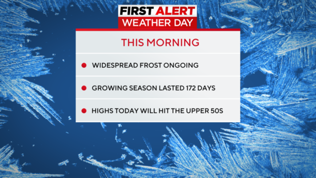
Lows dropped in Pittsburgh to just above 32° this morning.
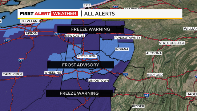
Clear skies and chilly air will provide our best chance of patchy to widespread frost and freeze for the region tomorrow morning.
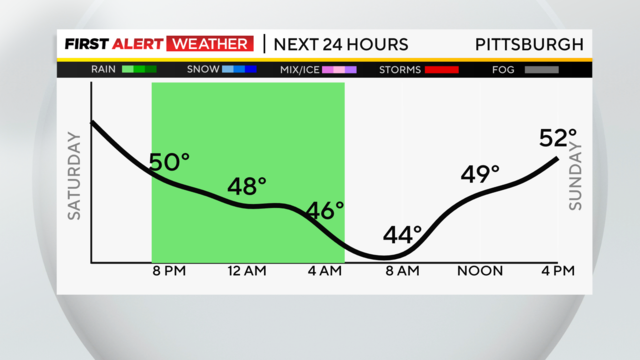
It's chilly with spotty showers through this evening. Temperatures only got to the low/mid 50s and then fell through the day.
They are three words that are used interchangeably, but there are some differences.
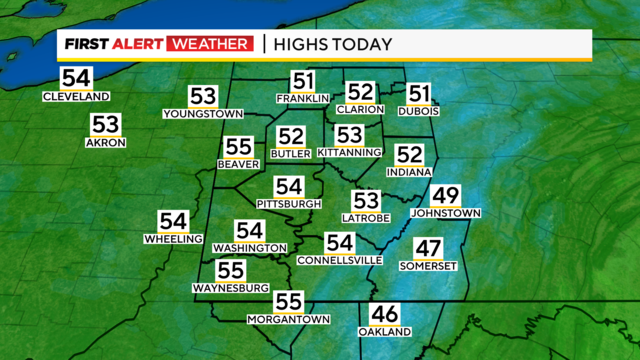
Expect pockets of drizzle, with drizzle being a little more 'dense' the farther north you go.
The area is still awaiting its first frost of the year.
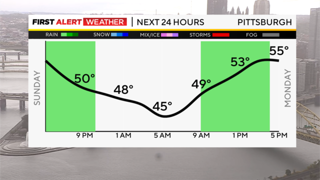
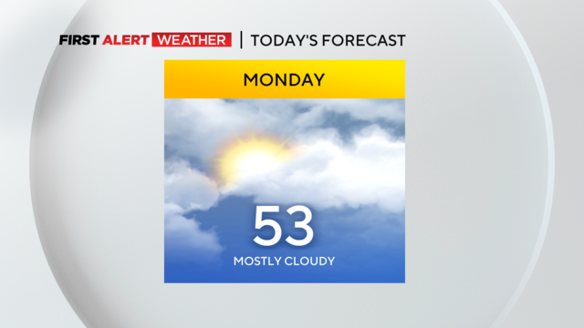
Scattered showers linger this evening and stick around to start the week, but they'll be spotty and hit or miss.
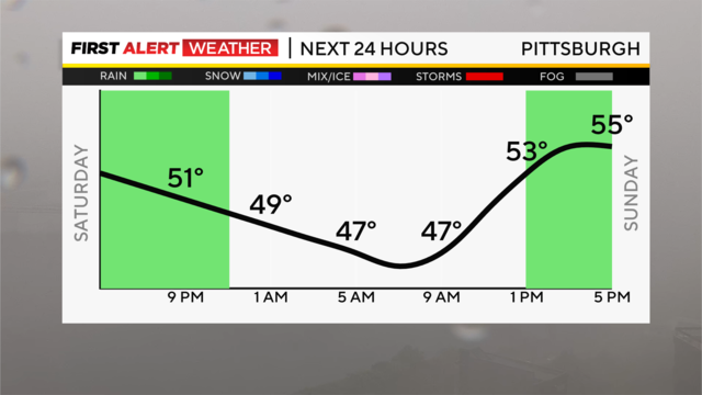
After a soggy, grey Saturday, we'll watch the steadier rain taper off through this evening, giving way to scattered showers, then just cloudy skies overnight and into the first half of Sunday with lows in the upper 40s.
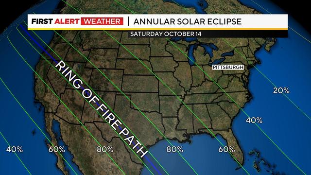
If the clouds were going to be cooperative, the Pittsburgh area would see about 30% of the sun's disk being blocked by the moon.
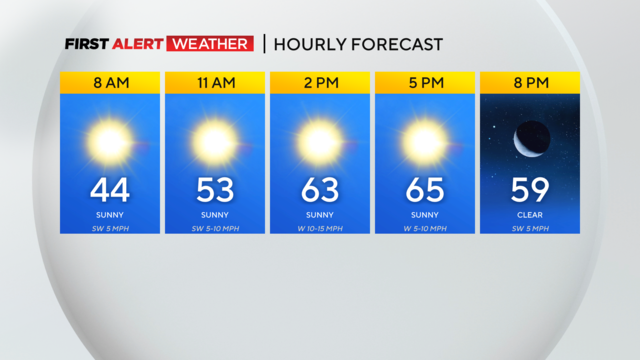
We're off to a chilly start for our Wednesday with temperatures in the 40s.
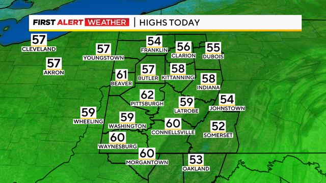
Western Pennsylvania certainly could use some rain.
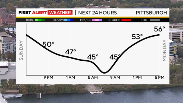
The sunshine managed to break through clouds in many spots this afternoon, yet areas north along I-80 and south of I-70 are still dealing with some pesky showers that will stick around through late tonight.
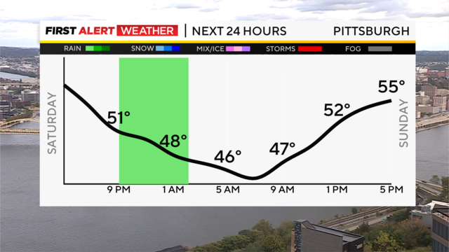
Breezy, much cooler conditions stick around tonight, with a few scattered showers here and there.

We will truly be making an about-face this weekend with our weather.

Sunny skies will be around after patchy fog clears out by 10 a.m.

High pressure to our north keeps this dry, unseasonably warm pattern in place through late week with highs and lows both around 10 degrees warmer than normal for this time of year.

Gorgeous sunshine and temperatures in the upper 70s helped us usher out the final day of September in fine fashion!
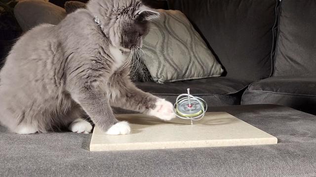
While some toys seem pretty simple, they actually work with the help of some cool science!

Morning conditions will be cloudy with some pockets of drizzle in spots.
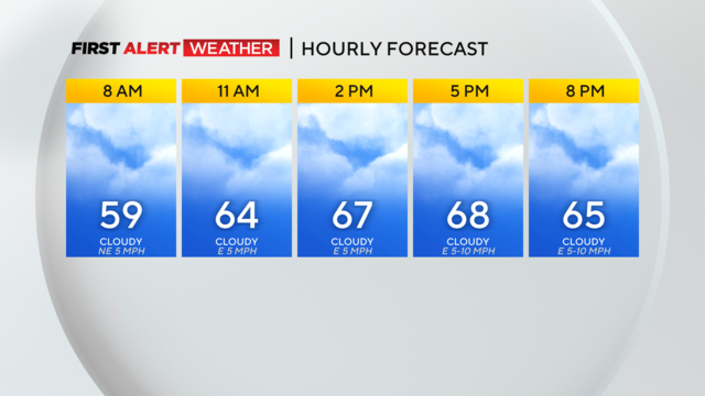
It's going to continue feeling like fall this afternoon with highs slightly cooler than average in the mid to upper 60s.
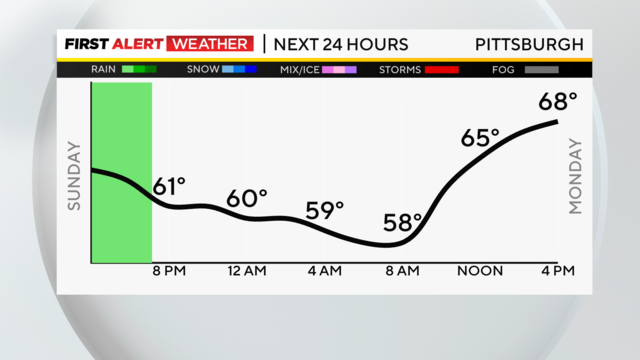
Monday evening rain chances return, with a stray shower possible on Tuesday.

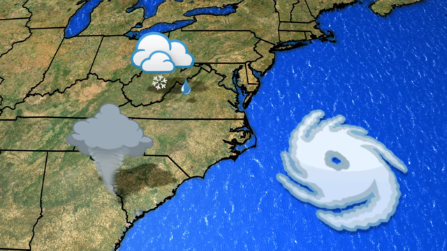
We will still have some showers to deal with, as western Pennsylvania sits on the western edge of Tropical Storm Ophelia.