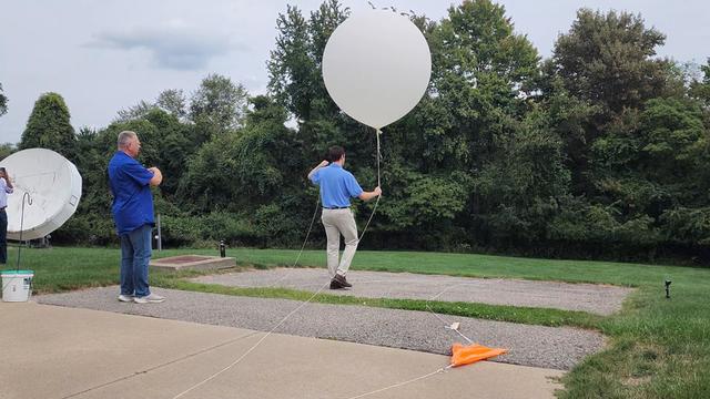
Hey Ray: The importance of weather balloons and what they do
They aren't the same as the balloons you'd find at Party City, but they're plenty important!
Watch CBS News
They aren't the same as the balloons you'd find at Party City, but they're plenty important!
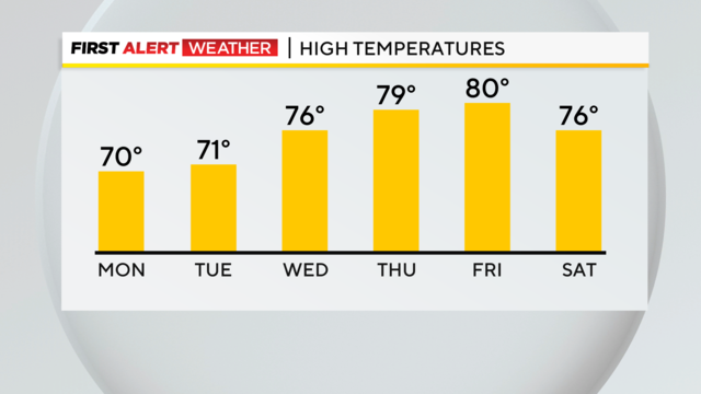
We certainly could use some rain, but there is little to no rain in the forecast over the next week.
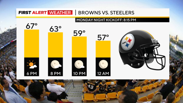
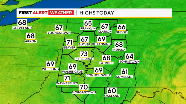
Highs today should be near 70° with morning lows down near 50°.
Spotty showers will remain around the area tonight and tomorrow.
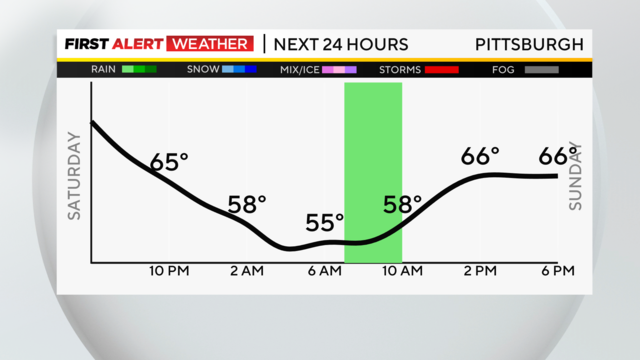
It was another gorgeous day region-wide, with highs in the mid-70s and sunny skies!

Weather records are old, but when they're broken, it's a big deal!
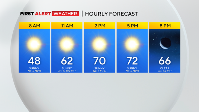
It's going to be sunny with highs in the low 70's!
Here we go. Break out the sweatpants and pumpkin-spiced-smelling candles with cooler air set to arrive this afternoon.
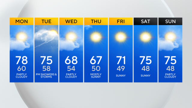
Break out the long sleeves and jackets, cooler air is heading our way.
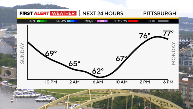
Lingering low pressure and a stalled front are keeping shower and storm chances around through tonight for areas east and south of Allegheny County.
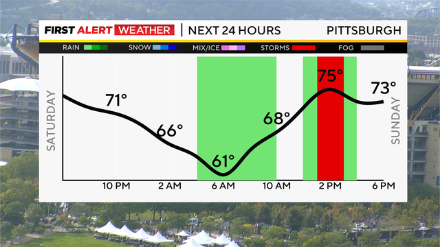
A scattered shower or storm is possible tonight and again off and on through the day Sunday thanks to low pressure swirling across our region.
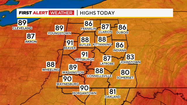
A hot, but not particularly humid stretch continues Tuesday with highs expected to hit the 90s for the second day in a row.
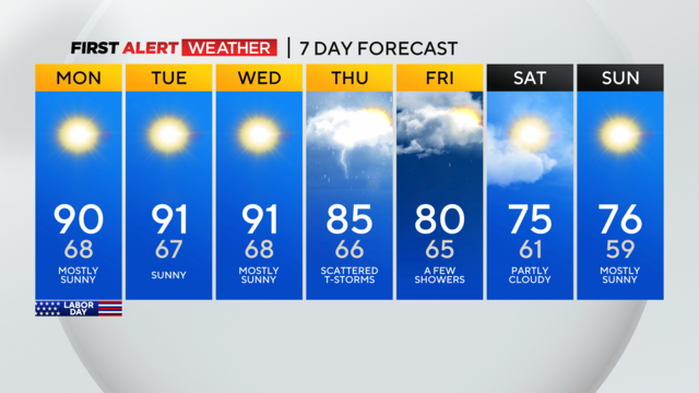
There are excessive heat concerns for our Labor Day with highs at or near 90 and feeling in the mid-90s for many.
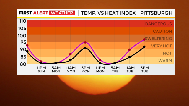
The Labor Day weekend is underway, and it will be much more comfortable in the pool, the shade, or the AC as compared to being in charge of the grill at any holiday cookouts!
The heat and humidity will remain on the rise as we kick off the new week and head into Labor Day.
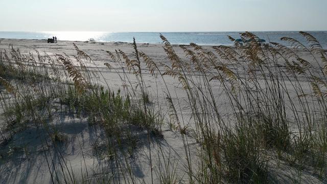
While that wind on the beach can make a mess, it also makes dunes and these are important!
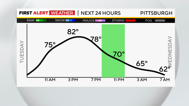
The rain chance is mainly for this evening.
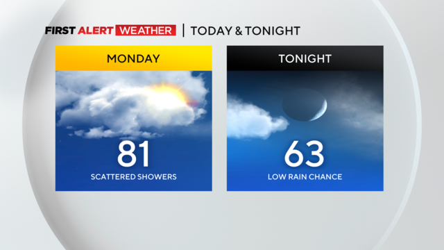
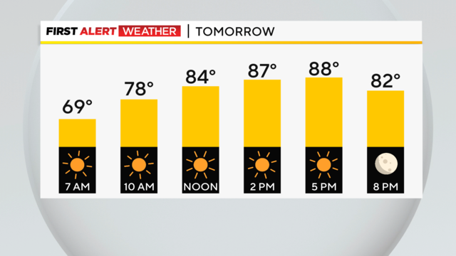
High temperatures will be in the low 80's with mostly cloudy skies.
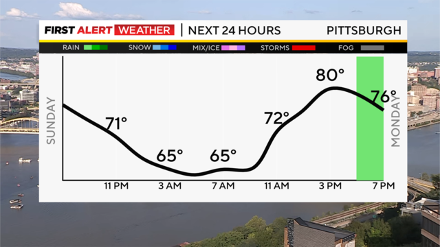
Another nice night is on the way, and mainly dry and pleasant weather will be in store for us all week.
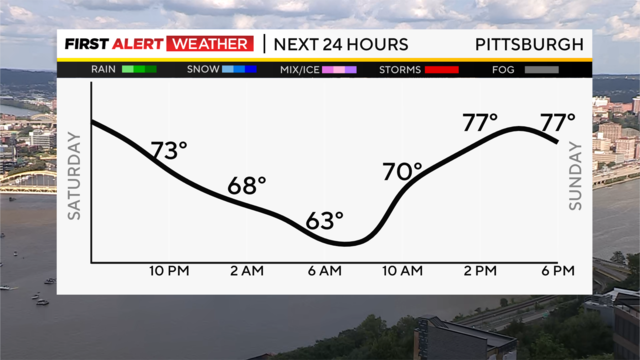
The weekend has started off on a pleasant, sunny note this afternoon and clear skies are the rule overnight with lows in the lower 60s.
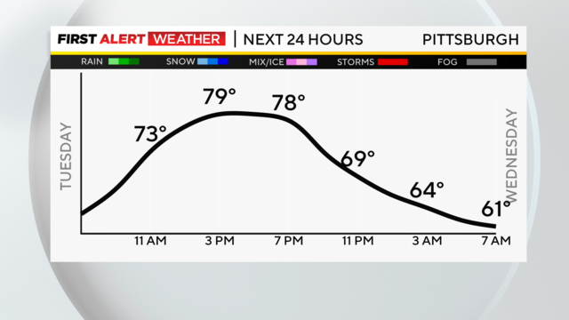
While we are on the edge, the powerful ridge of high pressure anchored in the center of the United States continues to be our main weather player here in Western Pennsylvania.
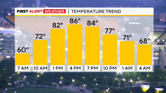
Temperatures will be back in the mid-80's today.
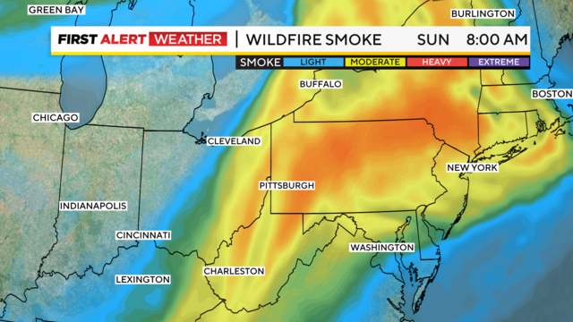
Wildfire smoke is back and will leave the sky looking hazy this Sunday morning and afternoon.
After a cool, clear, crisp morning, the summer heat returns for the last weekend before school starts!
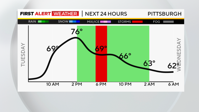
The best chance for rain Tuesday comes before 10 a.m. After that, rain chances will drop to the isolated range from scattered morning showers.