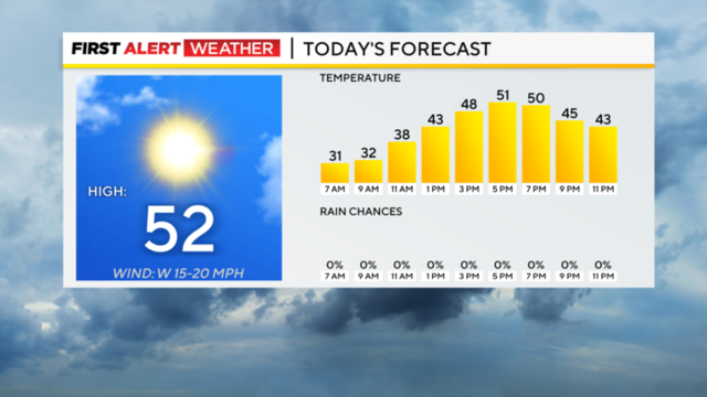
Pittsburgh Weather: A cold start gives way to sunshine and pleasant conditions
Looking ahead, we will see a slow warm-up through Thursday.
Watch CBS News
Looking ahead, we will see a slow warm-up through Thursday.
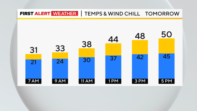
We are in the final leg of the wintry, gusty weather that kicked off the new week. Ironically, we sprung our clocks forward while rewinding our weather into something that resembles winter.
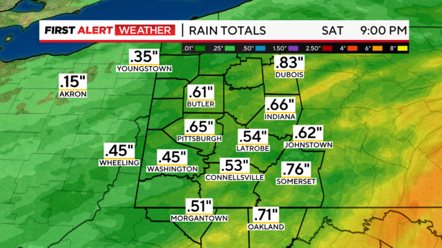
Saturday is a First Alert Weather Day due to heavy winds and rain.
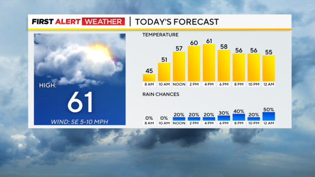
The weather remains warm but we've got rain coming through on the weekend.
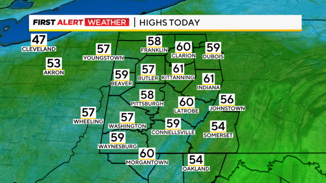
While some of the rain is hanging around, we'll still have warmer temperatures.
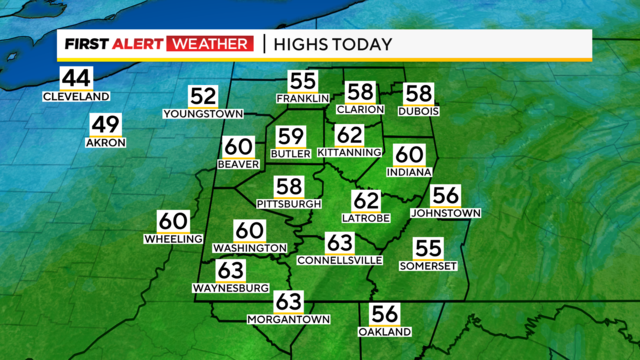
We've got some light rain on Wednesday but this weekend we could see snow once again.

While temperatures stay warm today, Pittsburgh won't see any new records being set.
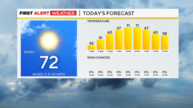
The record high for today is 74 degrees.
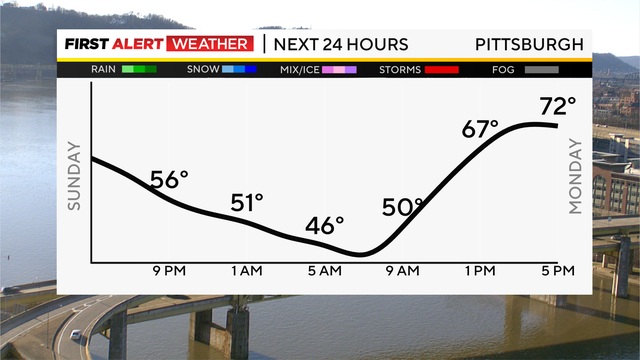
The weekend is ending on a beautiful, mild note with clear skies and lows tonight only in the mid-40s.

March is starting like February ended, with well-above-normal temperatures!
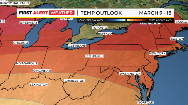
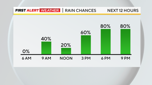
The rain moves out around mid-morning and then the warm temperatures slide in this afternoon.

Meteorological spring starts today and it will be a pleasant day!

Two stormy days are past but a chilly day is here on Leap Day.
Both today and Wednesday are First Alert Weather Days.
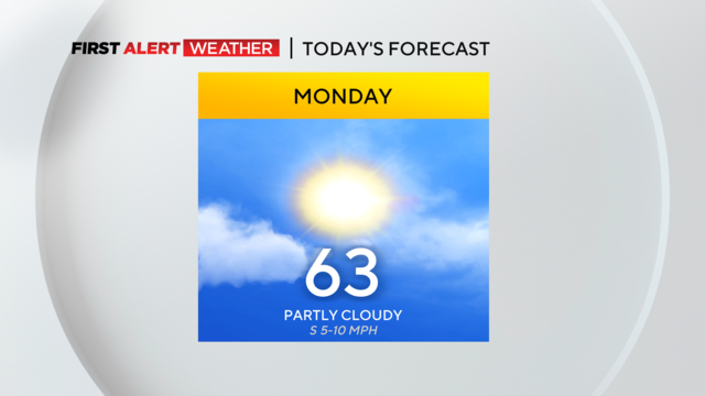
Clear skies should be in place from start to finish.

Clouds arrive tonight, and a stray sprinkle is possible in the Laurel Highlands and for areas north of I-80 into the wee hours of the morning.
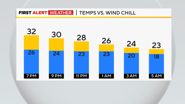
Sunny skies give way to clear and cold conditions tonight, with lows in the lower 20s to upper teens.

Long-range data shows a surge of warmth that will be around for most of next week before we cool down going into March.
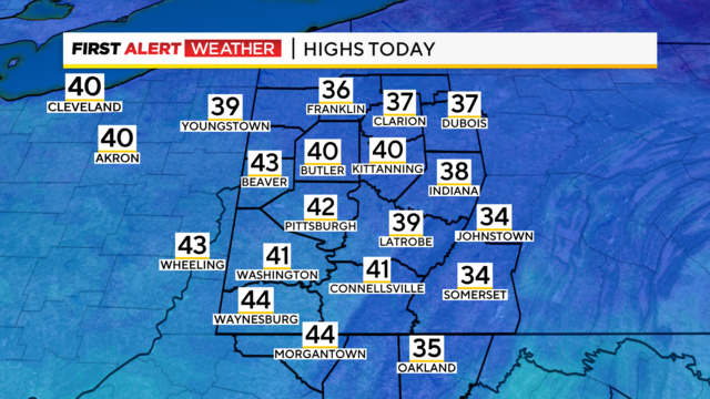
Today and tomorrow will be sunny.
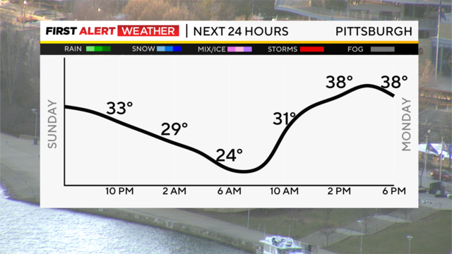
A weak cold front will drop down from the north but wash out, bringing only a chance for flurries along and north of I-80 tonight and just increasing clouds for the rest of us.
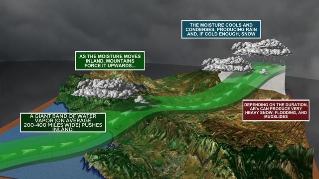
Here in Pittsburgh, we know all about rivers, but what about rivers in the sky?
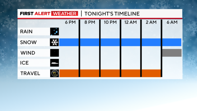
The snow continues to inch closer to the region, and this evening, snow showers will take over.
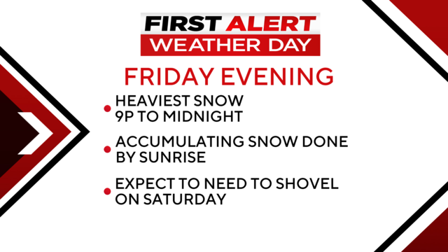
Today and Saturday are First Alert Weather Days due to overnight snow chances.
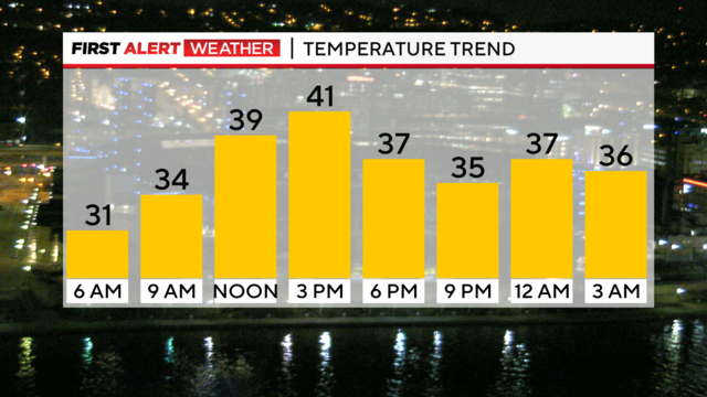
When it comes to today's forecast, there is still a chance for some light snow today, but that would come after sunset.
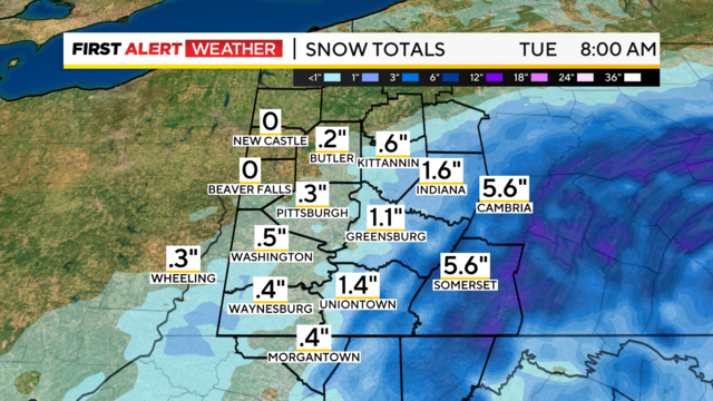
We will still have sunshine Monday with highs near 50. Rain and snow for some returns later this evening around 6 p.m.