NEXT Weather: Flooding concerns and a winter blast coming to town
With loose soil and very wet ground, any strong winds Saturday morning and afternoon have the potential to down trees and power lines.
Watch CBS News
With loose soil and very wet ground, any strong winds Saturday morning and afternoon have the potential to down trees and power lines.
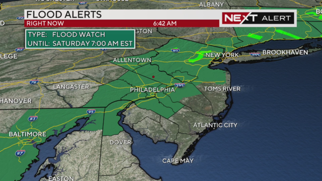
Wind advisories and flood watches are in place for the storm heading our way Friday night.
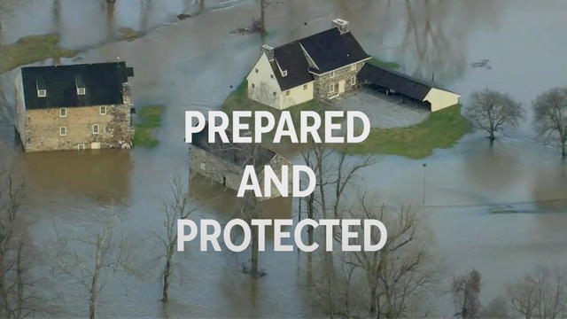
This week, CBS NEXT Weather Network had team coverage of the weekend's rainstorm, a man was saved by crews in Delco during the rainstorm, and much more.
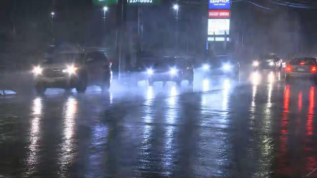
Thousands of people in Pennsylvania, New Jersey and Delaware are without power Wednesday after a powerful storm system moving through the Philadelphia region.
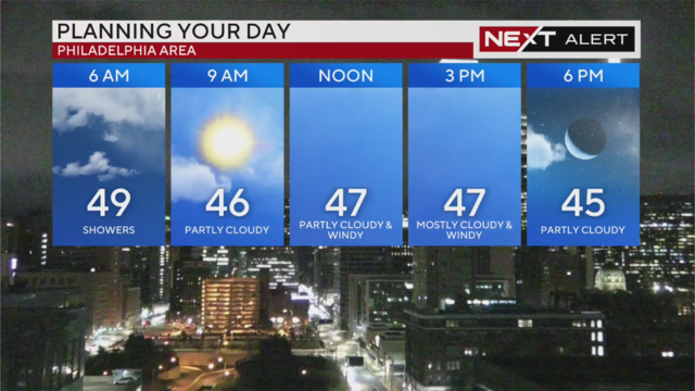
The heaviest rain and wind gusts have moved out of the area, but flooding remains a concerns along the Delaware Valley's rivers, creeks and streams Wednesday.
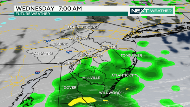
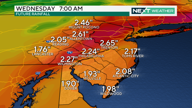
Since the storm began, many areas received well over an inch and a half of rain across the Philadelphia region.
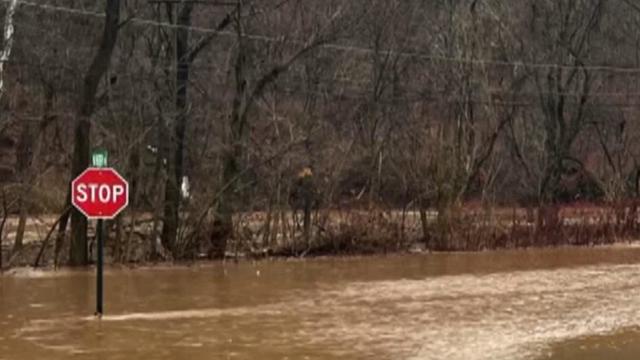
A major rainstorm is moving through the Philadelphia region on Tuesday and bring high winds, heavy downpours, thunderstorms and the potential for flooding and power outages.
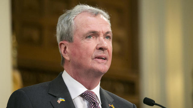
New Jersey Gov. Phil Murphy has declared a state of emergency on Monday ahead of a major rainstorm moving into the Philadelphia region on Tuesday.
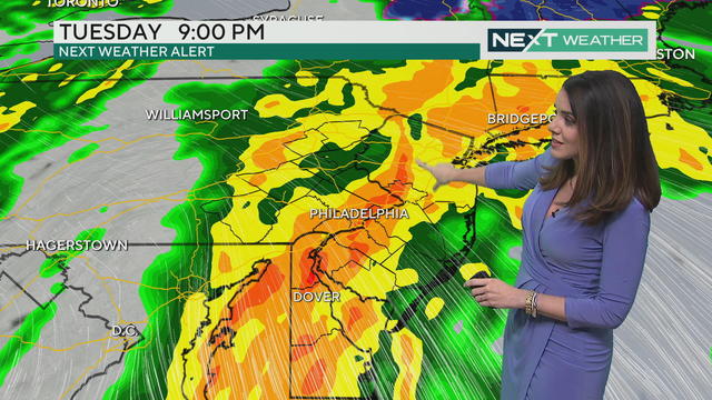
After a sunny and seasonable start to the week, a powerful storm system will bring rain to the entire Delaware Valley region, along with flooding threats, high winds and possible thunderstorms.
Expect some lingering fog Sunday morning and potentially freezing drizzle. Wraparound snow showers are possible north and west, and could make already icy roads more slippery.
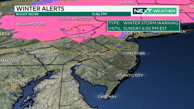
Who gets the most snow, when does snow change to rain and when is it all out of here in Pennsylvania, New Jersey and Delaware?
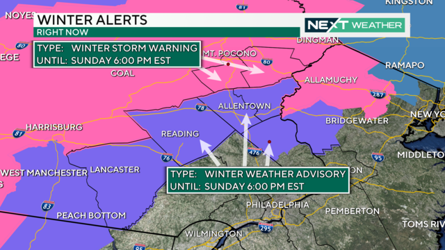
A winter storm will drop significant snow on the Poconos and parts north and west of Philly. Delaware and South Jersey will mostly get rain.
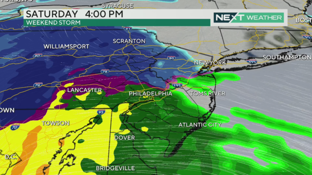
The forecast of a coming weekend storm is becoming clearer, and it looks like Philadelphia will see mostly rain.
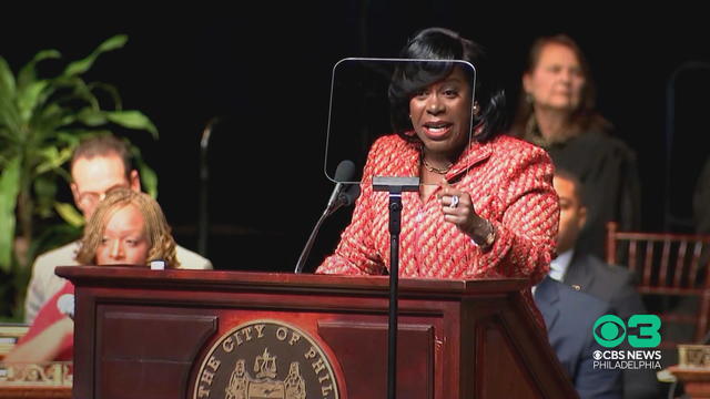
This week, Cherelle Parker made history by becoming the first female mayor of Philadelphia, the region is preparing for the first winter storm of 2024 and much more.
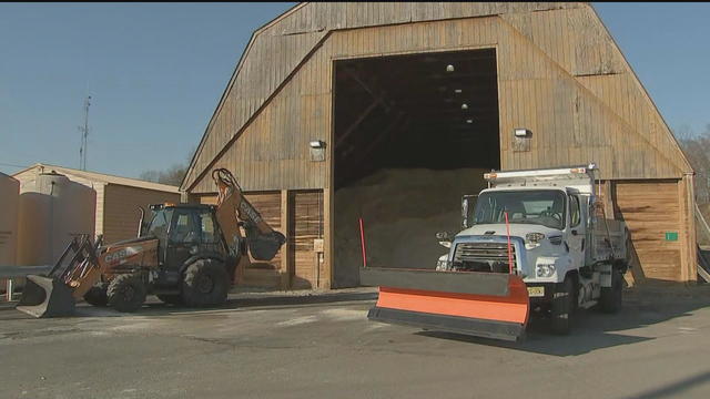
Camden County officials said they're ready for a potential winter storm after two mild winters.
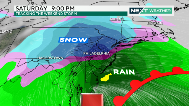
Quiet weather continues midweek, but the first weekend of 2024 has the potential to bring the Philadelphia region a significant winter storm.
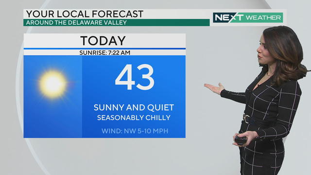
Expect sunshine and highs in the 40s Tuesday and Wednesday, but a potentially significant snow and rain event is on the way this weekend.
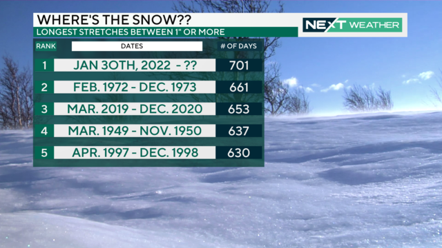
A strong storm system expected to arrive during the first weekend of 2024 shows the possibility of being a significant winter weather event.
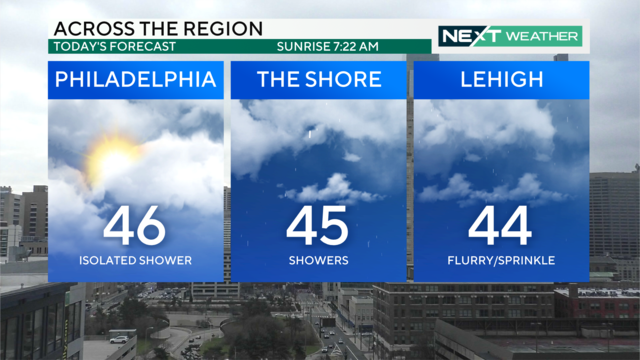
We're ringing in 2024 with a mostly cloudy Monday with highs in the mid-40s. There are chances for light passing rain showers, but no major impacts are expected.
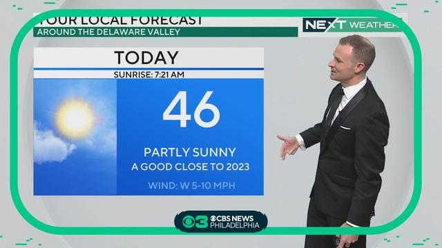
Highs Sunday will be in the mid-40s before temps drop to the mid-30s as we ring in the New Year. The chance for an isolated sprinkle of rain or flurries is possible late tonight, and then lingers through the first half of Monday. Grant Gilmore has your end-of-the-year forecast. https://www.cbsnews.com/philadelphia/news/next-weather-a-quiet-end-to-2023/

Partly sunny skies and seasonable temperatures spread across the region for the last day of 2023. A chance for isolated sprinkles or flurries moves in late and continues through Monday.
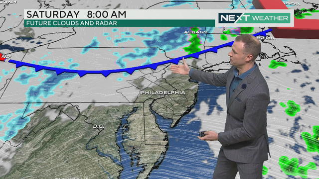
Saturday, Dec. 30 is cloudy with a chance of a light sprinkle in the Philadelphia region.
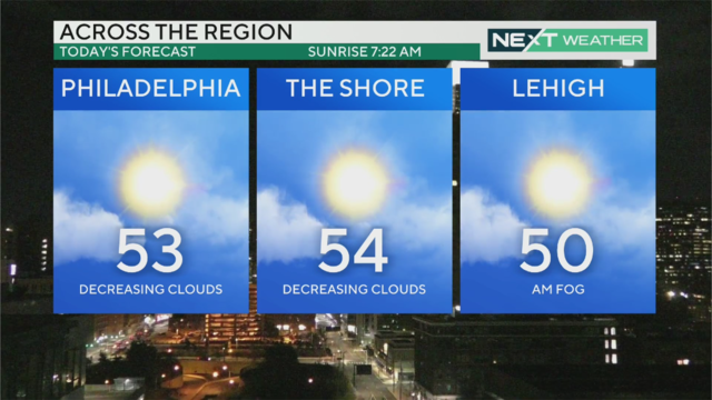
High temperatures will reach the 50s in the Philadelphia region on Friday, Dec. 29, 2023.
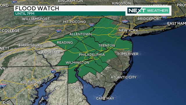
The Schuylkill River is forecast to crest around 1 p.m., which could lead to flooding and road closures along Kelly Drive and MLK Drive. A Flood Watch remains in effect until 7 p.m.
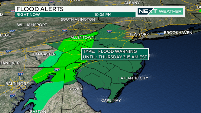
The Philadelphia region can expect rain for most of the day Wednesday, with heaviest showers late in the day and into the night.