Triple-digit heat indices continue as storm chances return for North Texas
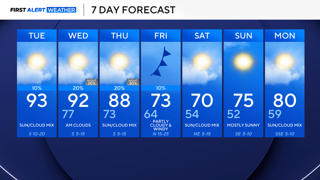
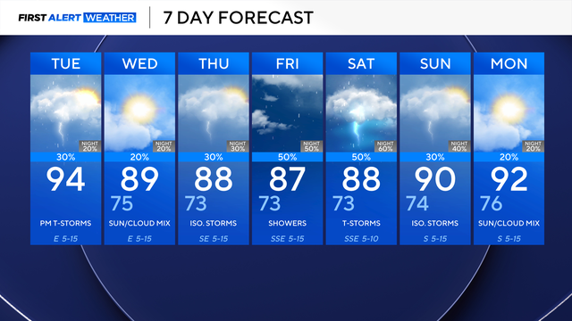
By Tuesday afternoon, a backdoor cold front (a cold front that moves in from the northeast) arrives, increasing our chances of isolated thunderstorms.
Watch CBS News
By Tuesday afternoon, a backdoor cold front (a cold front that moves in from the northeast) arrives, increasing our chances of isolated thunderstorms.
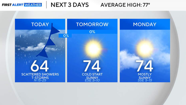
So far, the biggest impact has not been widespread severe weather, but strong, gusty winds.
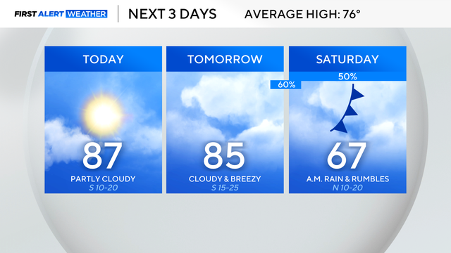
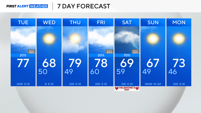
North Texas will see a nice break from any rain before chances quickly return late Friday to Saturday.
Looking ahead to Thursday and Friday, it's mainly quiet and warm.
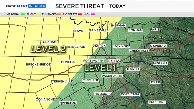
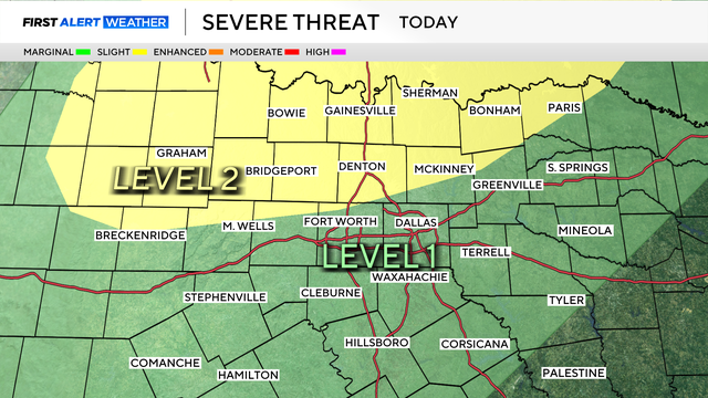
Large hail and damaging winds would be the main threats as storms may develop starting Tuesday evening and Wednesday.
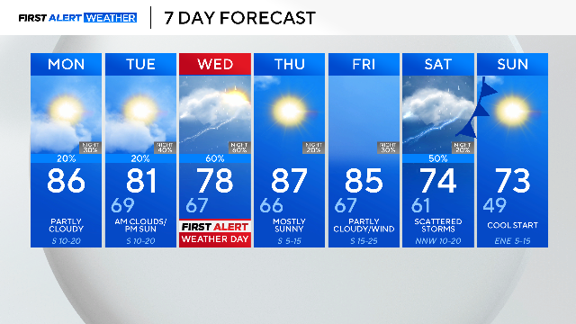
Monday, April 13, will be mostly dry with only a small 20% chance of an isolated shower or storm.
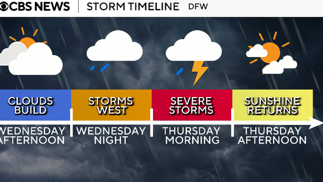
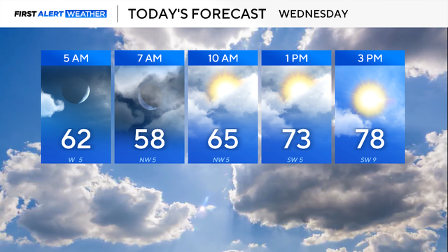
Looking ahead to Wednesday, the day will be dry throughout the day ahead of the first round of storms that move in overnight into Thursday.
Palm Sunday's forecast will be vastly different.
Expect plenty of clouds before the sunshine in the afternoon. It will be breezy at times, with some gusts up to and possibly over 20 mph.
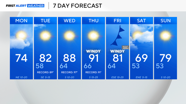
The cooldown will be short-lived as another bridge of high pressure builds in and raises temperatures back into the 90s by Thursday.
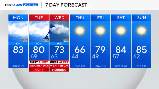
The next system swings through the area on Tuesday, causing the chance of severe weather.

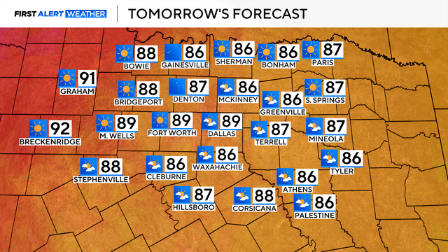
By the afternoon, expect partly cloudy skies and temperatures in the lower 80s.
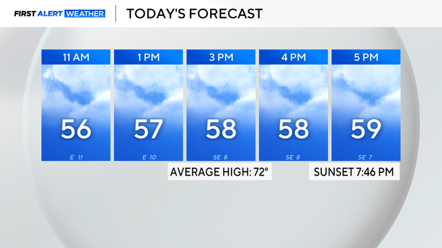
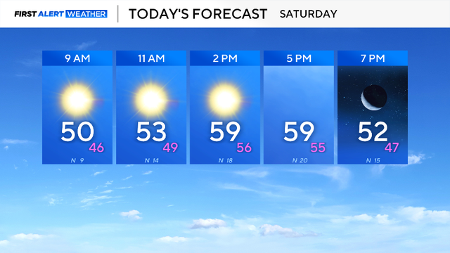
Grab the jacket because it will be chilly. Temperatures will climb into the low 50s by lunch and reach into the upper 50s by the late afternoon.
A cold front will be moving through the area, causing wind to gust up to 30 mph at times.
The main weather story over the next couple of days will be the elevated fire danger.
Humidity has increased as an upper-level low sits to the west and a cold front approaches from the north.
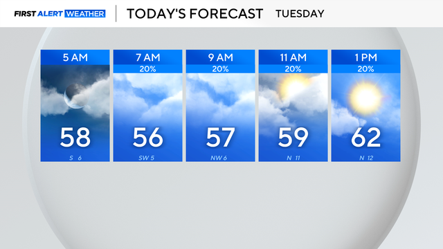
A cold front moving into the region will bring clouds and a chance for a few showers along and east of I-35 on Tuesday morning and into the afternoon.
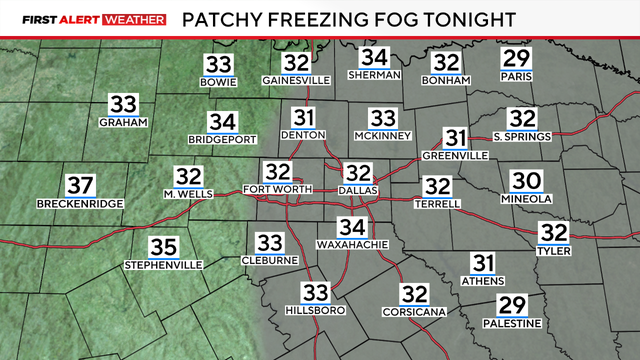
A First Alert Weather Day is in place due to the freezing fog advisory, which is in effect through 11 a.m. Wednesday, visibility will be under three miles.
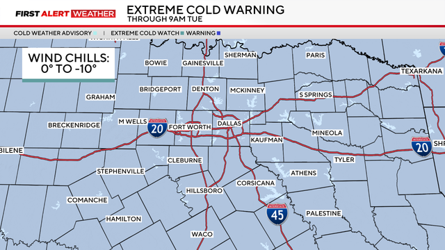
An extreme cold warning is in effect through Tuesday morning due to wind chills from 0 to -10 degrees covering the region.
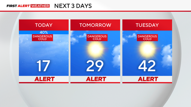
Weather Alerts are in place through Tuesday due to dangerously cold temperatures and icy roads at times.

As freezing temperatures move into North Texas, the SPCA of Texas urges pet owners to bring animals indoors, limit outdoor exposure.
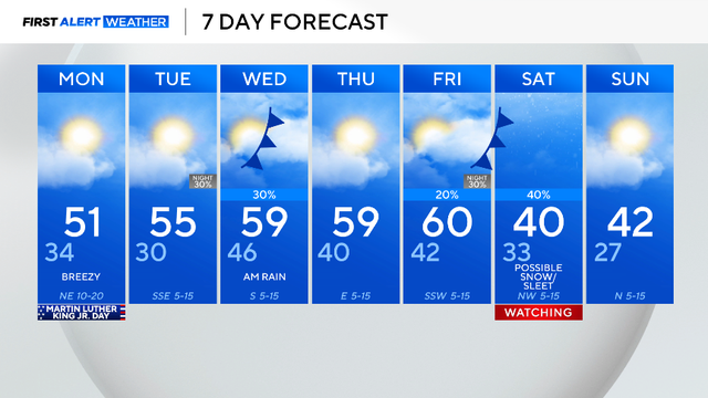
You'll need to grab a jacket heading out the door; temperatures will rebound in the afternoon, but most of the day will be chilly.
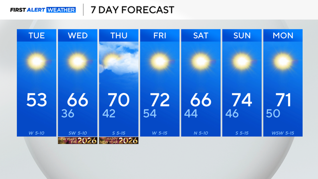
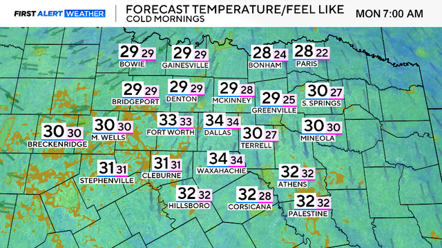
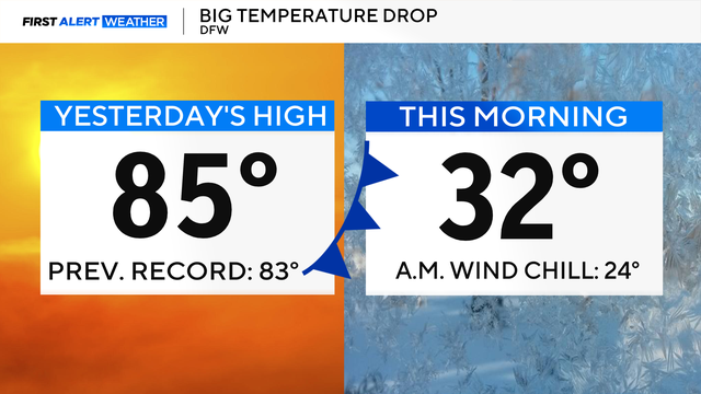
Temperatures across the area dropped below freezing in the 30s and 20s, and winds from the northwest at 5-10 mph made it feel like the 20s and teens.
Tuesday morning will still be chilly, as winds remain out of the north and skies continue to clear.
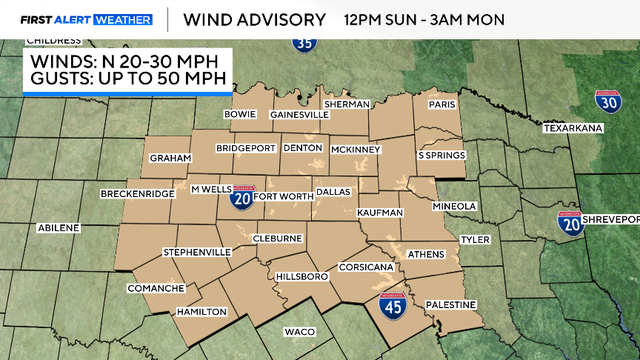
A wind advisory is in place beginning at noon Sunday through Monday morning, as gusts up to 50 mph will be expected.