Flood Watch in place all of Sunday as rain persists throughout the day in Pittsburgh
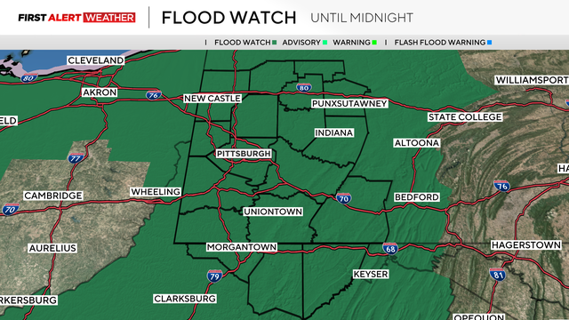
Most of the area is under a Flood Watch for most of the day on Sunday, as rain will be persistent.
Watch CBS News
Most of the area is under a Flood Watch for most of the day on Sunday, as rain will be persistent.
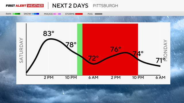
While there may be some quick drizzle, Saturday will be mostly dry, but on Sunday, rain and storms are possible.

Friday and Saturday will have very summer-like weather, but by Sunday, rain and storms are possible in Pittsburgh.

For the next couple of days, the mornings will be cool, the daytime will be warm, and nights will be comfortable in Pittsburgh.

Temperatures will warm up over the next couple of days, but rain chances loom this weekend.

A line of storms could move through the area between 12 p.m. and 3 p.m.

Storms will race through western Pennsylvania with wind speeds of 60 to 80 mph being possible.

Some wildfire smoke is rolling into the Pittsburgh area on Sunday, as scattered storm chances return to the forecast.

Sunshine is back in the Pittsburgh area on Saturday afternoon, but wildfire smoke returns overnight.

While the temperatures will remain in the 80s and above through the weekend, rain and the return of wildfire smoke are on the horizon.

Sunshine and warm temperatures are expected once again in the Pittsburgh area before some scattered rain this weekend.

Following a day of storms in the region, the pleasant conditions and sunshine return to western Pennsylvania on Wednesday.

Multiple tornado warnings were scattered across western Pennsylvania on Tuesday evening.
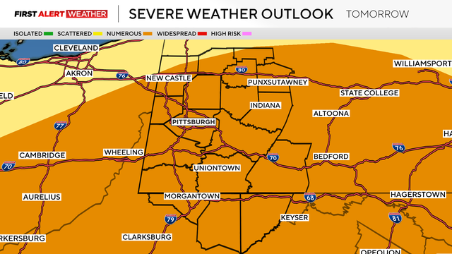
Damaging winds, flash flooding, small hail, and even possible tornadoes will be possible.
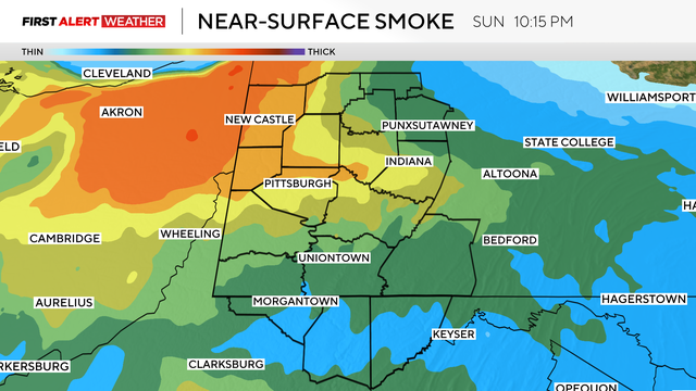
While some of the wildfire smoke will be back on Sunday, it will also be warm and sunny.
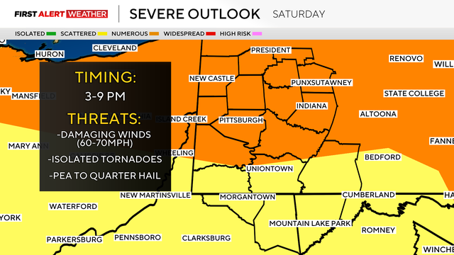
The wildfire smoke is moving on, but strong storms are possible this afternoon in Pittsburgh.

Friday will be another day with poor air quality in Pittsburgh as the wildfire smoke worsens.

The Pennsylvania DEP has declared Thursday a Code Red Day due to poor air quality caused by wildfire smoke.

Temperatures will reach into the 90s on Wednesday with hazy skies due to wildfire smoke.

Heat index values today are expected to be in the mid-90s, near 100 degrees.
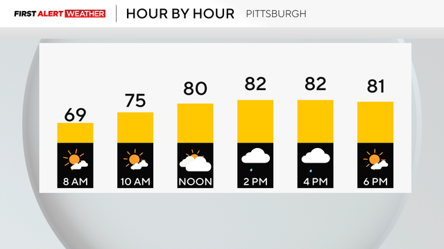
While we can't rule out an afternoon shower, it will be mostly sunny today in Pittsburgh.
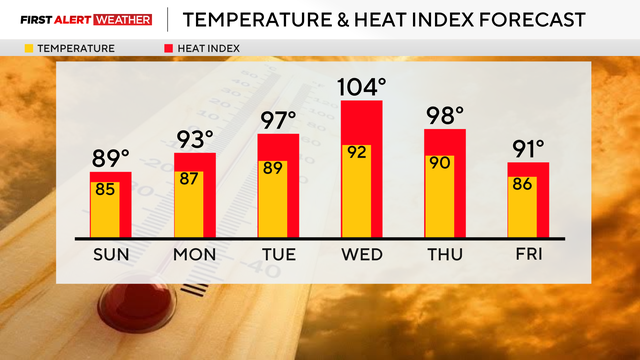
Saturday will have some scattered thunderstorms before the heat cranks back up next week.

Areas to the south of Pittsburgh on Thursday can expect rain and storms.

While there is still a chance of rain through the weekend, those chances have decreased in the last 24 hours.

A number of small factors are expected to bring a significant flash flood risk to the Pittsburgh area.