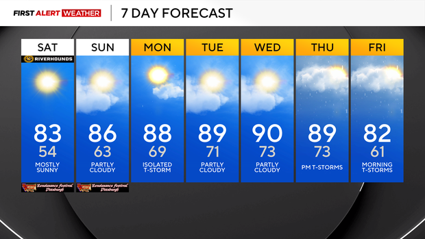
Saturday will be warm and comfortable before heat and humidity move back into Pittsburgh

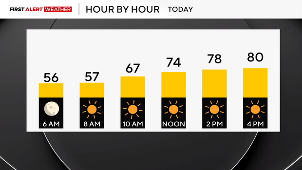
It's a cool and comfortable morning with temperatures in the upper 40s for some! The humidity will be comfortable today with mostly sunny skies and highs in the low 80s.
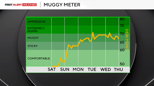
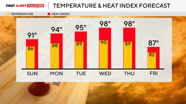
On Sunday, humidity is on the rise, and so are our temperatures, where we are back in the mid 80s and feeling in the upper 80s as moisture increases with an incoming warm front.
A stray shower is possible north tomorrow in the afternoon with a rumble or two of thunder, but it will be mostly dry!
Monday is our last chance to make it to the top of the list for wettest Augusts on record. We are .24" away from tying the wettest of 7.86" back in 1987.
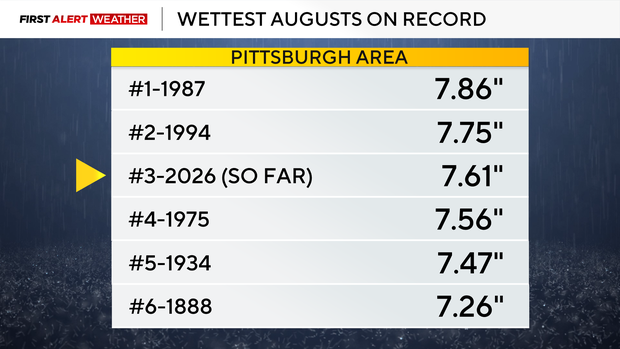
We are still 4.50" above normal for precipitation for the month and there have been some areas across the region that picked up over 8" for just the month.
We have several chances this week of getting to the 90s. Tuesday and Wednesday will be the hottest days this week with highs at or near 90. For the year, we have only had 6 days of 90° or hotter. We normally average 10 a year, and last year we had 17 days.
Wednesday evening into Thursday will be our next chance for scattered showers and thunderstorms.
Sunshine returns Friday with highs in the mid 80s.