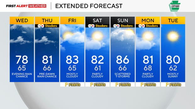
Wednesday remains mostly dry throughout the day in Pittsburgh with rain chances ticking up at night

You should be good leaving the umbrella behind this morning to dry out. It has been wet here locally, with yesterday's 0.53" of rain putting Pittsburgh over the 4" mark for the month. That's impressive since we have only completed about a third of the month. Clearly things will settle down at some point, and looking ahead, our rain chances look to be low over the next week.
There is some uncertainty, however, with model data really having a poor handle on things over the past, let's say, 2 months.
Our next rain chance comes tonight, with a chance for evening storms lasting into Thursday morning. This is probably going to be our best widespread chance for rain through Saturday. Most data is leaving this rain chance out, with the shortwave that brings the rain staying to our south.
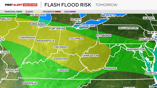
That is also where the Weather Prediction Center has highlighted as having the highest chance for flooding today. Places like Louisville and Lexington in Kentucky, along with Cincinnati, Ohio, are in or near the moderate risk zone for flooding today. Pretty much all of Western Pennsylvania is under a level one out of four (with four being highest) marginal risk.
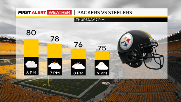
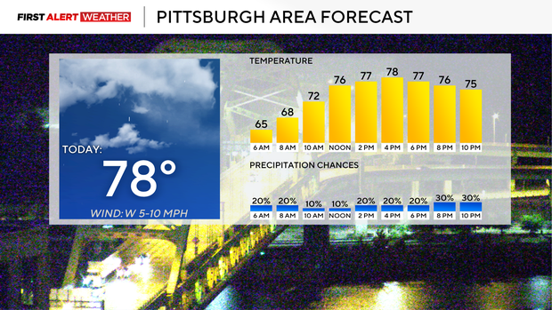
Besides that, things are looking pretty good with highs today near 80. I have Pittsburgh seeing a high of 78°. Noon temperatures will be in the mid-70s. Winds should be light and out of the southwest at around 5 mph.
Temperatures should hit the low 80s Thursday through Saturday. Storm chances will be back on Sunday.