Pittsburgh's summer rain total nears 7 inches, more on the way this weekend

What a month when it comes to rain. So far this month, Pittsburgh has recorded 6.88" of rain. This is after yesterday saw 1.04" of rain fall in the greater Pittsburgh area.
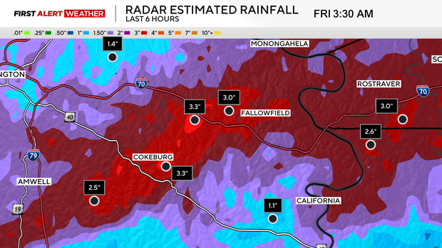
As of this morning (August 21st, 2026), we are sitting in 8th place on record when it comes to total rain for the month of August. The apex of rain occurred in southern Allegheny County, just south of I-70, where a fairly broad swath of 3+ inches of rain is estimated to have fallen from radar. In Washington County, the Cokeburg area through Fallowfield saw some of the larger rain totals, nearing 3.5 inches. Looking ahead, it doesn't look like we will see a lot of additional rain for the rest of the month.
Our next rain chance comes on Saturday and right now appears to be our best chance for rain for the remainder of the month. A cool front will roll through with afternoon scattered showers developing right on top of us, turning widespread into the evening hours for places east of Pittsburgh.
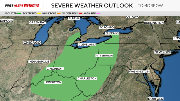
We are included under a marginal risk of severe weather for both Saturday and Sunday, but Saturday really appears to be the day at this point. The biggest concern will be strong straight-line winds, followed by a chance for large hail. We are starting to get into what is traditionally our second hail season of the year. There is a non-zero chance for a tornado too. On top of all of that, any downpours can lead to flash flooding with just how damp we are at this point.
Rain chances will stick around on Sunday, but at this point it looks like Sunday rain will be light with pockets of drizzle around as the atmosphere cools. The cool weather pattern should help to keep rain away, along with suppressing those high temperatures to more like something you'd expect to see in September.
One of the reasons we have seen so much rain this month so far is due to humidity levels staying high. With the cooler air in place for the rest of the month, dew points will be low along with precipitable water values. This means downpours will not be likely.
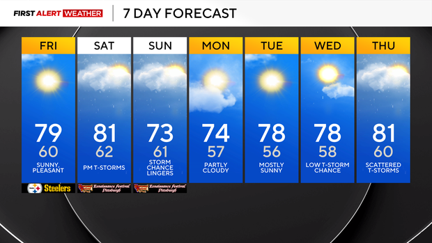
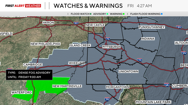
Getting into your forecast, we start off the day with some fog, but it will burn off with sunny skies expected for the rest of the day. Highs today will be near 80 degrees.
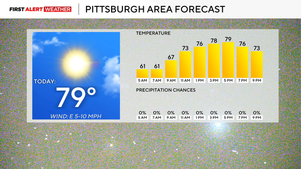
I also have highs on Saturday in the low 80s ahead of any rain and storms that develop in the afternoon. Morning lows on Saturday will dip into the low 60s.
Sunday will be cooler with highs only in the mid to low 70s and mostly cloudy to overcast skies. Pockets of drizzle will be around, and it will be breezy. I have Highs staying in the mid 70s on Monday before we see temperatures back in the upper 70s on Tuesday and Wednesday.