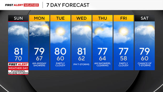
Pittsburgh-area expected to see 2 rounds of rain, thunderstorms on Sunday

Mid- and high-level clouds have been moving in from the west Saturday afternoon and evening in advance of two disturbances that will bring scattered to numerous showers and storms.
First Alert: Sunday (flash flooding and severe storms)
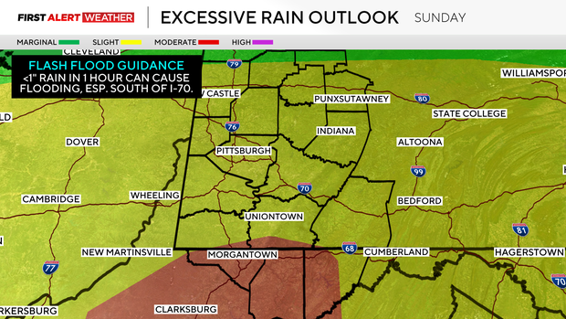
These disturbances, accompanied by unusually high content of atmospheric moisture across our region, will allow for showers and storms that will be efficient at producing rainfall. Given that soils are already saturated, especially south of I-76 into Northern West Virginia, this zone will have the greatest potential for flash flooding. A level-three (out of four) risk is in place in these locations for excessive rainfall. The complex of storm systems will likely be most widespread and feature heavier elements closest to where the warm front will be positioned during the early morning hours.
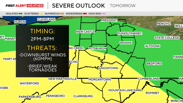
After 9-10 a.m., there will be a lull in the activity as we await the second shortwave to approach from the west. This will start to induce thunderstorms after 2 p.m. A mixed mode of linear storms and discrete cells is possible. Low-level wind shear will be sufficient for some storms to rotate, especially near and south of the turnpike where an outflow boundary from the first round of thunderstorms will be left in place.
If a tornado did occur, the threat would be very isolated, with tornado intensity on the low-end of the scale. Wind damage, especially downed trees and power lines are possible given the saturated soils.
Most areas will receive 0.5 to 1.5 inches of rain, with isolated amounts as high as two to three inches possible. The highest rainfall amounts are more likely to occur over the southern third of our forecast area, given these places will have a higher chance of getting two rounds of storms.
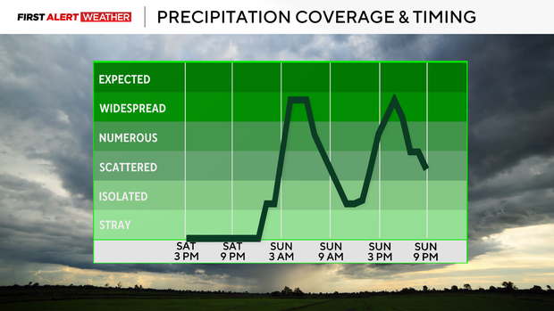
As we lose surface heating after sunset tomorrow, the severe weather potential will wane, and the coverage of showers and storms will diminish overnight.
Fog is possible Monday morning, and it will remain humid until the cold front passes through from northwest to southeast between 9 a.m. and 2 p.m. This front may trigger some isolated to scattered showers, especially across the southern 2/3 of our region before drier and comfortable air moves in Tuesday morning.
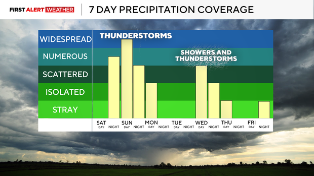
After a break in the activity on Tuesday, winds will quickly shift to the southwest on Wednesday ahead of another cold front and a strong push of jet stream energy.
These two features will trigger another round of showers and storms Wednesday afternoon and evening, with lingering showers Thursday morning as the cold front passes by.
Later next week, highs will likely stay in the mid to upper 70s with overnight lows in the mid-50s to near 60. Some showers and storms are possible next weekend as another trough approaches from the west.