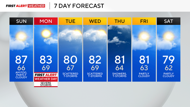
Sunday will be hot with less humidity in Pittsburgh, but storms move in on Monday

We are waking up to some patchy fog before we have plenty of dry time and sunshine to enjoy, but it'll be hot in the mid-to-upper 80s.
The key will be lower humidity.
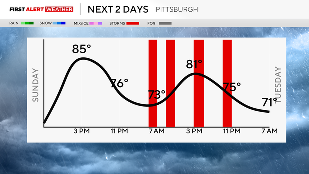
Monday is a First Alert Weather Day with a slight risk (2 out of 5) for strong to severe storms.
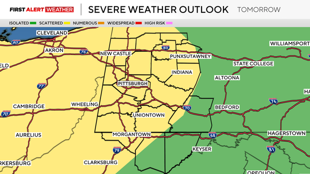
A couple rounds of severe weather are possible, with one being overnight Sunday into early Monday morning north of Pittsburgh and then a quick round in the afternoon south of Pittsburgh, then one more late Monday night into Tuesday.
The timing and coverage area can still change. There will still be plenty of dry time throughout the day, but you'll need to be weather aware if you have outdoor events or activities.
It'll be warm and humid, and heavy downpours can lead to flash flooding
Relief from humidity and below-normal temperatures are on the way for the end of the week, with the chance of showers continuing.