Pittsburgh will see periods of rain and thunderstorms through the weekend
Storms and rain chances will persist through the weekend and into early next week.
Watch CBS News
Storms and rain chances will persist through the weekend and into early next week.
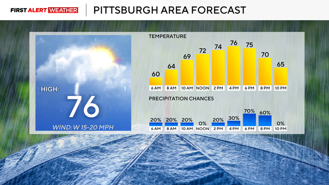
Over the next 36 hours, storm chances will begin to spike across the region.
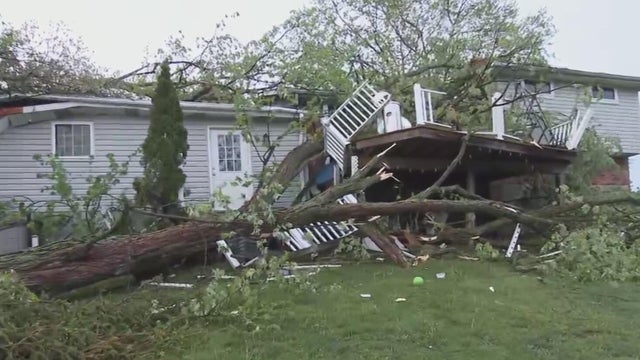
Duquesne Light and First Energy crews are working to get power restored across Pittsburgh following Tuesday's storms.
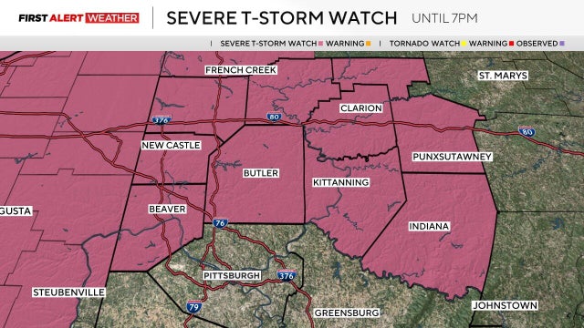
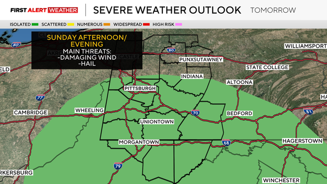
We're not quite done with the rain and storms just yet, as we could see rain, heavy winds, and hail through the weekend.
Storm chances return to the area on Thursday afternoon.
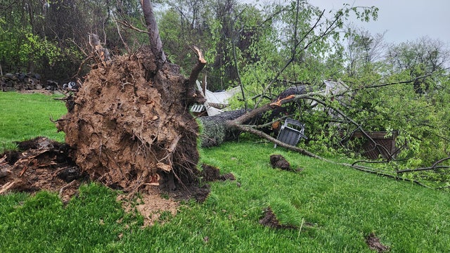
Strong storms swept through the Pittsburgh area on Tuesday evening, prompting tornado and severe thunderstorm warnings.
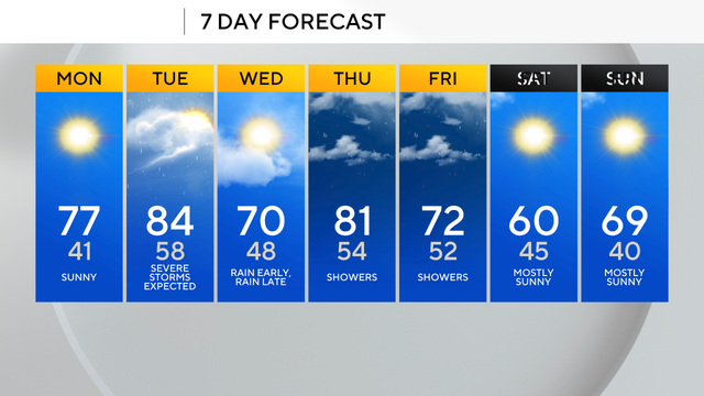
Tuesday is a KDKA First Alert Weather Day in the Pittsburgh area due to strong storms being possible.
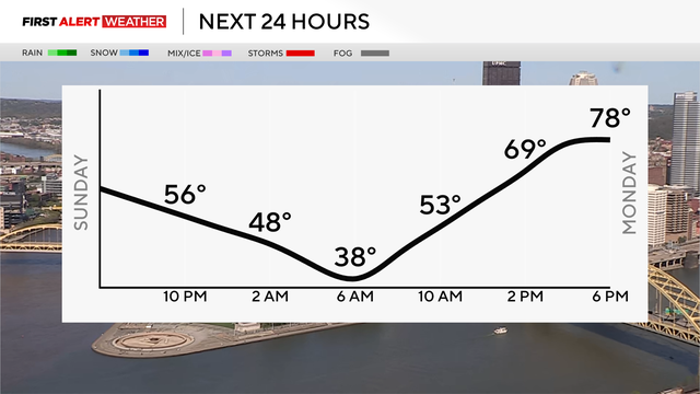
After beautiful sunshine and seasonable highs in the 60s on Sunday, we dip into the upper 30s to lower 40s by Monday morning.
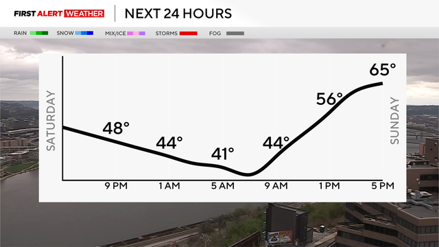
Saturday morning begins very warm and humid across most of western Pennsylvania and northern West Virginia.
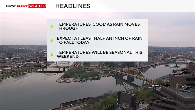
Rain returns to the Pittsburgh area on Friday with two rounds expected, and that will cool off our temperatures.
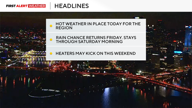
While the record-high for April 24 in Pittsburgh is 90, we might get close on Thursday with highs in the mid-80s.
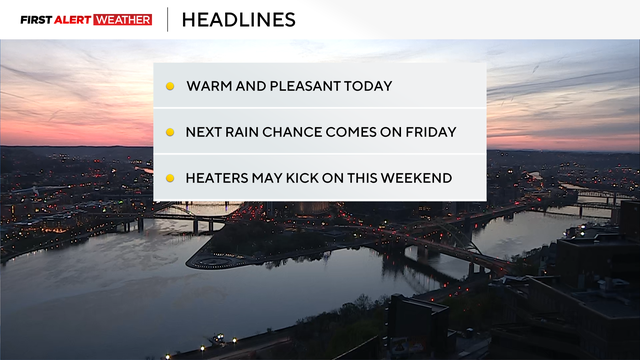
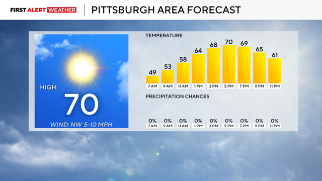
We're looking at another above-average temperature day in Pittsburgh with some sunshine.
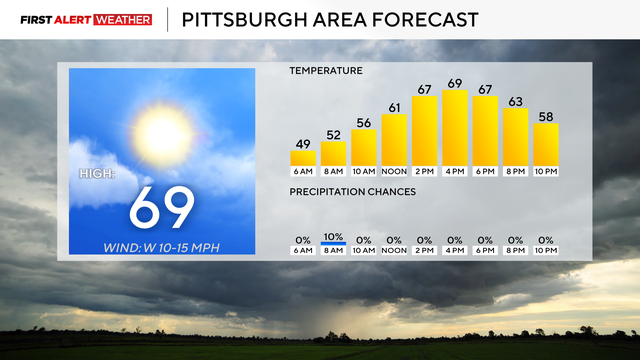
Today will be the coolest day of the work week.
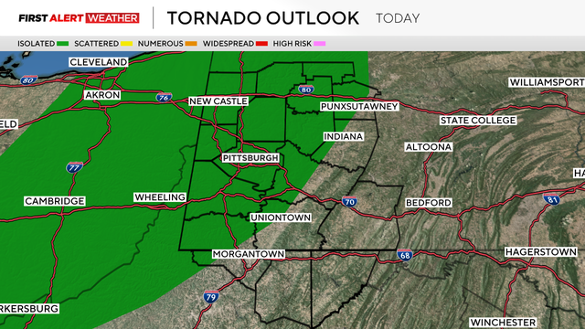
Strong storms will be possible this afternoon.
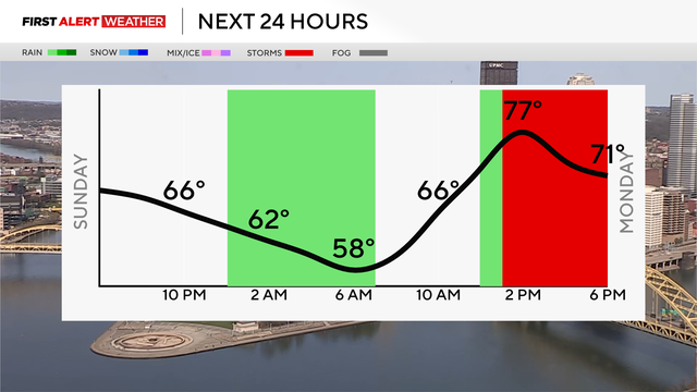
We'll have a cooler Easter morning after near-record-highs on Saturday, but storms do loom this week.
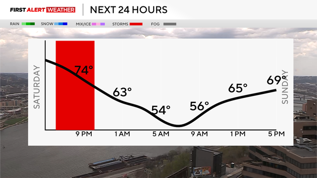
Rain and storm chances slowly creep in throughout the weekend, and they'll linger into next week.
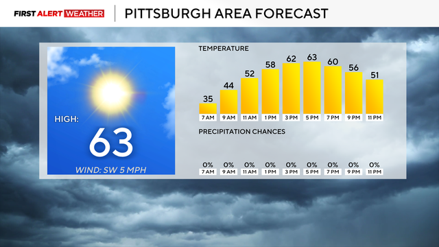
After some cooler days, we're heading toward some warmth, but potential storms loom.
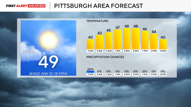
The colder air remains for the next couple of days with some of the windy conditions sticking around.
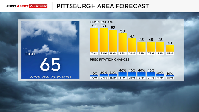
One could make the argument today is a First Alert Weather Day with strong winds, falling temperatures, and snow overnight.
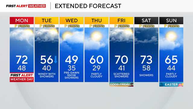
It's a KDKA First Alert Weather Day, as storms are possible in the Pittsburgh area on Monday afternoon.
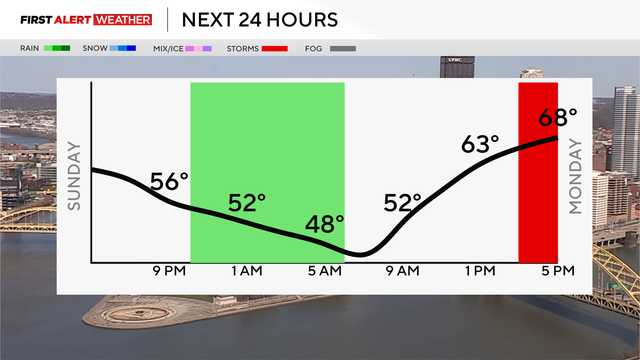
There is a chance that severe storms may occur this week, and some low temperatures can lead to frosty conditions.
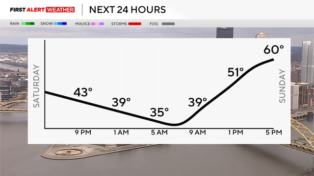
After a mainly cloudy Saturday, patchy fog will arrive early Sunday morning, followed by eventual clearing and a pleasant end to the weekend.
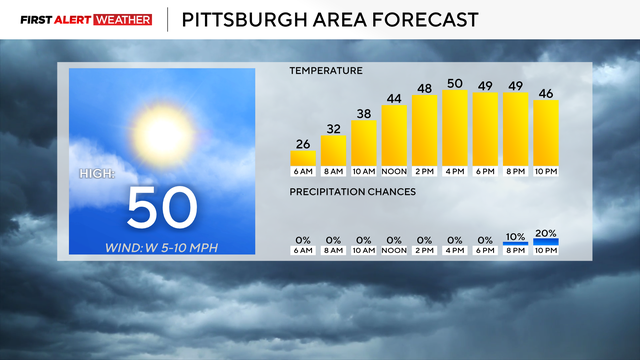
Highs today will hit the low 50s with noon temperatures in the mid-40s.
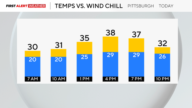
Winds today will make it feel like the 20s all day.
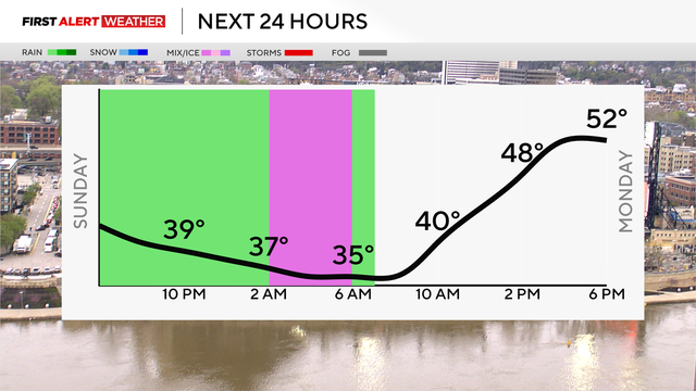
Rain and snowfall will continue during the week and temperatures will become cooler.