Widespread rain and storms expected all weekend; flood watches issued
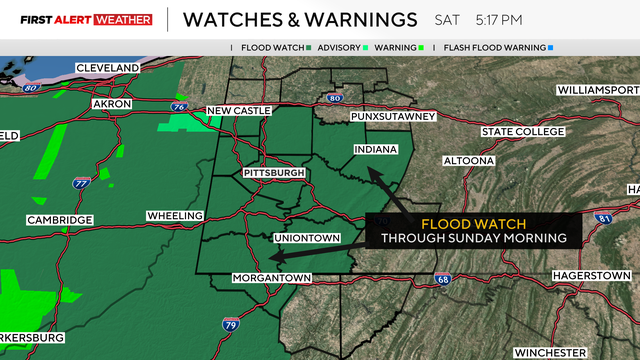
A flood watch is in effect until Sunday morning for almost our entire KDKA-TV viewing area.
Watch CBS News
A flood watch is in effect until Sunday morning for almost our entire KDKA-TV viewing area.
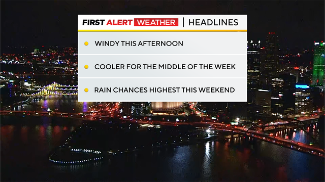
Winds will gradually diminish as the day goes on.
Wind gusts will be around 20 mph at times throughout the day and then diminish overnight.
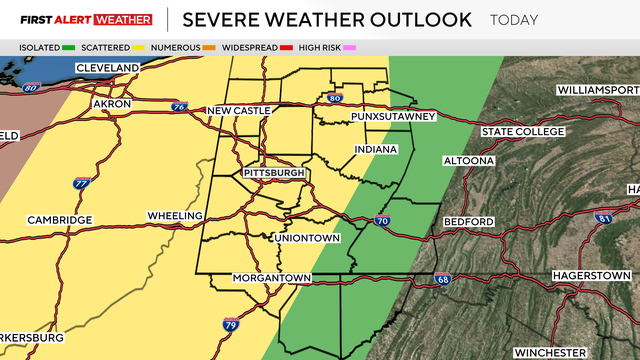
The main threat with this system will be storms with damaging winds and a tornado risk.
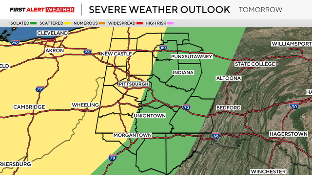
Unseasonably warm air sticks around to end the weekend, with highs Saturday hitting the mid to upper 70s and 70s on the way again Sunday.
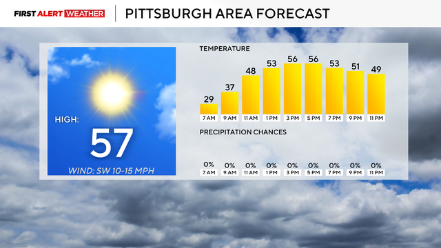
Today is looking dry with noon temperatures in the low 50s.
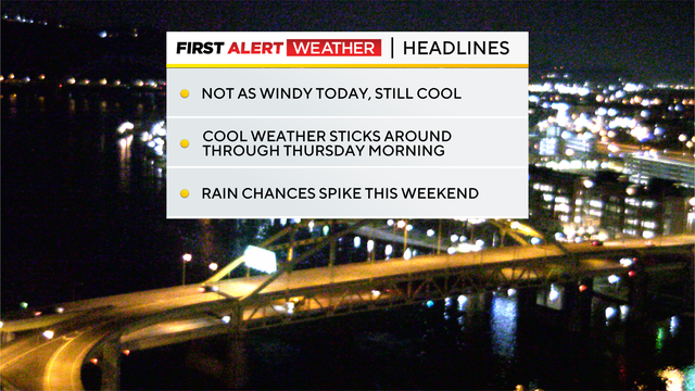
It won't be as windy today as it was yesterday.
Afternoon temperatures should be in the mid to low 50s.
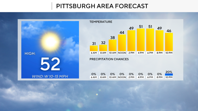
It'll be sunny to start the day with partly cloudy skies expected to begin moving in after 3:00 this afternoon
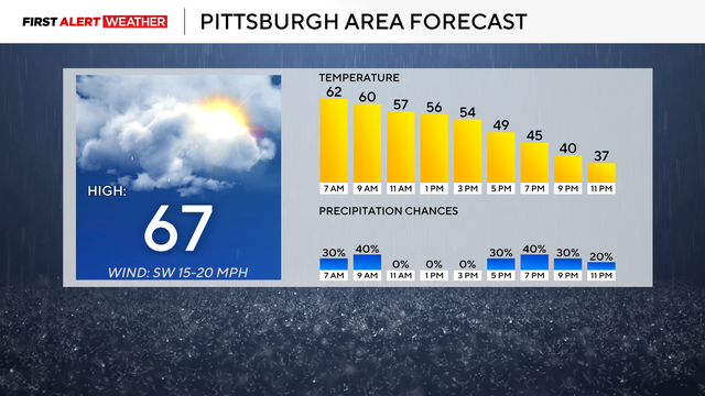
Highs today will officially be 67 degrees, but that is a little misleading as that temperature was hit at midnight.
Our next rain chance arrives on Thursday morning.
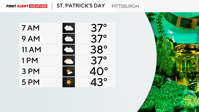
There is a chance for you to see both light rain and snow before noon.
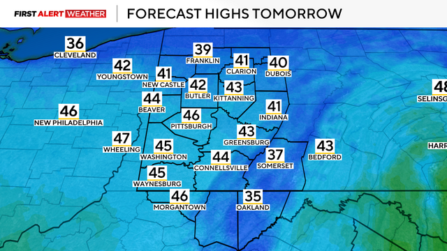
A round of severe weather prompted several watches and warnings across the Pittsburgh area on Sunday.

Isolated showers and storms will be northwest of Pittsburgh and more storm chances are in the area for the weekend.
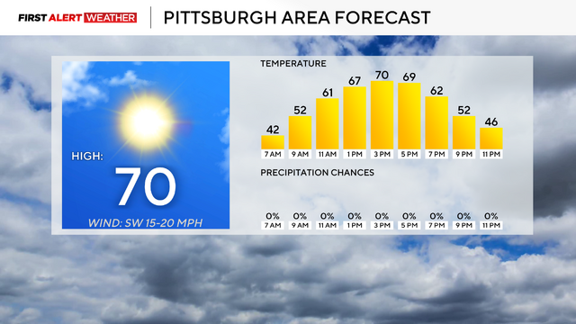
Last year, we hit the 70 degree mark for the first time on March 4.
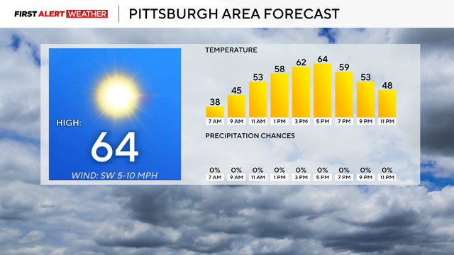
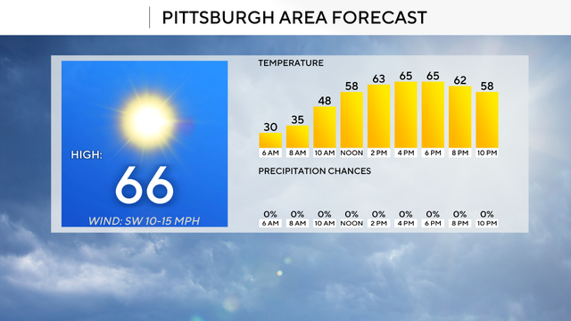
Temperatures are expected to be in the 60s.
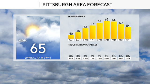
Temperatures today could reach the mid-60s.
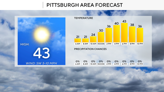
The sunshine will make things look warmer than they actually are.
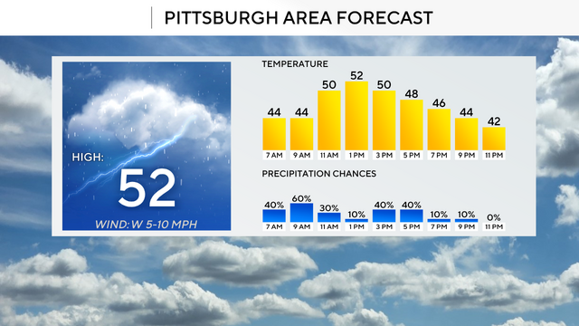
If your kids walk home from school, today might not be the best conditions for it.
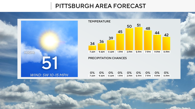
Today will be the warmest day we've seen in Pittsburgh since February 4.
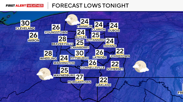
The Pittsburgh area is expected to see milder temperatures this week with a few light rain chances.
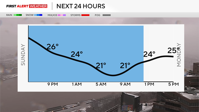
Rain will become snow on Sunday and high winds are expected along with potentially slippery roads.
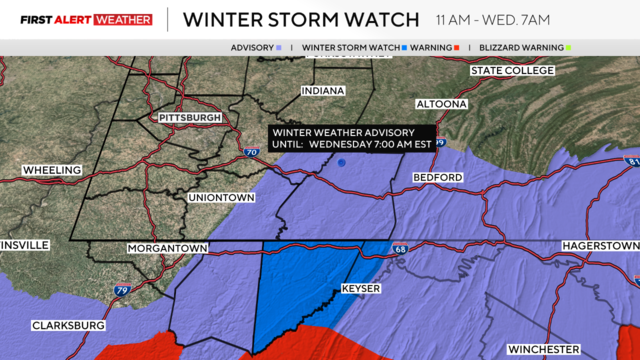
Garrett County, Maryland is under a Winter Storm Watch from 11 a.m. Tuesday through 4 a.m. Thursday.
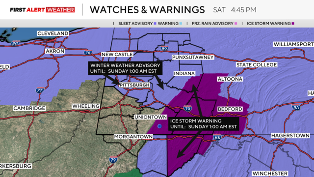
Freezing rain and icy conditions are coming to the Pittsburgh area moving forward.
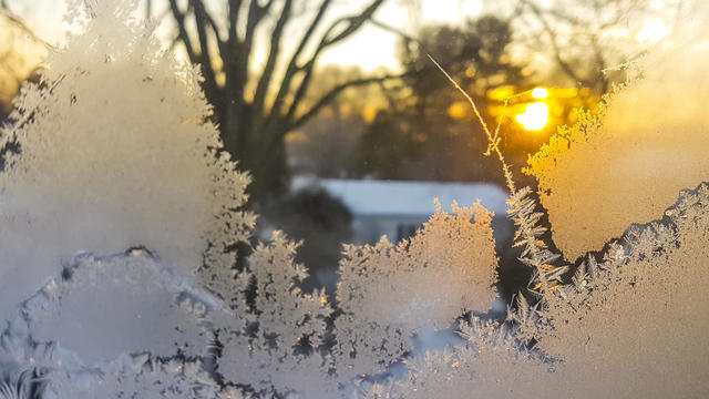
While the ice glistening on the trees and wires can look beautiful, they can turn into a nightmare.