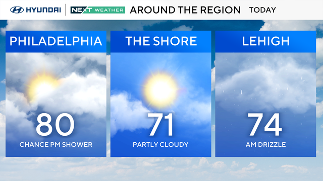
Highs near 80 for Mother's Day, chance for an isolated afternoon shower
After a foggy and cloudy morning, plan on summer-like conditions by midday with above-average temperatures and highs near 80 across the Delaware Valley.
Watch CBS News
After a foggy and cloudy morning, plan on summer-like conditions by midday with above-average temperatures and highs near 80 across the Delaware Valley.
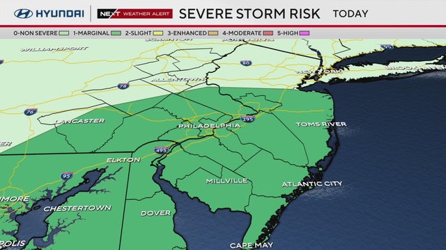
The Philadelphia area is under a NEXT Weather Alert because severe storms are possible on Saturday evening.
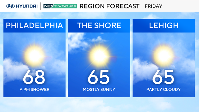
On Friday in the Philadelphia region, you'll want a sweatshirt or light jacket before heading out the door in the morning with temperatures in the 40s.
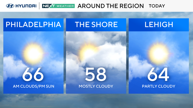
Skies will give way to sunshine Thursday in the Philadelphia region as temperatures will be in the 60s.
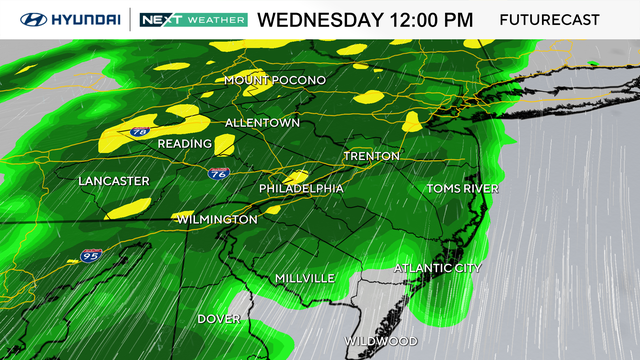
A thunderstorm or two in the Philadelphia region is possible Wednesday afternoon and evening, but any severe weather is unlikely.
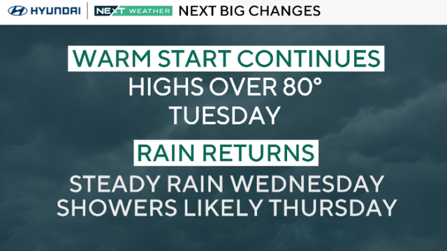
Monday in the Philadelphia region was a spectacular way to start the week, and Tuesday will be even warmer with highs 10-15 degrees above normal in the mid-80s.
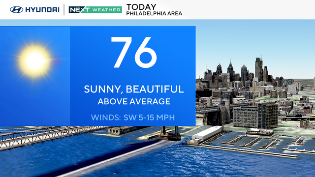
Monday in the Philadelphia region will be sunny and warm, but we're tracking more rain this week.
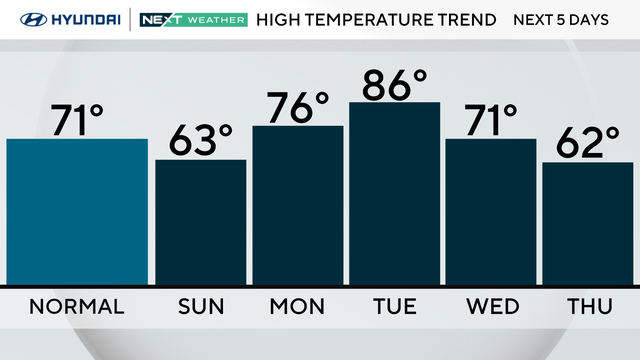
After a cloudy start, Sunday is mostly sunny and a bit breezy with highs in the low 60s before a stretch of warmer weather kicks off the work week.
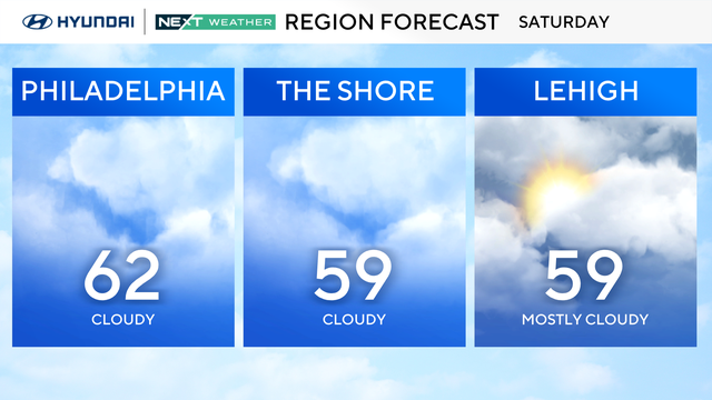
Saturday and Sunday will be cool with lows in the 40s and highs in the low 60s.
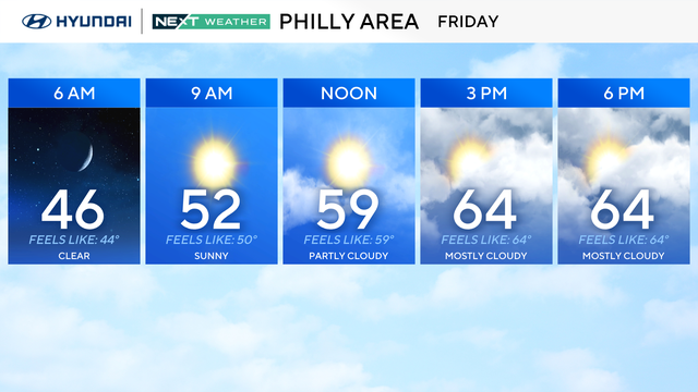
Highs will be in the mid-60s on Friday in the Philadelphia region, so it will be great sweatshirt weather.
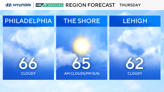
Highs will be in the mid-60s on Thursday, so it will be great sweatshirt weather in the Philadelphia region.
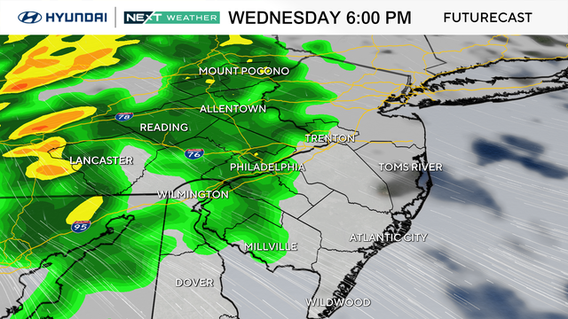
Get your outdoor activities done early on Wednesday as rain arrives in the Philadelphia region in the late afternoon and early evening.
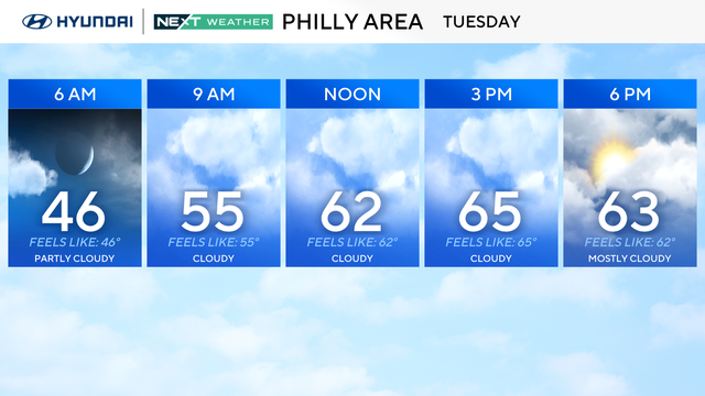
Tuesday is another pleasant day in the Philadelphia region with increasing clouds and highs in the upper 60s with the chance of a spotty shower.
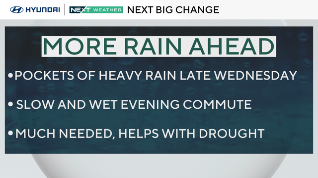
The Philadelphia area can expect warmer temperatures Monday before rain moves through later this week.
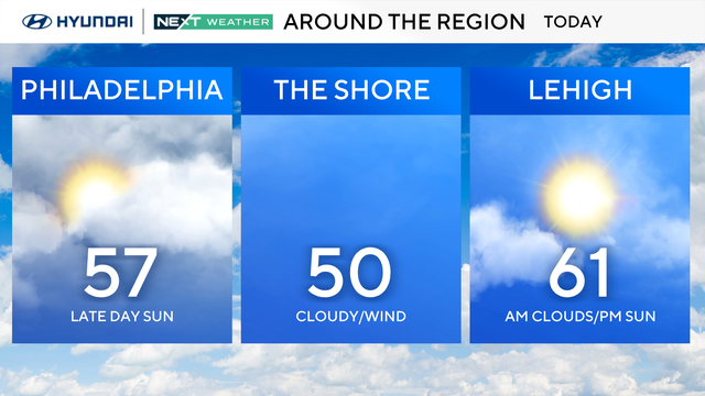
Rain moved out of the Delaware Valley Sunday morning, but skies will stay cloudy and gray for most of the day before some late-afternoon sunshine.
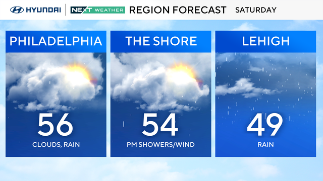
Umbrellas will be needed as well as contingency plans if you are going to be outdoors on Saturday, especially during the nighttime hours.
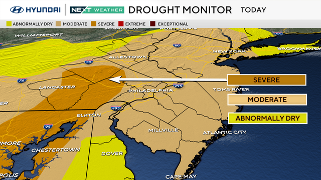
Since Oct. 1, almost all of southeastern Pennsylvania, Southern Jersey and Delaware have gone from no drought conditions to a moderate and severe drought.
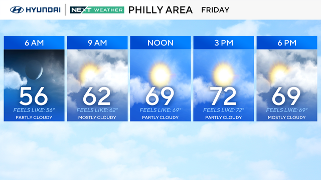
After a warmer couple of days, a cold front will bring rain to the Philadelphia region this weekend.
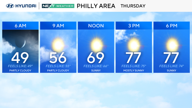
Sunshine and warmth will be the rule on Thursday in the Philadelphia region.
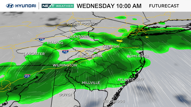
An umbrella might be needed heading out the door on Wednesday morning in the Philadelphia region as rain showers move through.
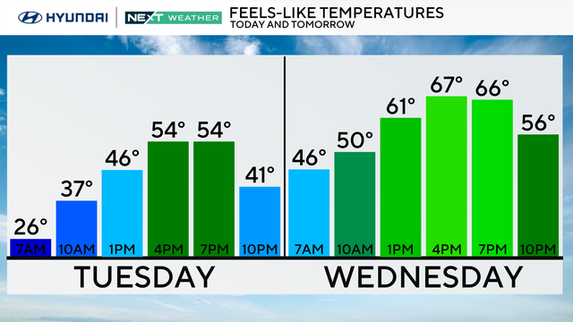
After a freeze warning expired, Tuesday is sunny and chilly with high temperatures in the 50s in the city.
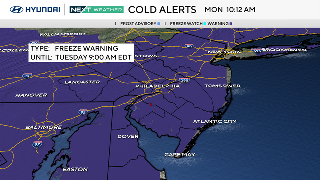
The Philadelphia region will bottom out with highs in the low-to-mid-50s on Monday, well below the average for this time of the year.
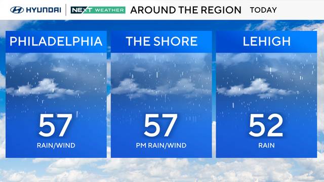
Periods of rain will continue throughout the early and mid afternoon Sunday with high temperatures only reaching the mid-50s.
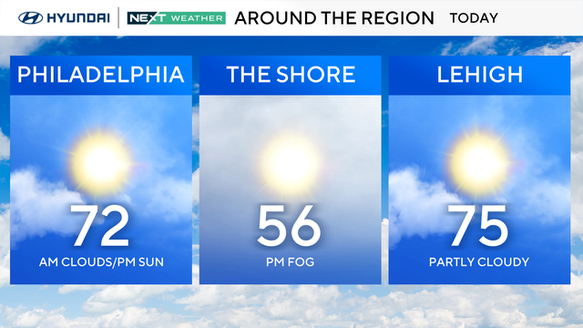
Saturday will be a better day to be outside, although some places closer to the shore will be a bit chilly under cloud cover.
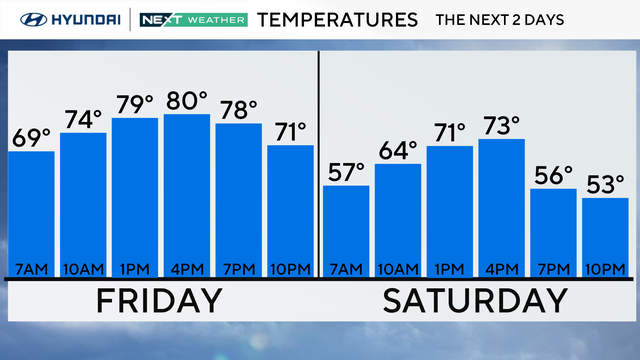
The cooldown in the Philadelphia region begins Friday, but it will still be shorts and T-shirt weather.