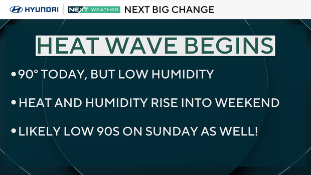
Sunny Thursday in Philadelphia region as heat wave begins. Here's the weather forecast.
Thursday will be a hot day with highs near 90 degrees. However, humidity levels (dew point temps) should stay very low, so it won't feel quite as hot and you won't be a dripping ball of sweat, unless you're exercising in the sunshine during the peak heating of the day, which we do not recommend.
Have your sunglasses close as well because it will be a sun-filled sky from rise to set.
NEXT big weather changes
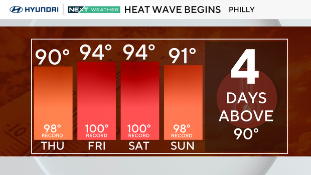
Expect our second heat wave of the season to last four days, Thursday-Sunday. Saturday is likely to be the hottest of the bunch.
In addition, the humidity will creep up as well, though not as bad as Mother Nature's furnace in late July and August, meaning overnight lows won't drop below 70. This will add to the discomfort.
We've now added Sunday to the heat wave as storm chances have shifted a bit this weekend.
It's now looking most likely that we'll see storms Saturday evening into the overnight hours, and then a few spotty storms later Sunday. Enough sunshine on Sunday should push temperatures back into the low 90s before a cooler breeze knocks us back to normal on Monday.
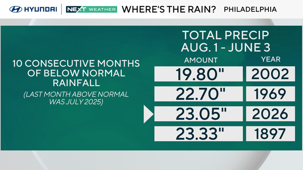
On the flip side, we need the rain badly!
We have now gone 10 consecutive months with below normal precipitation. If we go back to August 1, we've only had a little more than 23" of precipitation, a deficit of over a FOOT!
For the time period it's the third-driest stretch on record.
Here's your 7-day forecast:
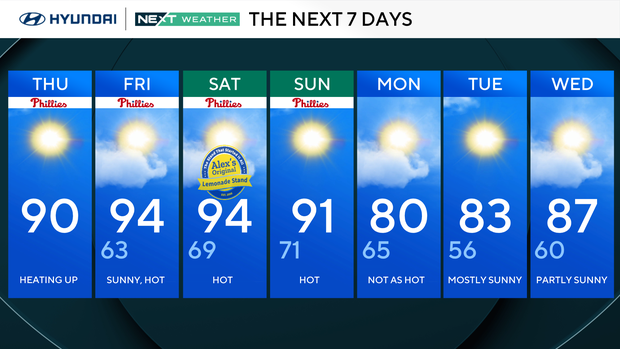
Thursday: Heating up. High 90.
Friday: Sunny and hot. High 94, low 63.
Saturday: Hot. High 94, low 69.
Sunday: Hot. High 91, low 71.
Monday: Not as hot. High 80, low 65.
Tuesday: Mostly sunny. High 83, low 56.
Wednesday: Partly sunny. High 87, low 60.


