Warm, muggy Sunday in Philadelphia before dangerous heat wave arrives. Here's the forecast.


After a wet start to the weekend, we keep the muggy conditions around for Sunday in the Philadelphia area, although the temperatures will be a bit warmer. There is a slight chance of a few scattered showers or a rumble of thunder.
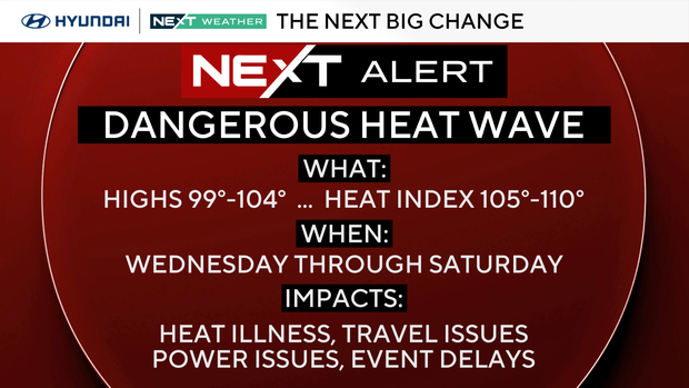
A heat wave with dangerous feels-like temperatures in the triple digits is on the way to the Philadelphia region this week.
NEXT big weather changes
A bubble of extreme heat will affect everyone east of the Rockies. Expect many record highs and record warm lows to be challenged and broken.
The heat wave begins on Tuesday and will last through Sunday.
Things start off with a manageable 92 degrees. But by Wednesday, Thursday, Friday and Saturday, the dangerous heat has settled in. These will be the hottest days with highs from 99 to 104. The high humidity will make it feel like 105-110+.
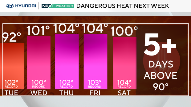
The record highs each day for the next week are 100 or above, and we may tie or break some of them. These are very old records dating back 125 years!
An Extreme Heat Watch has been issued from noon Wednesday until 8 p.m. Sunday. This will be elevated to an Extreme Heat Warning by Monday or Tuesday, and cooling centers will be opened.
Pop-up afternoon and evening thunderstorms are possible each afternoon due to the heat and humidity. Any rain could keep some locations in the upper 90s rather than 100s, and any storm could cause flash flooding or briefly turn severe for wind gusts.
Plan and prepare for the heat
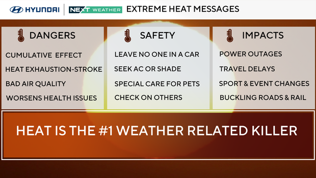
Have somewhere cool to rest, special care for pets, check on neighbors and family, limit time outdoors, and check fluid in cars.
Buildings without air conditioning will retain the heat. That cumulative effect of the heat after 2-5 days could be deadly for some. Travel delays are possible.
Swimming pools, movie theaters and shopping malls are places to stay cool.
Cars become death traps in the heat. No people or pets should ever be left in the car. The heat can reach 125 degrees in minutes and cause death. Check your back seat before leaving a car.
Our heat records since 1894
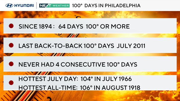
- There have only been 64 100-degree days in Philly since 1894 (per the NWS).
- We've had only one 100+ day in 14 years. That was last June 24, 2025.
- The hottest day on record for Philly is 106 on Aug. 7, 1918.
- The hottest July temperature on record is 104 on July 3, 1966.
- Back-to-back 100-degree days have only occurred 14 times. The last back-to-back 100-degree days was in July 2011.
- Three consecutive 100-degree days have only happened twice in Philly history during July of 1993 and July of 1966.
- We have NEVER had four consecutive 100-degree days.
- Records we are chasing: July 1 record is 102 from 1901, July 2 is 103 from 1901, July 3 is 104 from 1966.
Here's your 7-day forecast:
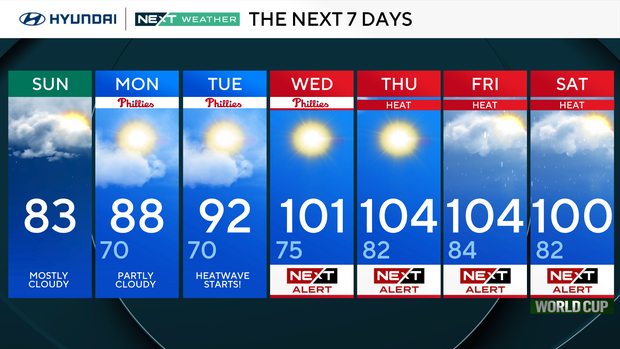
Sunday: Mostly cloudy. High 83.
Monday: Partly cloudy. High 88, low 70.
Tuesday: Heat wave starts. High 92, low 70.
Wednesday: NEXT Weather Alert: Heat. High 101, low 75.
Thursday: NEXT Weather Alert: Hot and humid. High 104, low 82.
Friday: NEXT Weather Alert: Hot and humid. High 104, low 84.
Saturday: NEXT Weather Alert. High 100, low 82.


