Rain and thunderstorm chances in the Philadelphia area after flood watch ends. Here's the weather forecast.

Conditions remain muggy Tuesday with scattered showers throughout the day, especially along the I-95 corridor and south.
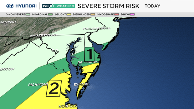
Heavier showers and a few thunderstorms are possible across the southern half of Delaware east into the Jersey Shore.
A severe thunderstorm watch is in effect for Cape May County, New Jersey, and Sussex County, Delaware, until 8 p.m.
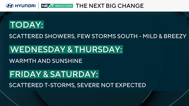
The threat for severe weather to the south is relatively low, but a few storms may produce some damaging winds and flash flooding. Showers and storms will clear out as the skies begin to clear through the evening and into the overnight.
NEXT big weather changes
The sunshine will return for the middle of the week with high temperatures in the mid-upper 80s both Wednesday and Thursday.
By Thursday night, however, the chance for a few showers will returns.
A slightly better chance for a few scattered showers and storms will take us through Friday and Saturday ahead of a building heatwave that looks to lead until into early next week as high temperatures climb into the upper 80s and lower 90s.
Here's your 7-day forecast:

Tuesday: Showers. High 75.
Wednesday: Mostly sunny. High 85, low 62.
Thursday: Partly cloudy. High 88, low 64.
Friday: Scattered storms. High 86, low 65.
Saturday: Chance of showers. High 8, low 68.
Sunday: Mostly sunny. High 88, low 68.
Monday: Heating up. High 92, low 67.


