NEXT Weather: Warmth sticks around, and so does the high pollen count
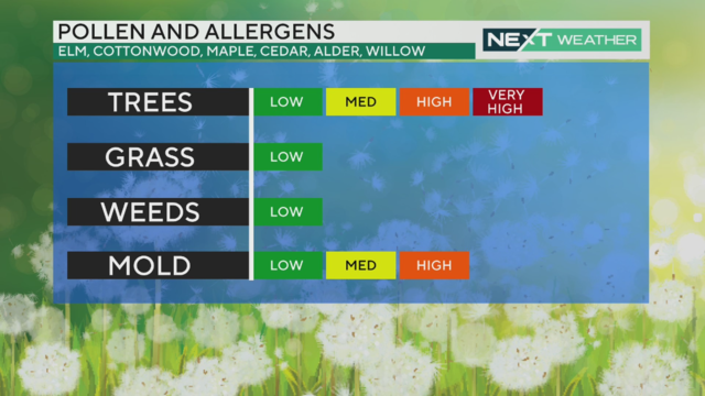
Friday there's a chance of rain in Philadelphia - but it's mostly just a cloudy day with some risks to allergy sufferers - and more warm March temperatures.
Watch CBS News
Friday there's a chance of rain in Philadelphia - but it's mostly just a cloudy day with some risks to allergy sufferers - and more warm March temperatures.
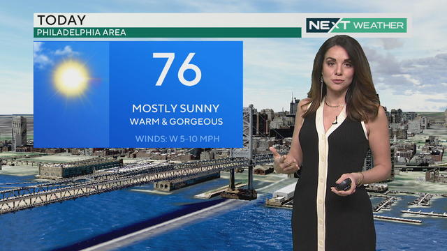
Thursday is mostly sunny with highs above 70 across much of the region - it's a little cooler down the Shore but still pleasant.
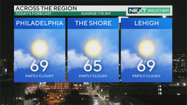
Wednesday is a mild morning before temperatures rise to the high 60s in the afternoon - then we hit the 70s later this week.
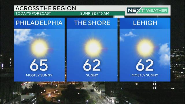
While the normal high temperature for this time of year is 51 degrees, by Tuesday afternoon highs around the Lehigh Valley will be around 65 degrees with mostly sunny skies.
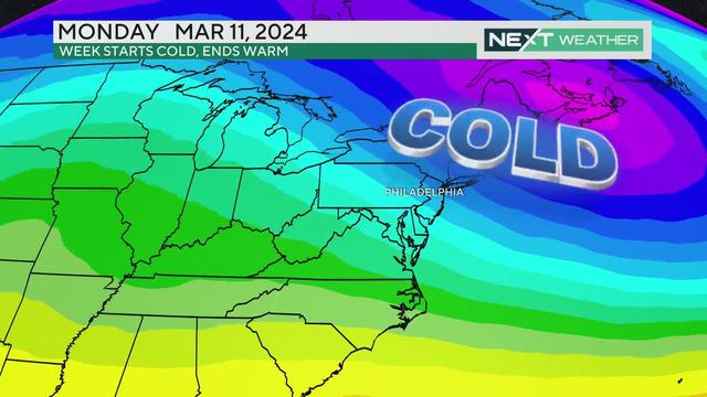
Monday starts chilly and windy after an unsettled weekend, but the Philadelphia region will see lots of sun this week and temperatures climbing into the 60s and 70s.
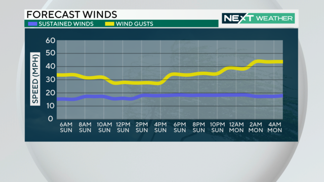
The Philadelphia region will take a break from the wet and cloudy conditions Friday before rain returns Saturday.
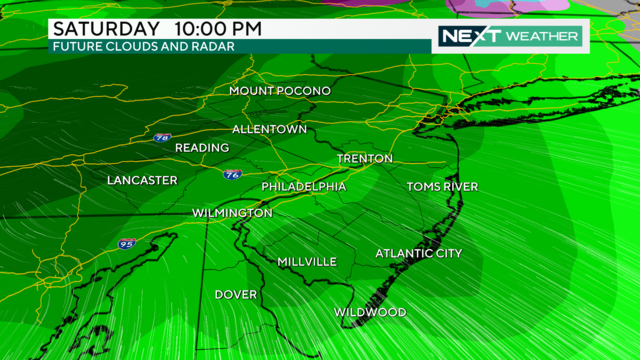
The Philadelphia region will see a brief break from the rain on Thursday before storms move through over the weekend.
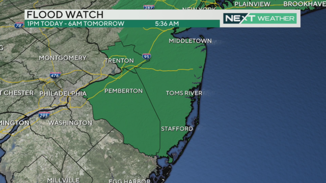
Storms in the Philadelphia region this week will bring plenty of rain, raising flooding concerns at the Jersey Shore and other areas.
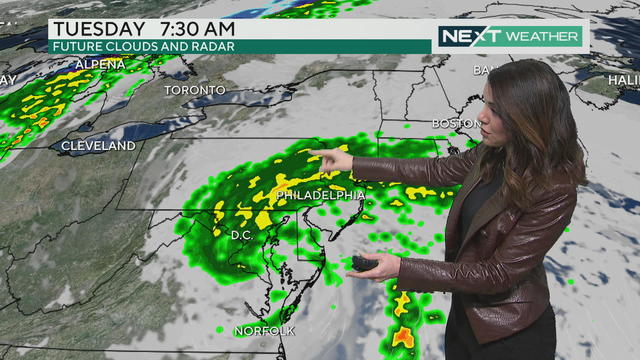
Tuesday starts with scattered showers early followed by cooler temperatures - Friday is the only day this week that doesn't look rainy.
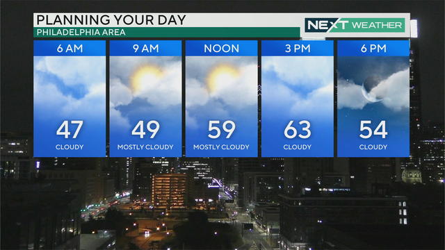
After a stunning Sunday with highs in the 60s, the week ahead is packed with several rainy weather systems that'll increase the threat for flooding by the end of the week.
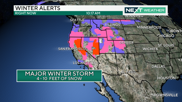
This is the latest in a series of storms to pound California. The California storm will arrive in the Delaware Valley on Wednesday and Thursday.
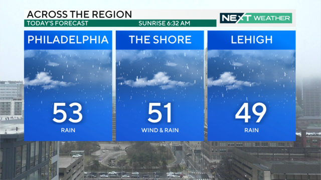
Saturday will have periods of heavy rain and cloud coverage with mild temperatures peaking at 53 degrees with a low of 43 degrees.
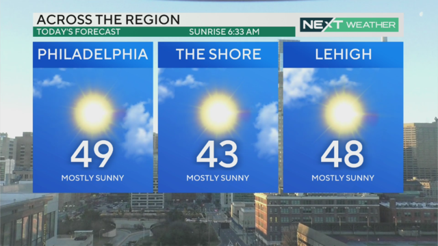
There's a bit of a morning chill in the Philadelphia region Friday before temperatures increase to nearly 50 degrees - with highs in the 60s coming.
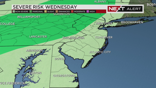
Rain arrives in the region before noon, but the height of the storm comes between 4-8 p.m., when we can expect heavy rain, thunderstorms, possibly lightning and wind gusts upwards of 40 mph.
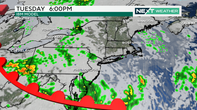
As February winds down, we'll see a big warm-up over the next few days, with highs in the 60s for many locations across the Philadelphia region.
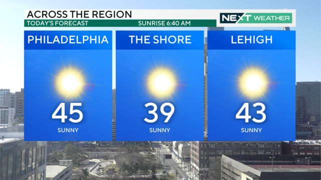
Sunday is quiet and sunny with crystal clear skies during the day. Temps are boosted into the 50s Monday, and it's looking like we could see our first 60-degree day of the year by midweek.
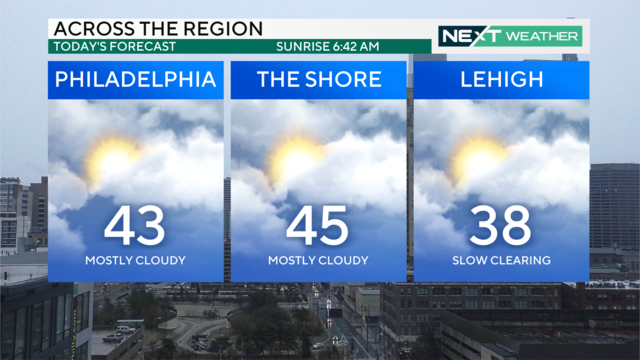
After a rainy but mild end to the week, temperatures take a dip to start the weekend off chilly, but sunny.
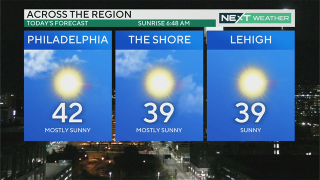
High temperatures will top out in the low-to-mid-40s Tuesday and the weather will remain relatively calm before the next chance for rain at the end of the week.
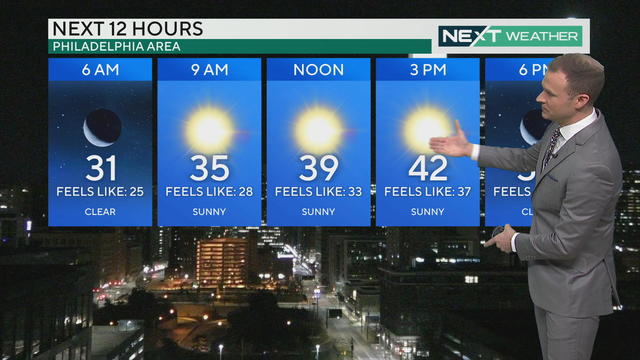
While actual high temperatures will warm into the low 40s Monday, wind chills will keep the feels-like temps in the 30s for a sunny and seasonable Presidents Day.
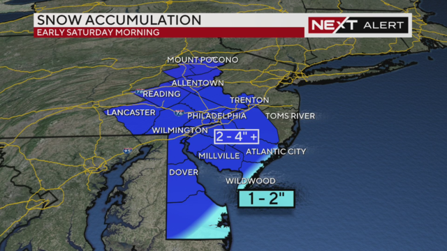
A quick-moving system will bring most of the Philadelphia area between 2-4 inches of snow by Saturday morning.
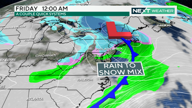
Sunshine returns Wednesday afternoon in the Philadelphia region before two back-to-back systems bring another chance for winter weather.
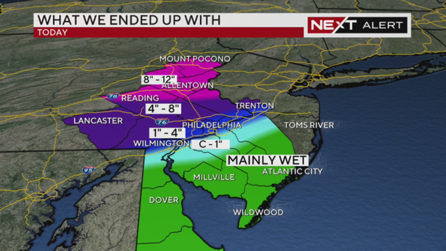
Snow totals were around or exceeding a foot in the Lehigh Valley and Poconos while lesser amounts fell closer to Philadelphia.
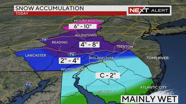
Snow changes over to rain in Philadelphia around 7 a.m. Tuesday. By the time the storm moves out, the city and areas along the I-95 corridor could see between 2-4 inches of snow.
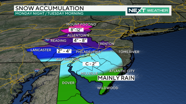
Philadelphia is expected to get about 2 to 4 inches of snow due to the winter storm.
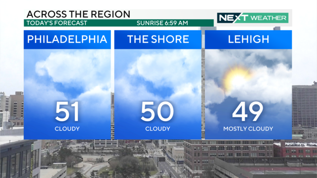
It'll be cloudy and mild across the Delaware Valley for your Super Bowl Sunday parties, but rain, slushy snow and gusty winds are on the way Monday and Tuesday.