NEXT Weather: Mild weekend then NEXT Weather Alert for rain and snow
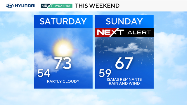
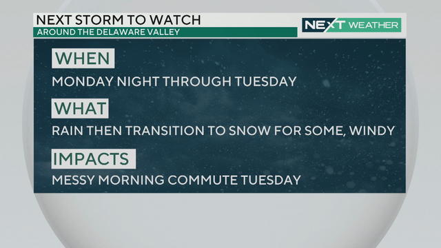
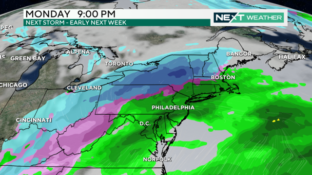
Mild conditions will continue through the weekend but a NEXT Weather Alert has been issued for Tuesday for rain and potential snow.
Watch CBS News
Mild conditions will continue through the weekend but a NEXT Weather Alert has been issued for Tuesday for rain and potential snow.
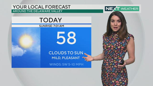
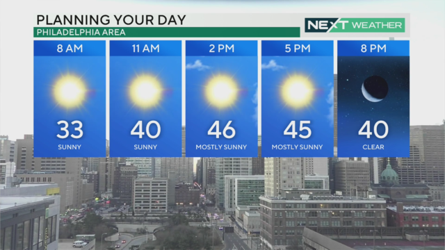
Friday's weather starts cloudy in Philadelphia, but the sun should return quickly. Expect above-average temps into the weekend.
The dry and mild stretch in the Philadelphia region will continue on Thursday with highs in the low 50s under mostly sunny skies, but an end is in sight.
The week's warming trend continues Wednesday with a high of 47 degrees in Philadelphia - and we could reach the 50s Thursday.
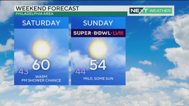
Weather in Philadelphia is seasonable with a high temperature of 42 before a warmer week and potential temps in the 60s by the weekend.
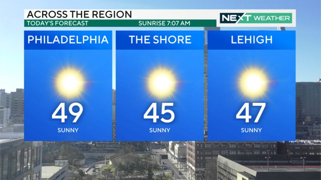
Expect sunny skies Sunday through Thursday with high temperatures in the 40s and 50s, and possibly even the low 60s on Saturday!
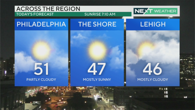
Clouds should hopefully break by the late morning or early afternoon Thursday in the Philadelphia region and let the sun out.
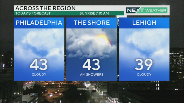
There are clouds and mild temperatures across the Philadelphia region today and chances of sprinkles.
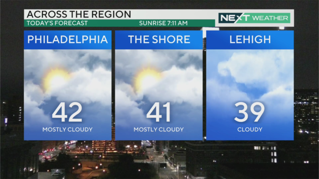
There are some clouds in the sky, but we're in for a stretch of dry and calm weather in the Philadelphia region.
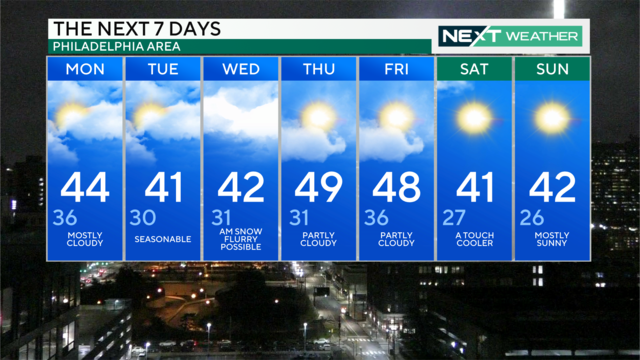
The week ahead advertises very minimal chances for precipitation, but a midweek clipper system could bring a little rain or snow.
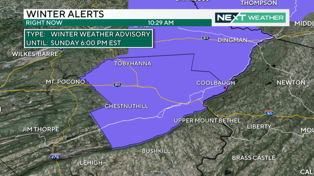
Another storm system spreads nearly an inch of rainfall across the entire Philadelphia region Sunday with accumulating snow in the Poconos.
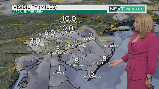
Dense fog kicks in Saturday in Philadelphia, with rain at night into Sunday morning. More showers or wintry mix possible Sunday night.
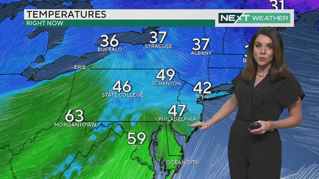
A dense fog advisory is in place as we watch for temperatures that could push 60 for some of the Philadelphia region.
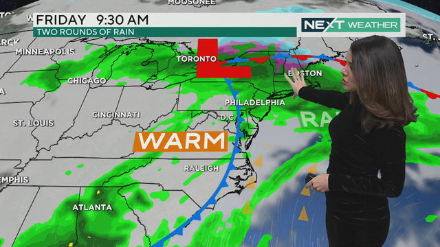
Light but steady rain and fog continue through the day and into Friday before lightening up Friday night.
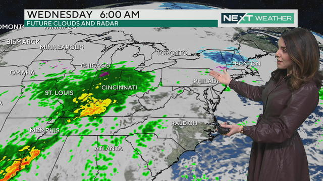
Some rain is in the forecast for Wednesday night and Thursday morning in our region.
Highs Monday will be close to 37 degrees, which could help with snow melting. Expect even warmer temperatures through the rest of the week, but with multiple chances for rain.
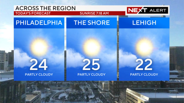
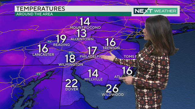
With the weekend continuing to experience frigid temperatures, frostbite should be a concern for residents of the Delaware Valley.
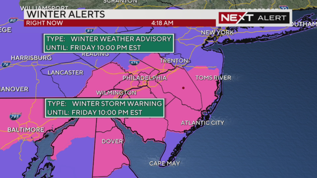
Snow is falling in the Philadelphia region on Friday and some isolated spots could see as much as six inches of snow.
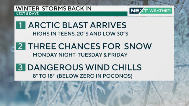
A dangerous blast of arctic air is moving into the region this week, bringing the Delaware Valley some of the coldest weather its seen in several years.

With loose soil and very wet ground, any strong winds Saturday morning and afternoon have the potential to down trees and power lines.

Burlington County issued a voluntary evacuation for areas hit hard by previous flooding and declared a state of emergency ahead of Friday night's storms.
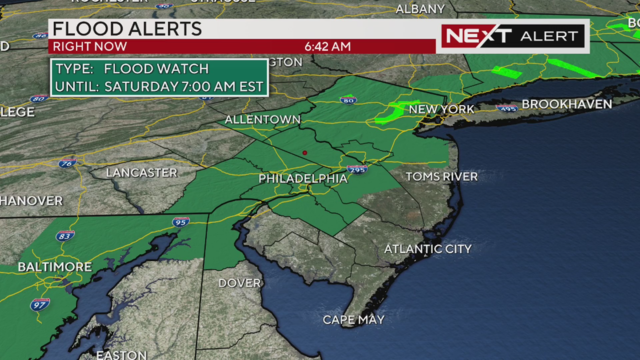
Wind advisories and flood watches are in place for the storm heading our way Friday night.
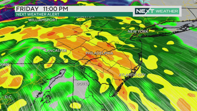
More rain arrives Friday night into Saturday morning, and will fall on already saturated ground and swollen streams and creeks.
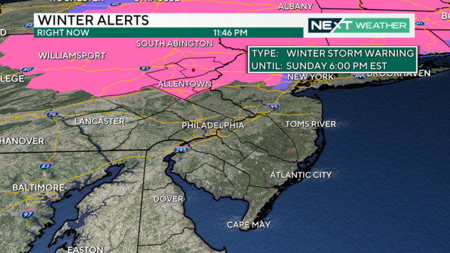
Who gets the most snow, when does snow change to rain and when is it all out of here in Pennsylvania, New Jersey and Delaware?
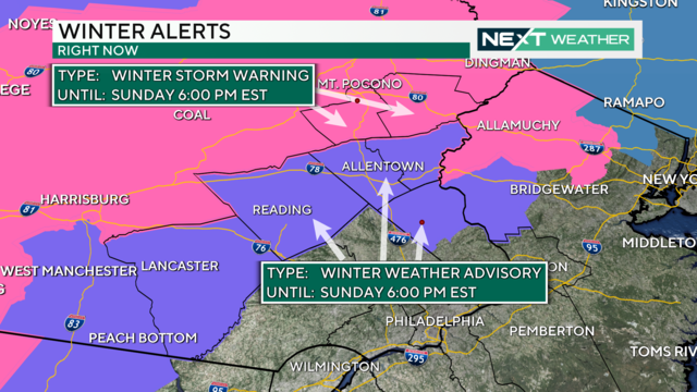
A winter storm will drop significant snow on the Poconos and parts north and west of Philly. Delaware and South Jersey will mostly get rain.