Hot and gusty week ahead after brief thunderstorm hits North Texas, blowing down trees, damaging homes
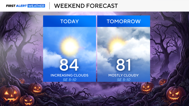
Most of the region will stay dry on Sunday.
Watch CBS News
Most of the region will stay dry on Sunday.
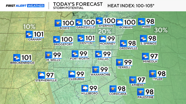
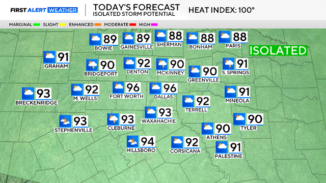
Temperatures will reach near-triple-digit levels today, with heat index values in the 100-105°F range.
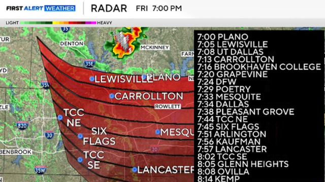
Small hail and strong winds remain possible as the storms track southeast toward the Metroplex.

The extended forecast shows triple digits are expected for at least the next week.
More triple-digit temperatures are on the way for next week.

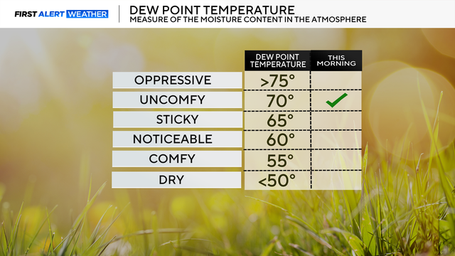
This pattern stays with us throughout the week, and we will continue to see an uptick in humidity.

Throughout most of the workweek, highs stay between 100 ° and 103°.
Moisture will return by mid-week, so the feels like temps will jump back to the 105° - 110° range starting Tuesday-Wednesday.
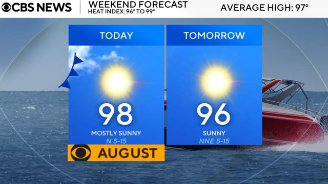
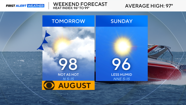
Temperatures will still climb into the upper 90s this afternoon, but unlike the past several days, much lower humidity will make it feel much more comfortable.
Most of North Texas will remain dry as these storms likely fall apart as the front moves south, but there is a low risk of a strong-to-severe storm overnight.

Looking ahead to Friday, the heat peaks, with highs around 104° and feels-like temperatures as hot as 109°.

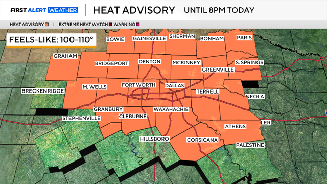
The heat continues, with a heat advisory in place and feels-like temperatures as high as 109°. Those conditions are likely to continue on Thursday.

The triple-digit heat will intensify as we move through the end of the workweek.

By the weekend, we'll have a slight pattern change as high pressure shifts just far enough west that a weak front moves through.
Temperatures will quickly climb into the 90s by lunch and reach 100+ degrees by the late afternoon.
Temperatures will quickly climb into the 90s by lunch and reach 100 degrees by the late afternoon.
Air temperatures across the region will range from 98-100 on Thursday afternoon.

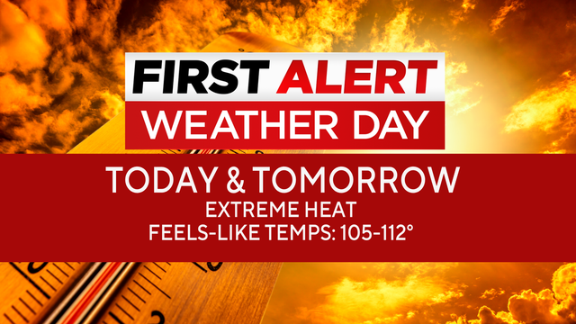
Wednesday, July 22, is a First Alert Weather Day as an extreme heat warning remains in place.
We won't see much of a change in our weather pattern throughout the workweek and into the weekend as the triple-digit heat sticks around.
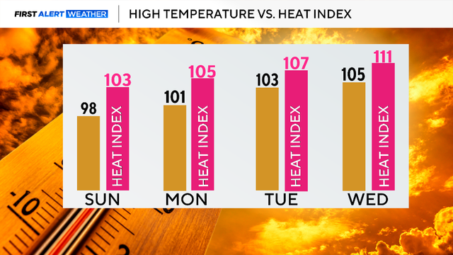
Temperatures will quickly climb into the 90s by lunchtime with a high of 98 degrees by 5 p.m.
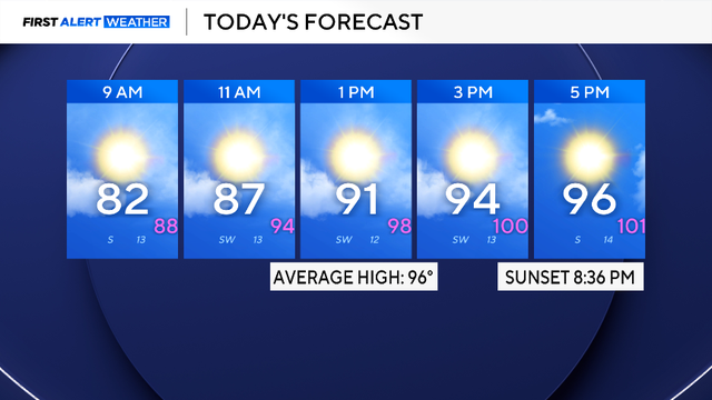
Temperatures will quickly climb into the 90s by lunchtime with a high at 96 degrees by 5 p.m.
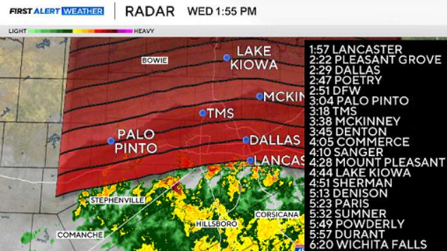
We'll see our storm chances continue on Thursday, and some showers and rumbles may build in as early as the back half of the morning commute.
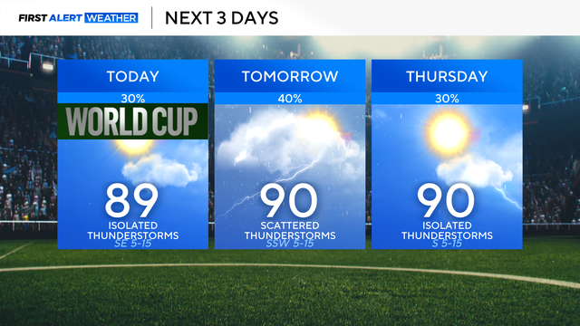
Shower and thunderstorm activity will be better south of the Dallas-Fort Worth Metroplex on Tuesday afternoon.

While scattered showers and a few thunderstorms remain possible through the afternoon and early evening, the overall threat has diminished significantly.
Rain chances will continue next week, slowly dwindling by Friday.