Scattered storms possible Sunday after hot Saturday in North Texas with
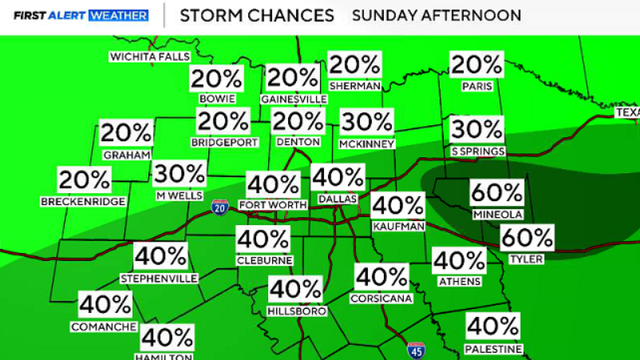
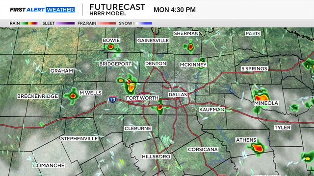
On Sunday, scattered storms are likely in the afternoon, with coverage increasing by the evening.
Watch CBS News
On Sunday, scattered storms are likely in the afternoon, with coverage increasing by the evening.
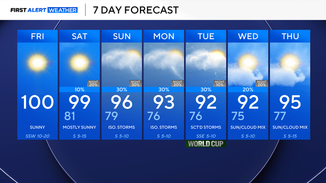
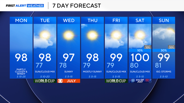
There is a very slim chance of showers on Saturday, with a much better chance of isolated to scattered storms on Sunday.
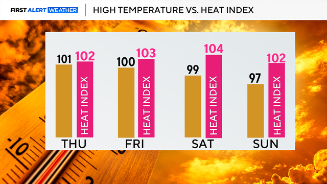
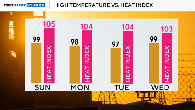
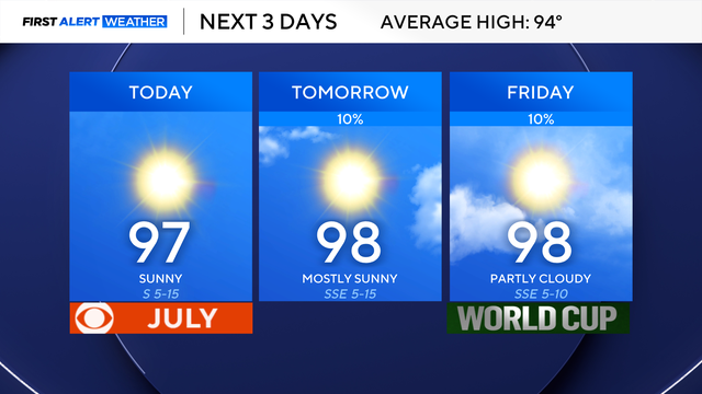
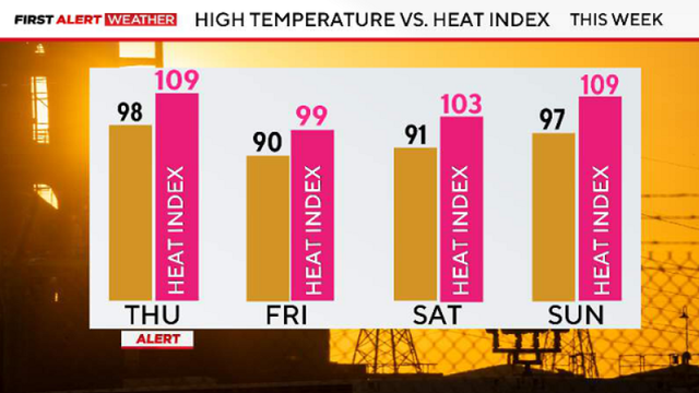
The heat continues, with temperatures in the triple digits and feel-like temperatures a few degrees warmer.
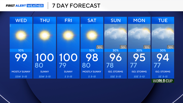
Rain chances are only 10%, so not everyone will see showers and storms. However, everyone will experience the heat.
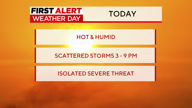
A First Alert Weather Day has been issued for Tuesday afternoon due to the threat of strong-to-severe storms.
If you're heading out to Dallas Stadium for the World Cup, be sure to bring extra water if you'll be outside, as it will feel like the 100° mark.
That heat sticks around Sunday, with forecast highs in the upper 90s to near triple-digits.

Organizers at the FIFA Fan Fest in Dallas' Fair Park paused entry on Sunday evening as lightning moved across the area.
Our rain chances rise slightly to 20% Sunday, and that will continue into Monday.
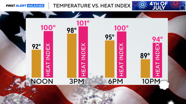
Highs on July 4 will be in the upper 90s, with feels-like temperatures ranging from 100-105 degrees.
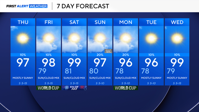
The only change to the forecast will be the return of some rain chances, mainly east of I-35.
There is a 20% chance for an isolated shower or rumble by the afternoon on July 4, with better coverage of isolated storms possible Sunday afternoon.
Temperatures on Tuesday afternoon will feel like triple digits, and this trend will continue into the Fourth of July weekend.
The above-average temperatures and feels-like temperatures in the triple digits continue this week.

The hot, humid, and windy weather will continue through the end of the month.
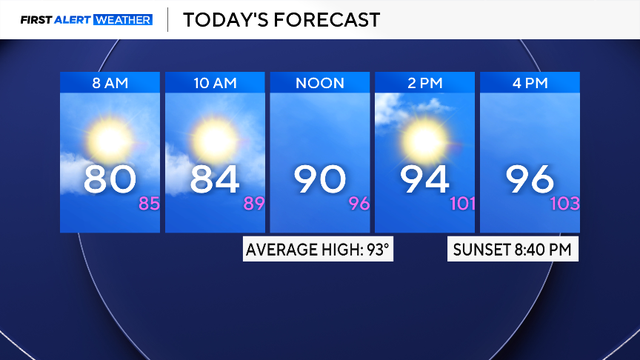
The heat index will be in the triple digits for Saturday.
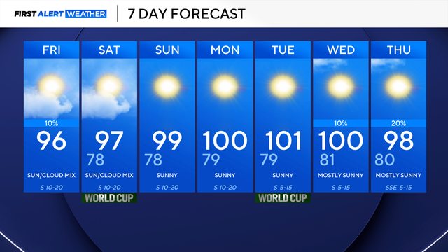
Throughout Friday, skies will be partly cloudy with highs in the mid-90s.
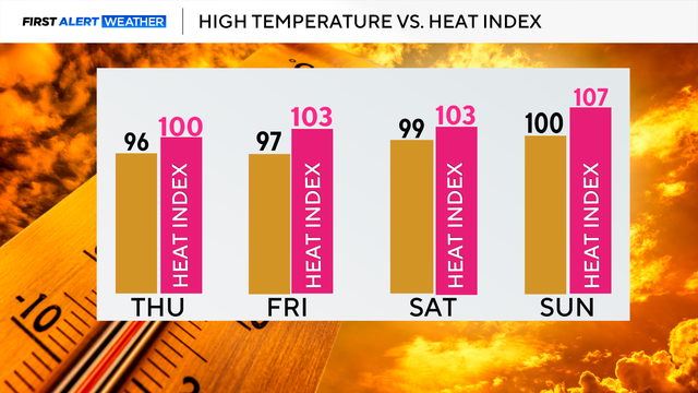
By Thursday afternoon, temperatures will reach the mid-90s and feel like they are triple digits. This trend continues into the weekend.
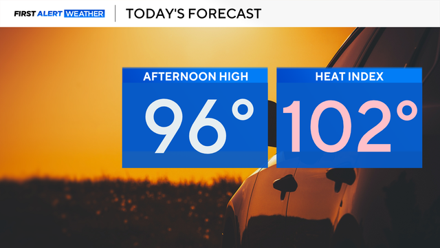
It will be another hot day, with highs in the mid-90s and feels-like temperatures over 100°.
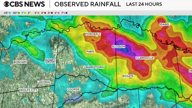
Rain chances will fade overnight as high pressure builds across Texas. Temperatures will steadily climb through the remainder of the week.
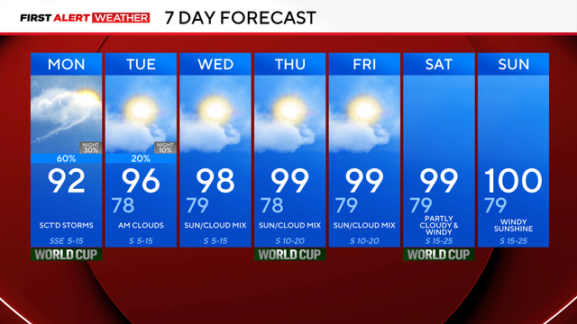
After these rain chances, DFW turns dry, and we really start to heat up.
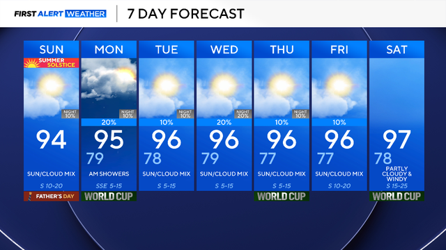
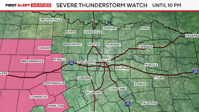
Sunday overnight, a complex of storms, some severe, will cross the Red River around 4 a.m. and will cross I-20 around 6 a.m.
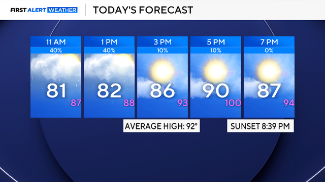
High temperatures will be in the 90s, with a heat index over 100 degrees.
A Heat Advisory is in effect beginning at noon through 9 p.m.
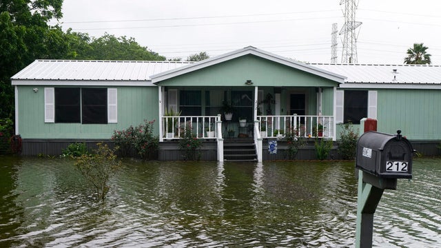
Arthur, the first named tropical storm of the 2026 Atlantic hurricane season, weakened to a post-tropical cyclone after making landfall.