Near-record temperatures, high fire danger expected for DFW this week
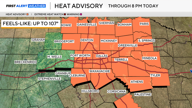
There's a heat advisory in place for Monday, mainly due to high temperatures.
Watch CBS News
There's a heat advisory in place for Monday, mainly due to high temperatures.
The First Alert Weather Team continues to monitor the fire danger area wide as it is once again elevated across North Texas with wind gusts today up to 25 mph.
What you'll notice Wednesday and through the rest of the workweek is an uptick in the wind, gusting up to 30-35 mph at times.
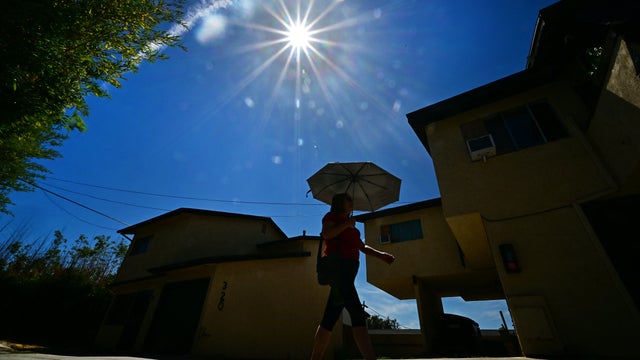
Temperatures will rise to 100° in the afternoon, with the heat index reaching 106°. A heat advisory is in effect from 1 p.m. to 8 p.m.

The heat index in some places could reach up to 108 degrees.

Throughout most of the workweek, highs stay between 100 ° and 103°.

Looking ahead to Friday, the heat peaks, with highs around 104° and feels-like temperatures as hot as 109°.
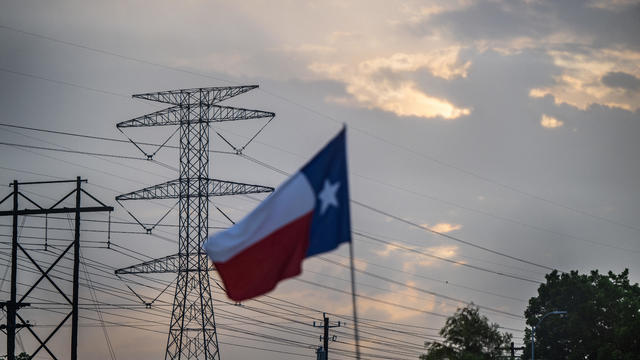
The debate isn't just about power.

The heat continues, with a heat advisory in place and feels-like temperatures as high as 109°. Those conditions are likely to continue on Thursday.

Every day, you can find Dallas for Change on the ground serving the homeless community cold drinks and other supplies as the triple-digit heat continues to smother the region.
By the weekend, we'll have a slight pattern change as high pressure shifts just far enough west that a weak front moves through.

Dangerous heat is sending more people to the ER. Here's where North Texas outdoor workers can get free hydration kits.

Wednesday, July 22, is a First Alert Weather Day as an extreme heat warning remains in place.

As dangerous heat continues across North Texas, construction crews are changing schedules, adding hydration breaks and covering up to stay safe. Experts also warn pet owners to keep animals cool and know the signs of heat stroke, for both people and pets.
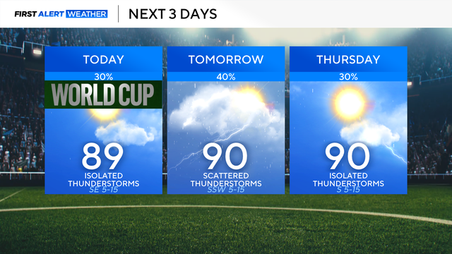
Shower and thunderstorm activity will be better south of the Dallas-Fort Worth Metroplex on Tuesday afternoon.
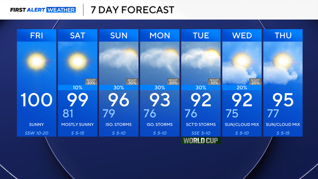
There is a very slim chance of showers on Saturday, with a much better chance of isolated to scattered storms on Sunday.
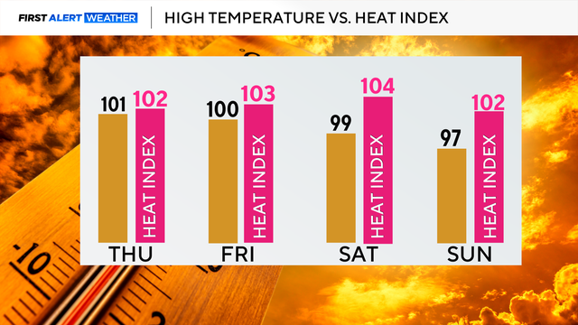
The heat continues, with temperatures in the triple digits and feel-like temperatures a few degrees warmer.
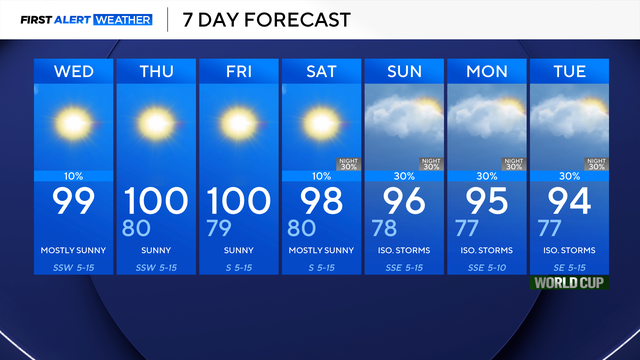
Rain chances are only 10%, so not everyone will see showers and storms. However, everyone will experience the heat.
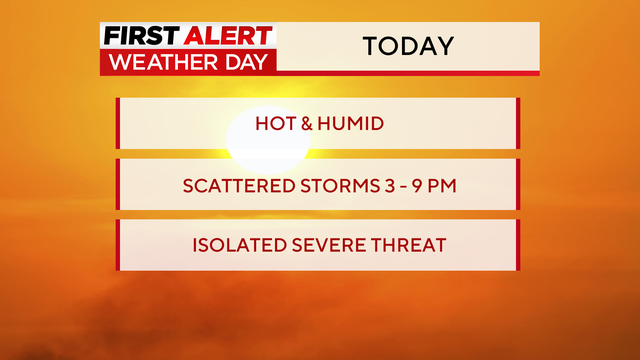
A First Alert Weather Day has been issued for Tuesday afternoon due to the threat of strong-to-severe storms.
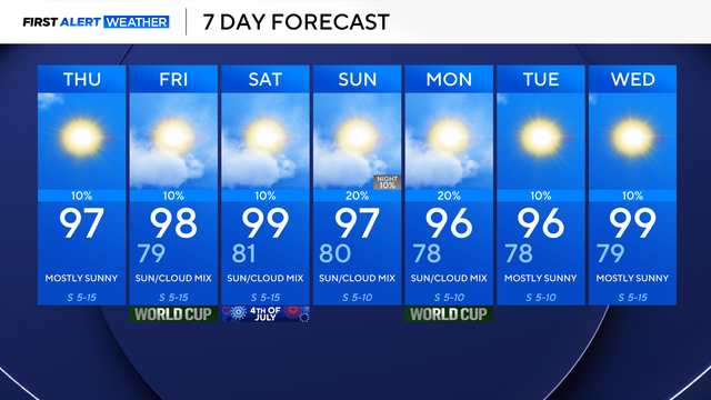
The only change to the forecast will be the return of some rain chances, mainly east of I-35.

Temperatures on Tuesday afternoon will feel like triple digits, and this trend will continue into the Fourth of July weekend.
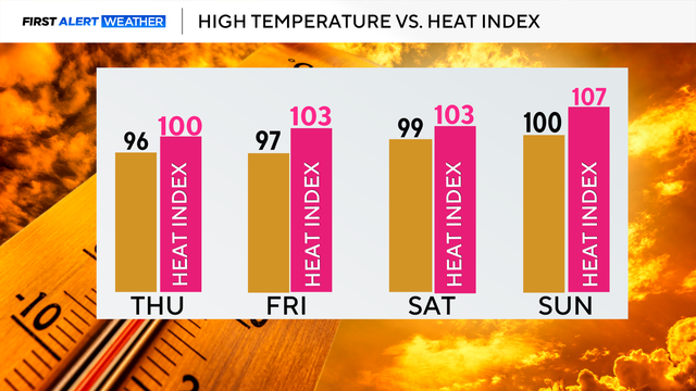
By Thursday afternoon, temperatures will reach the mid-90s and feel like they are triple digits. This trend continues into the weekend.
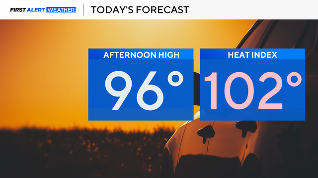
It will be another hot day, with highs in the mid-90s and feels-like temperatures over 100°.
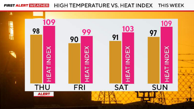
A Heat Advisory is in effect beginning at noon through 9 p.m.
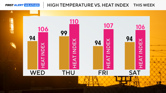
Looking ahead to Thursday, a First Alert Weather Day is in place due to extreme heat, with a heat advisory in effect at noon.