Strong to severe storms possible as North Texas stays hot, humid


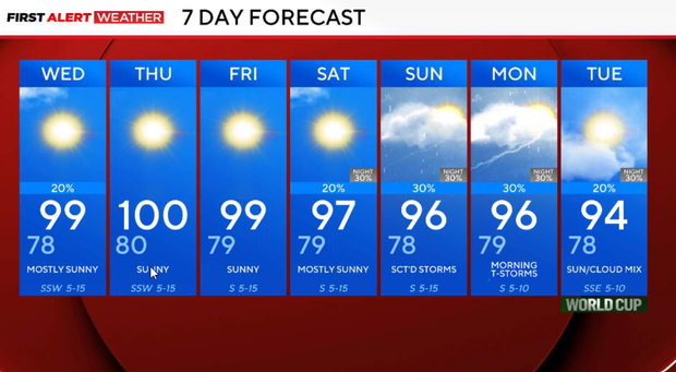
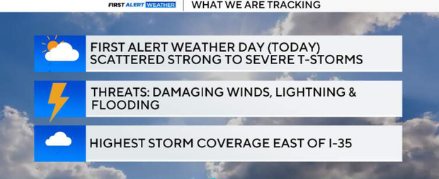
Tuesday is a First Alert Weather Day for scattered afternoon and evening storms. The greatest storm coverage and strongest storms are expected along and east of I-35, including much of the metroplex. A few storms could produce damaging downburst winds, frequent lightning, and localized flooding. Hotter, drier weather returns Wednesday through Friday, with highs near 100° by Thursday. Storm chances increase late Saturday night again into Sunday.
Tuesday night
Storms will become more numerous between 4 p.m. and 8 p.m., with the highest coverage from the northern metroplex southeast into East Texas. Rain chances range from 30-50% east of I-35, with lower coverage farther west. A few storms could become strong, producing wind gusts over 60 mph, small hail, torrential rainfall, and dangerous lightning. Slow-moving storms may also lead to localized flooding, especially where heavy rain falls in a short amount of time.
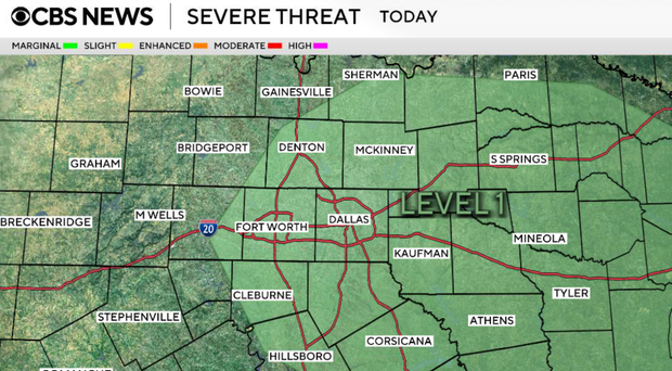
Storms gradually diminish after sunset, with most activity ending between 9 p.m. and 11 p.m.. Skies become partly clear overnight with lows settling into the mid-70s.
Isolated storms Wednesday
Only isolated storms remain possible, mainly across our far eastern counties, while most of North Texas stays dry. High pressure begins rebuilding, allowing temperatures to climb into the upper 90s. Humidity will be a little lower west of I-35 as slightly drier air mixes in, but it will still feel hot during the afternoon.
Sunny and hot Thursday and Friday
Expect mostly sunny skies and the hottest weather of the week so far. Highs will be near 100° across much of North Texas with heat index values around 100 to 105°. Rain is not expected.
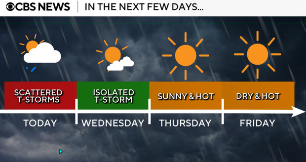
Friday will be very similar to Thursday with abundant sunshine, highs near 100°, and continued hot summer conditions. South winds remain light to moderate with no meaningful rain expected.
Hot and mostly dry weekend
Saturday starts hot and mostly dry with highs in the upper 90s to near 100°. By late Saturday night into Sunday, a weak front approaching from the north may trigger another round of scattered showers and thunderstorms. Increased clouds and rain chances should help trim temperatures slightly by Sunday and Monday.
The heat remains in place through the rest of the workweek before storm chances return over the weekend. While temperatures stay near 100° through Friday, slightly cooler conditions are possible early next week if weekend storms develop as expected.