Bitter cold weather continues in Philly, tracking a milder weekend
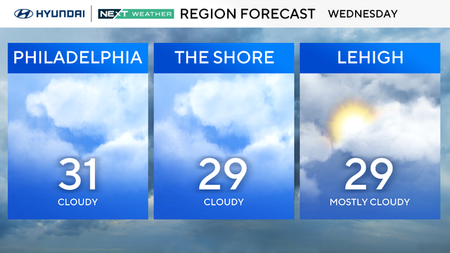
Wednesday will continue our bitter stretch of cold weather with morning low temps in the teens.
Watch CBS News
Wednesday will continue our bitter stretch of cold weather with morning low temps in the teens.
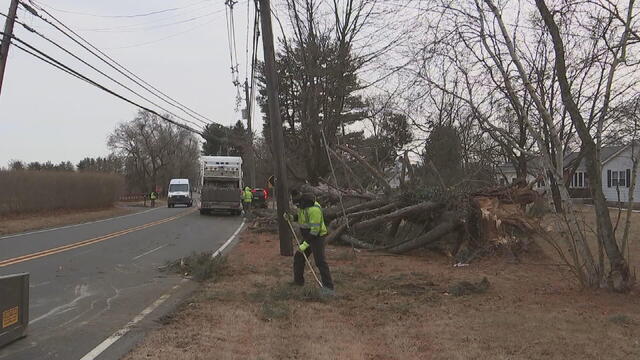
Cleanup continued in Robbinsville Township as public works crews cleared debris after many trees toppled over when powerful winds blew through the area Sunday.
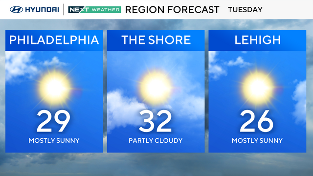
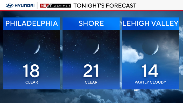
A frigid blast will keep temps in Philadelphia below freezing for much of the week.
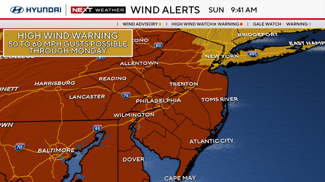
The winds should taper off Monday evening, but breezy conditions will continue through Tuesday.
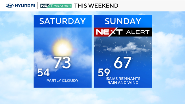
The same storm system that brought snow and sleet to the area Saturday will bring a surge of warmth, but also more rain to the area as we head through Sunday.
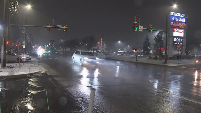
PPL Electric Utilities also wants to remind everyone to make sure their house is prepared in case they lose power on Sunday from the high winds.
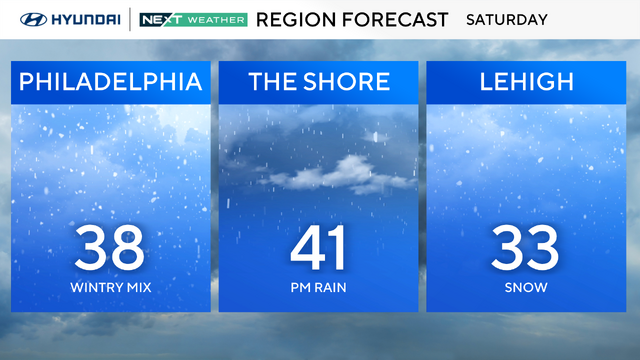
A NEXT Weather Alert is in effect Saturday as another storm system approaches the area. This system brought snow starting late Saturday morning, which will change to sleet and rain by early evening.
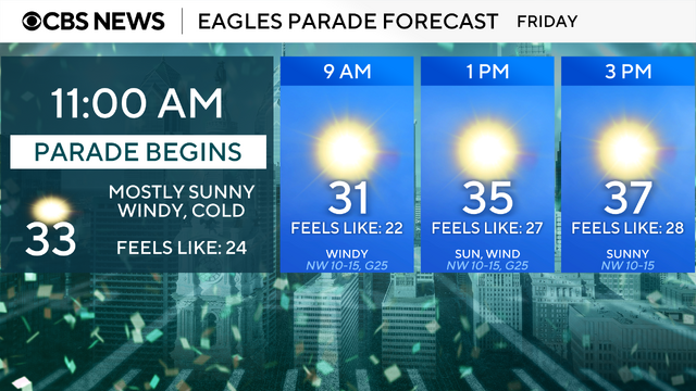
While Friday will be a dry and mostly sunny day, it will also be very cold and windy the entire day in Philadelphia.
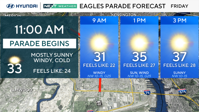
The Thursday morning commute will be wet, but things clear up for the Philadelphia Eagles parade on Friday.
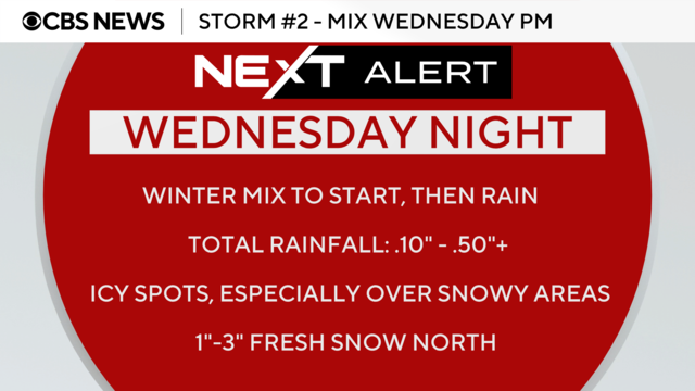
The messy week of weather will continue on Wednesday in the Philadelphia region with a storm that will bring a wintry mix and rain.
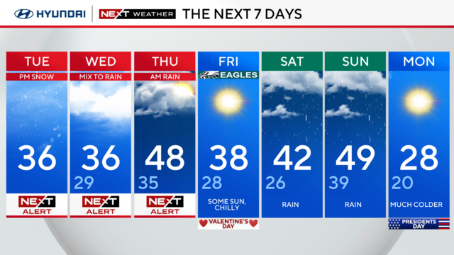
Snow will start falling Tuesday afternoon in the Philadelphia region and the rest of the week will feature two more storms.
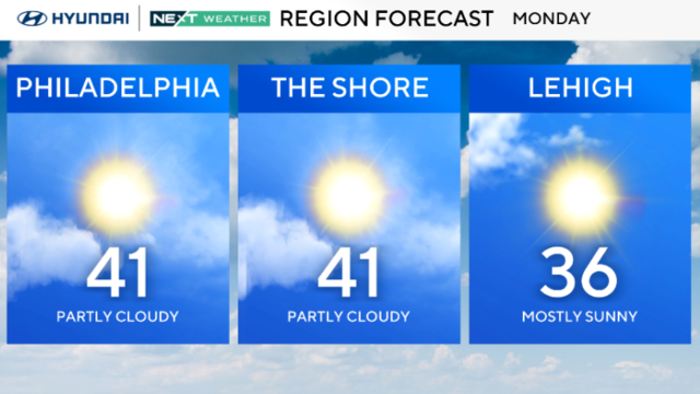
Multiple NEXT Weather Alerts are in effect this week because of snow, sleet and rain expected in the Delaware Valley.
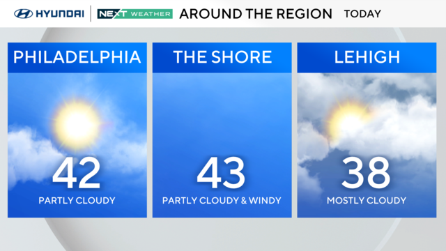
After a quiet start to the week, the NEXT Weather team is tracking multiple chances for unsettled, wintry weather and storms across the Delaware Valley.
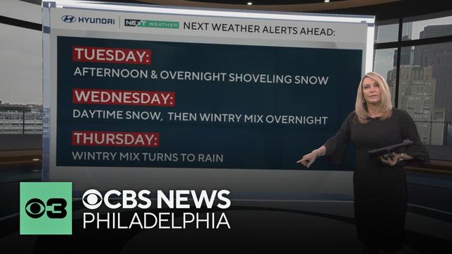
Sunday afternoon will see highs in the 40s with partly cloudy and sunny skies in Philadelphia, perfect weather for watching the Eagles in Super Bowl LIX. Looking ahead to this week, the NEXT Weather team is tracking multiple chances for snow and a wintry mix.
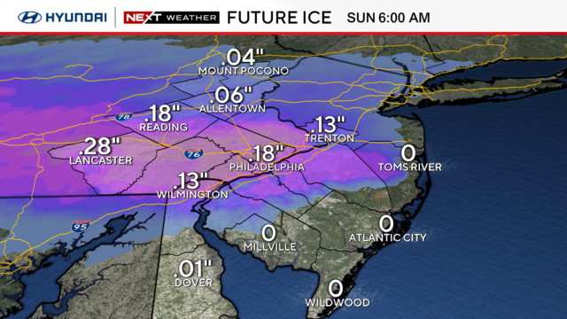
While most of the region doesn't get major snow from this storm, there's a threat of icy roads that you should be aware of.
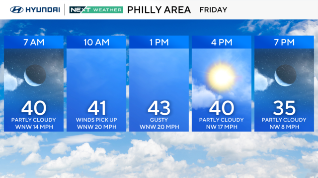
While Friday brings a break in the precipitation, there will be gusty winds, and more winter weather is on the way.
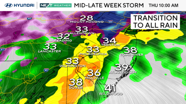
The Philadelphia region's next weather maker will likely affect the roads Thursday morning as rain, snow, freezing rain and sleet will hit the area.
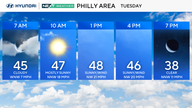
Temperatures will be up and down this week, and the NEXT Weather team is tracking chances for rain, snow, sleet and freezing rain.
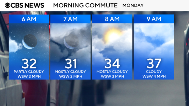
The Philadelphia region will be warm on Monday, but it will also be the start of our seesaw temperatures for the remainder of the week.
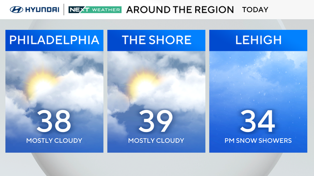
Mostly cloudy skies will meet and greet us on Sunday, with highs hovering near 40 degrees. Here's your Groundhog Day forecast in Philadelphia.
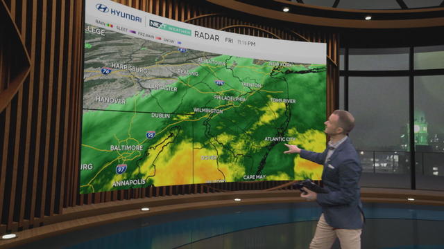
Around a quarter to a half inch of rain fell across the region Friday before the rain cleared out as a cold front swept across the region Friday night into early Saturday morning.
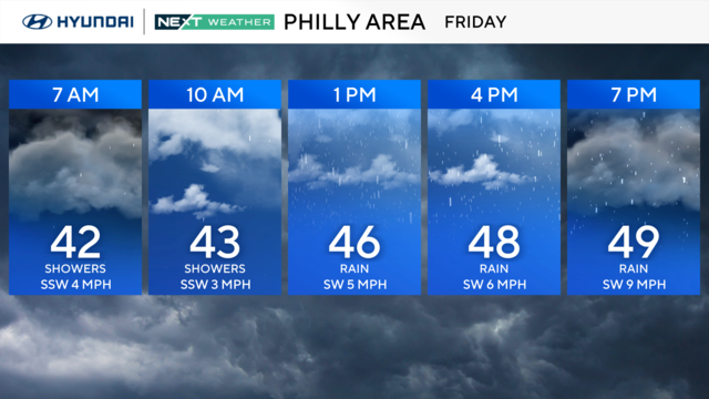
Despite the rain and clouds, temps will top out near 50 on Friday in the Philadelphia region.
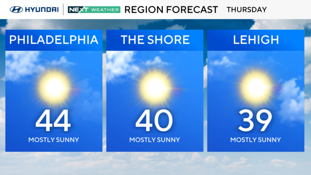
Thursday will be calmer and mostly sunny in the Philadelphia region.
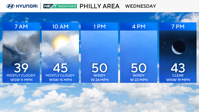
There's over a 30-degree difference in the high temperature between this Wednesday and last around Philadelphia — but wind gusts above 50 mph will make it feel cooler.
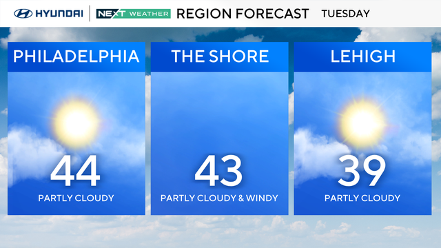
Tuesday will be another day with high temps in the mid-40s and plenty of sunshine in the Philadelphia region.