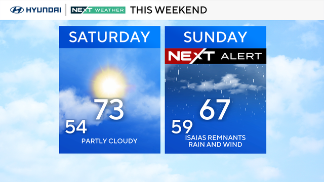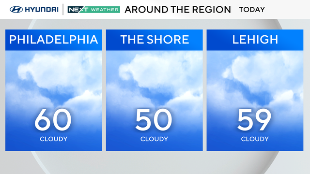
Fog and clouds with patchy drizzle this Saturday in Philadelphia region
On Saturday, early morning fog will thin, but skies will remain cloudy with a thick marine layer mainly near the shore. Drizzle and spotty showers are possible.
Watch CBS News
On Saturday, early morning fog will thin, but skies will remain cloudy with a thick marine layer mainly near the shore. Drizzle and spotty showers are possible.
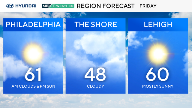
Philadelphia will be sunny on Friday with a high of 61, but the weekend ends with storms on Sunday that will bring heavy rain, damaging winds and more.
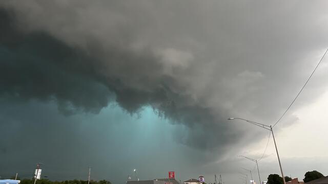
When it comes to severe weather events like tornadoes and flash floods, what's the difference between a watch and warning, and which is worse?
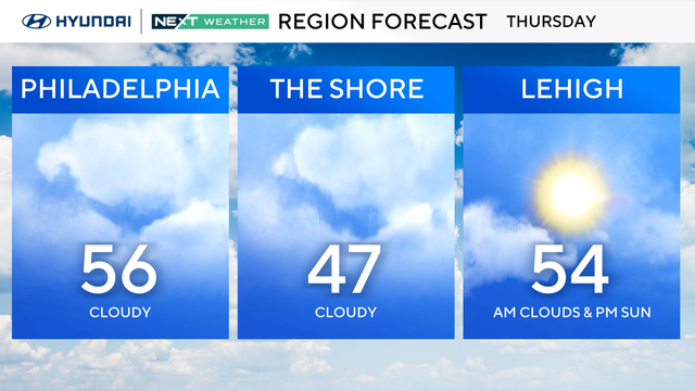
Clouds will increase Thursday in the Philadelphia region, but temperatures remain in the 50s.
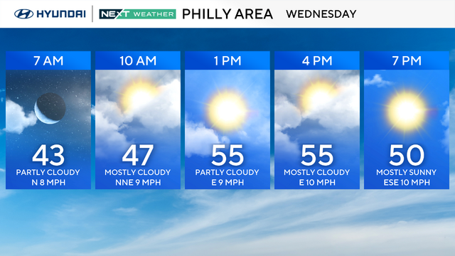
Temperatures will drop a bit in the Philadelphia region but stay above average.
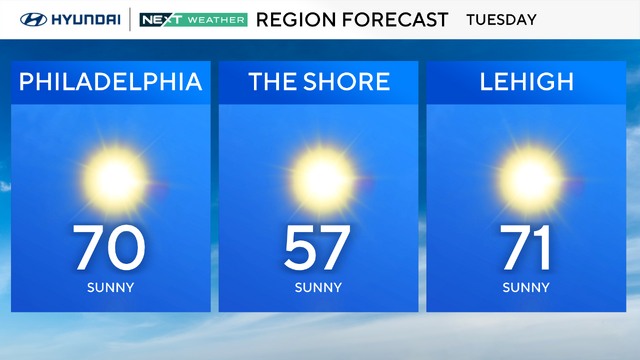
The Philadelphia region will have the chance to hit 70 degrees for the first time this year on Tuesday.
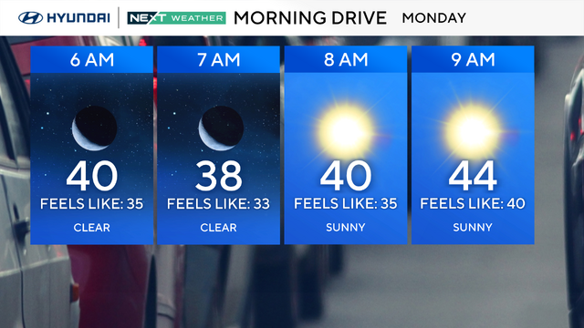
Sunday is mostly sunny, breezy and much milder, with highs approaching the mid and upper 50s. Winds will be around 15-25 mph, with a few gusts over 30 mph.
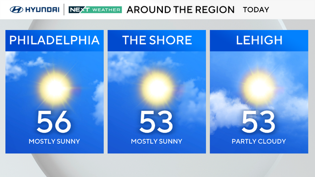
Sunday is mostly sunny, breezy and much milder, with highs approaching the mid and upper 50s. Winds will be around 15-25 mph, with a few gusts over 30 mph.

Winds will be whipping through the Philadelphia region Friday afternoon, and a storm will pass through overnight.
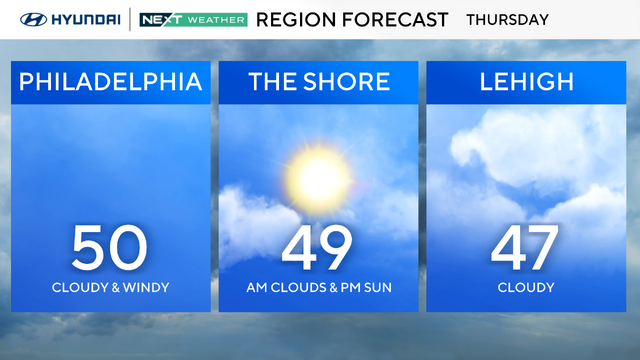
Thursday in the Philadelphia region will be cloudy and seasonably chilly with a gusty wind that will make it feel much colder.
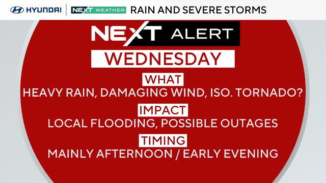
Wednesday is a NEXT Weather Alert Day because of of heavy rain and severe storms in the Philadelphia region.
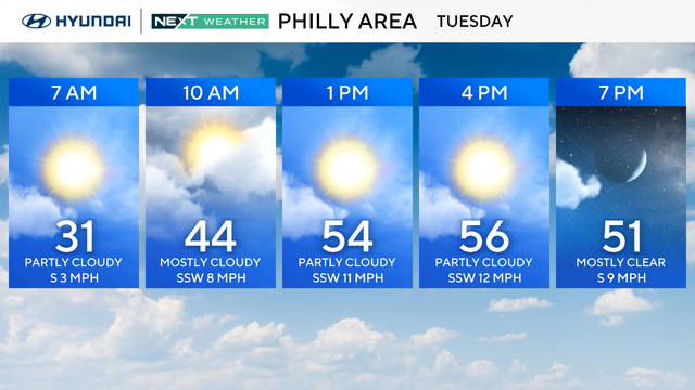
Temperatures will rebound to the 50s on Tuesday in the Philadelphia region before Mother Nature brings us our first taste of severe storms this week.
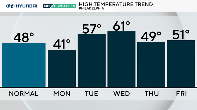
Philadelphia remains cold Monday, and heavy rain is expected later this week.
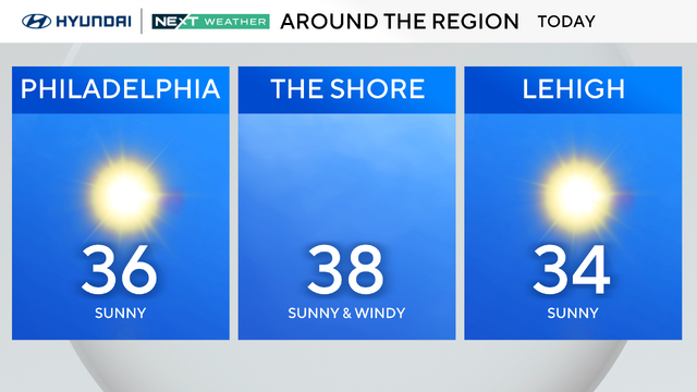
After highs on Saturday in the 60s, we're back to a taste of winter on Sunday, with lows overnight in the teens and 20s.
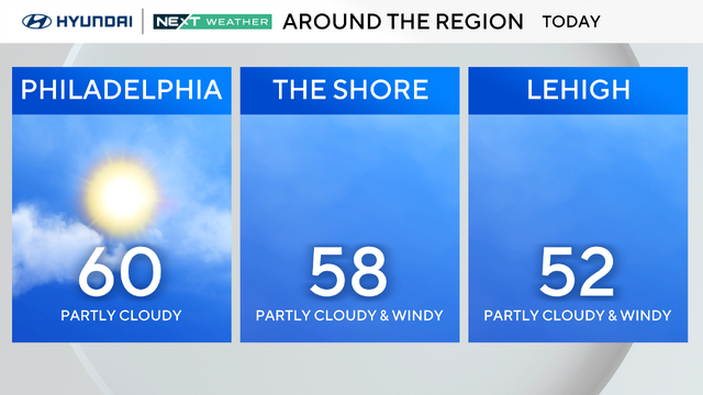
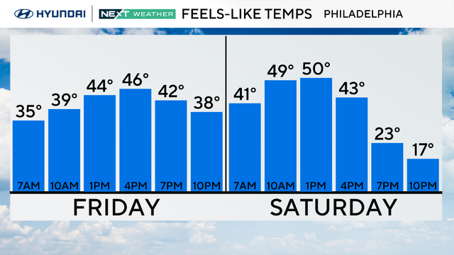
The lion of winter comes roaring back in with windchills reaching the 20s by early evening Saturday.
There will be plenty of sunshine to go around the Delaware Valley, but the breezes will kick up, gusting to 30 mph at times.
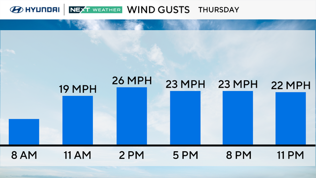
Wednesday's high of 61 degrees in Philadelphia was the official first 60-degree or higher day of the year.
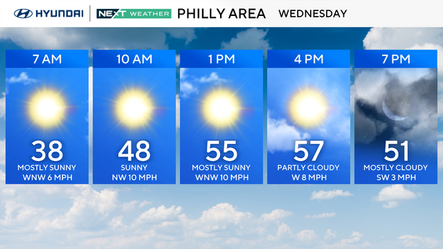
The Philadelphia region will see a sun-filled sky and unseasonably warm weather on Wednesday.
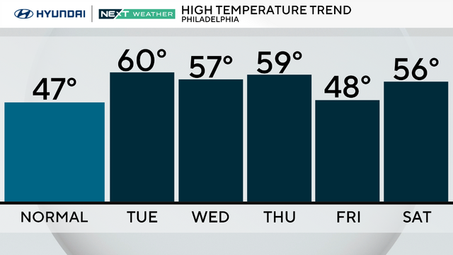
After a sunny and mild day on Monday, we'll be pushing the 60 degree mark on Tuesday in the Philadelphia region with the help of some southerly winds.
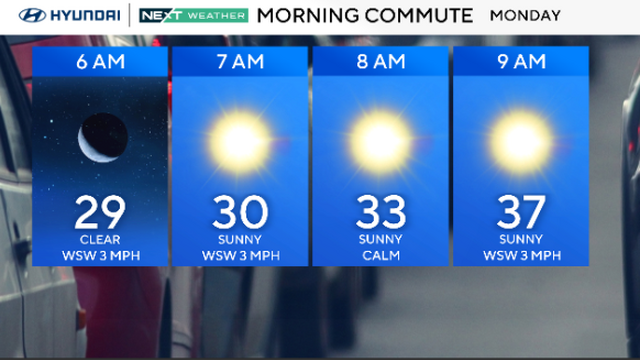
Temperatures will climb into the 50s on Monday with plenty of sunshine, and from here on out we'll see above-average highs throughout the week.
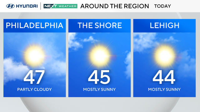
Sunday will signal the start of a warm-up, with more seasonable temperatures in the afternoon.
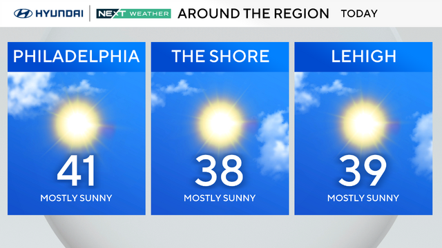
After another brutally cold week, we'll finally rebound a bit on Saturday and by Sunday the temps should be near normal.
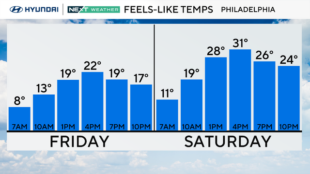
Skies will clear out to make way for sunny but cold weather Friday in the Philadelphia area.
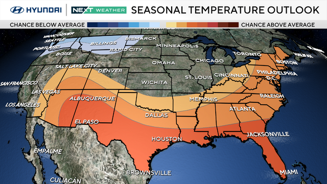
March 1 will usher in spring. Hours of daylight are already increasing and common sense would lead us all to believe temperatures will be rising as well.
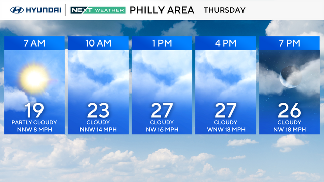
Thursday will be a breezy and very cold day in the Philadelphia region after a major winter storm moved south of our area and dumped up to a foot of snow in Virginia.