Heavy rain moving into North Texas Thursday
There is a level 2/4 risk for flooding from DFW toward the Red River counties.
Watch CBS News
There is a level 2/4 risk for flooding from DFW toward the Red River counties.
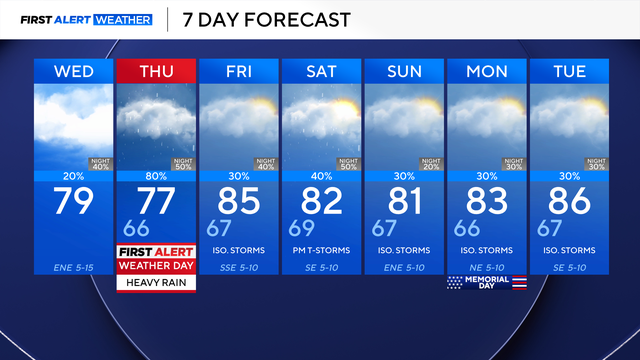
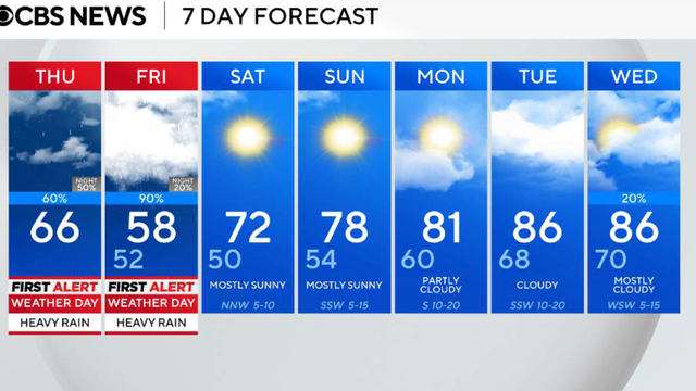
Thursday is a First Alert Weather Day due to the threat of heavy rain and non-severe thunderstorms.
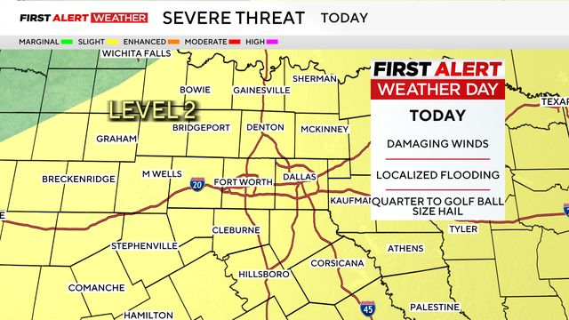
A First Alert Weather Day is in effect for the day, with expected impacts to include damaging winds, localized flooding, and hail.
Monday will be hot, breezy and cloudy.

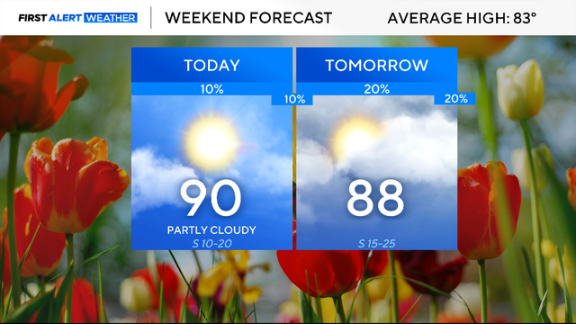
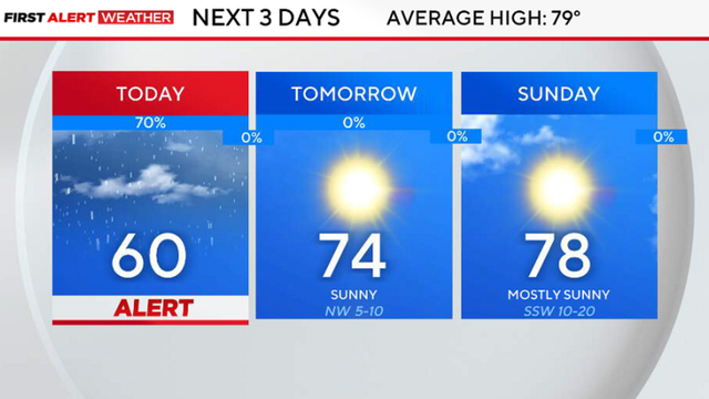
While most of North Texas will remain dry for Sunday, expect things to change to start the work week.
Now is time to prepare for severe storms and have a plan.

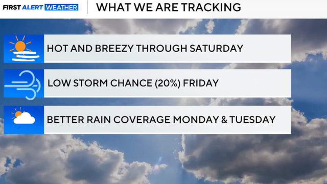
Friday will be warm and windy with increasing humidity.
After Wednesday's high of 91 at DFW, highs are expected around 92 Thursday afternoon.
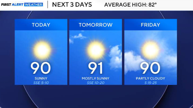
Skies will stay mostly sunny with quiet weather continuing under high pressure.
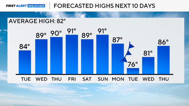
Looking ahead to the rest of the workweek, the warming trend continues. A high-pressure ridge builds in; expect highs to return to near 90 on Wednesday.
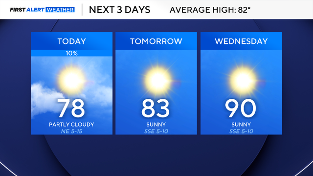
A quiet and warm weather pattern is settling into North Texas through the workweek as highs climb back into the upper 80s and lower 90s.
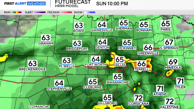
Storms turned severe to the south west of DFW on Sunday night, dropping tennis ball-sized hail in some places.
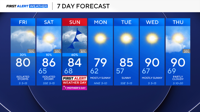
Make sure you have an indoor plan for Mother's Day celebrations on Sunday!
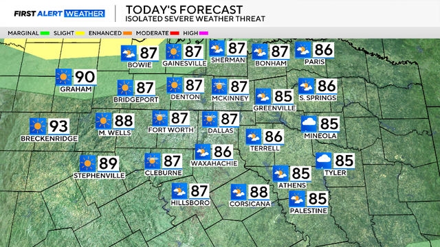
There have been some changes to the forecast, especially regarding the chance of severe weather.
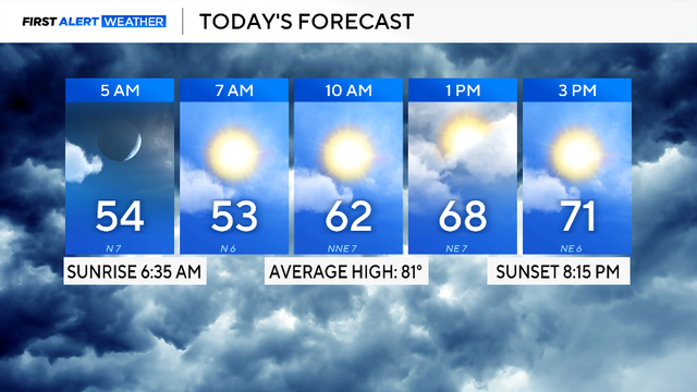
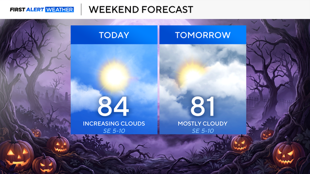
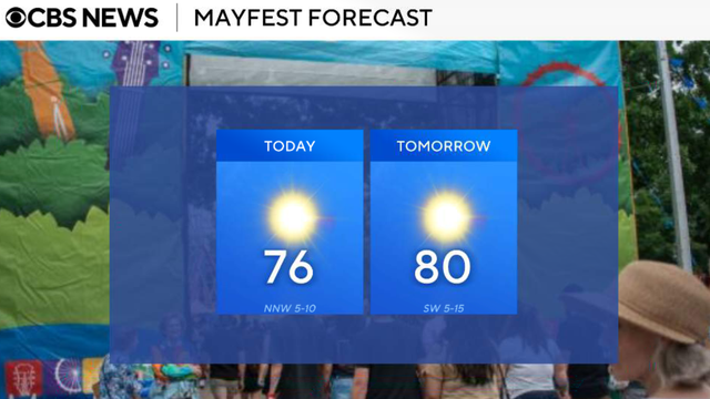
Expect more clouds than sunshine, but temperatures will be warmer than on Wednesday, with highs in the mid-70s across DFW.
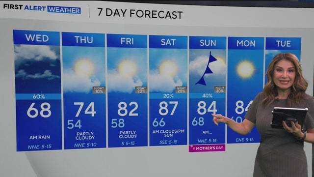
Temperatures quickly rebound into the 80s on Friday and stay above average into the weekend. There is a chance for isolated storms on Mother's Day as a cold front moves through, but don't cancel any outdoor plans just yet. More from Nelly Carreño.
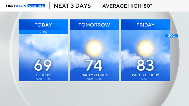
The cold front responsible for bringing us these cooler temperatures is stalling out to our south and as a result there are better chances there to see a shower or spot storm.

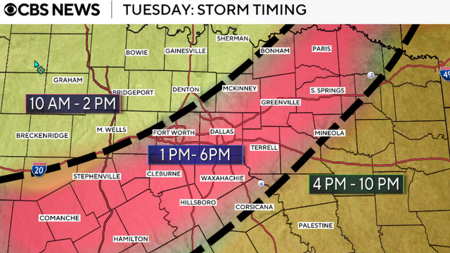
We didn't wake up to rain, but expect storm chances as the evening gets underway.

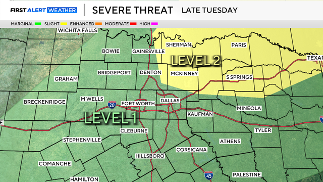
Tuesday will be a First Alert Weather Day with late-day storms in the forecast.
Rain chances also return for next weekend.
We could see storms in the Dallas-Fort Worth area in the middle of the coming week.
Thunderstorm activity will be limited on Friday, so this is mainly a rain event, not severe weather.
Showers and a few storms will develop late Thursday morning into the afternoon.
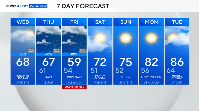
We'll deal with rounds of heavy rain, starting Thursday afternoon and evening. That rain picks up as we get into Friday.

Multiple tornadoes, massive hail and damaging winds tore through North Texas, leaving injuries and major destruction behind.