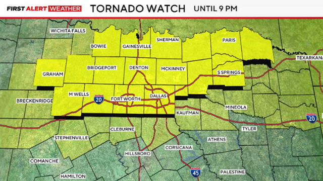
After severe storms, North Texas cools down with more rain chances later this week
The weather will quiet down overnight and cool down on Wednesday, with cloudy skies and highs in the 70s.
Watch CBS News
The weather will quiet down overnight and cool down on Wednesday, with cloudy skies and highs in the 70s.
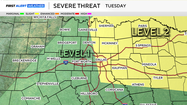
Tuesday will be a First Alert Weather Day due to the potential for strong to severe storms areawide.
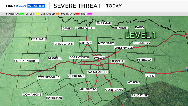
The Storm Prediction Center now has a slight risk for some of the same counties that were impacted by the storms Saturday night.
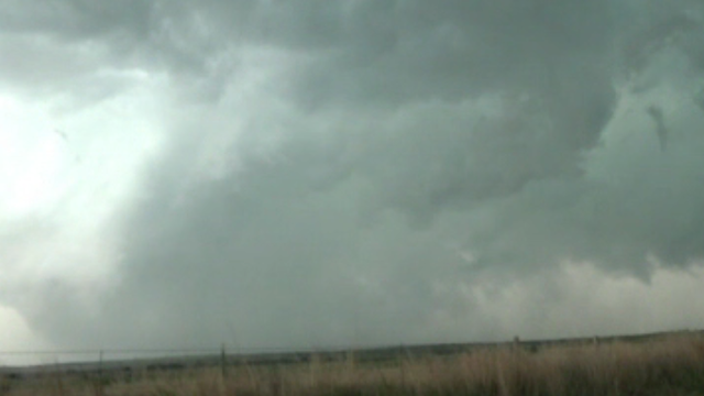
Parker County said one person has died as a result of the storms on Saturday night.
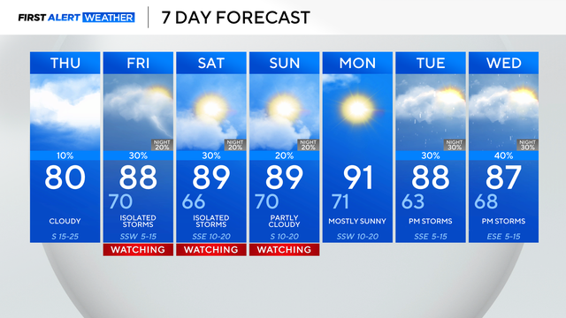
There is a slim 10% chance of an isolated strong-to-severe storm north and west of the metroplex, but with a strong CAP in place, it should remain dry Thursday.

On Thursday, skies will be brighter, temperatures will be warmer, and it will be breezier.

Overnight, rain will become more scattered. Most areas will trend quieter, but we can't rule out a few leftover showers.

Showers and some rumbles of thunder return and likely will impact the morning commute on Tuesday.

Temperatures this week will warm-up by midweek and our rain chances will return to the forecast.
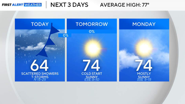
So far, the biggest impact has not been widespread severe weather, but strong, gusty winds.
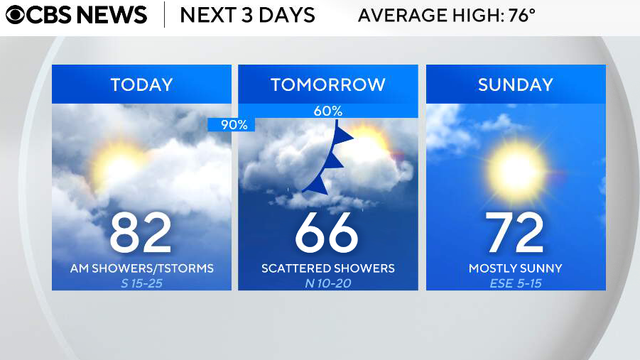
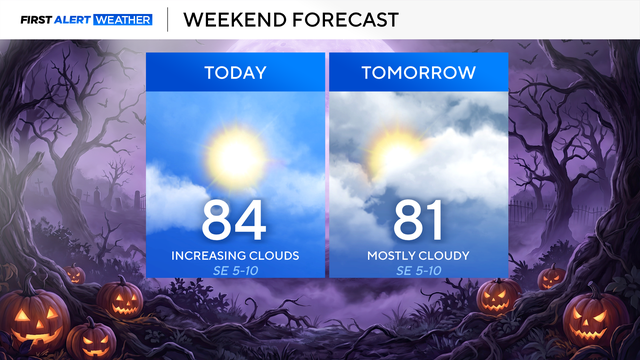
Mostly cloudy skies are in store on Friday, with highs in the low 80s and wind gusts up to 35 mph.
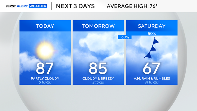
North Texas will see a nice break from any rain before chances quickly return late Friday to Saturday.
Looking ahead to Thursday and Friday, it's mainly quiet and warm.
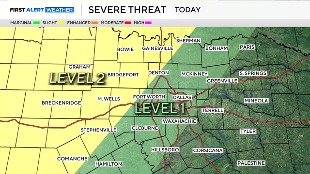
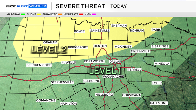
Large hail and damaging winds would be the main threats as storms may develop starting Tuesday evening and Wednesday.

"We did not expect what was going to happen," Edward Eastland said.
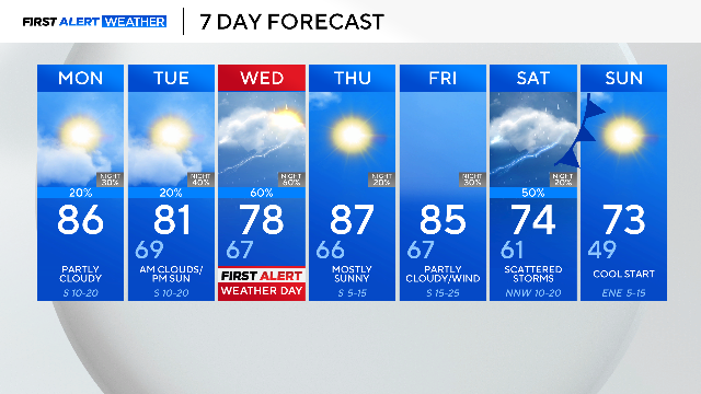
Monday, April 13, will be mostly dry with only a small 20% chance of an isolated shower or storm.
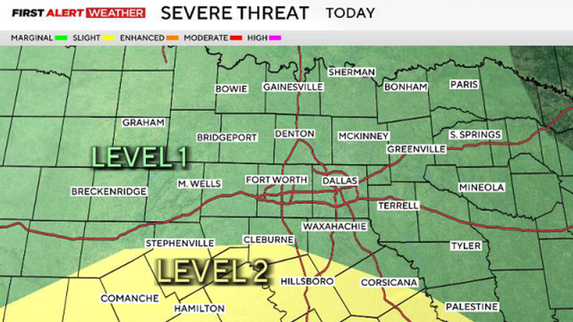
The severe weather potential is looking to take place in the afternoon through the evening.
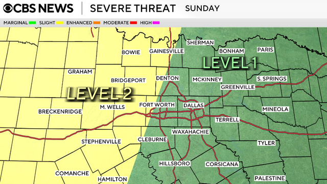
There will be a few sub-severe showers & storms Saturday afternoon. The potential for strong to severe storms is increasing on Sunday & then again Tuesday & Wednesday.

Thursday will be the final rain-free day in North Texas for the next week.

Expect clearer skies by Wednesday afternoon with warmer temperatures close to the 80-degree mark.

Our first chance for rain returns on Friday afternoon.
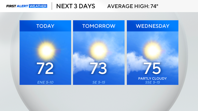
Highs will be just a few degrees above the average of 74° at 72°. Expect highs to climb back above average by Wednesday.

An active weather pattern returns by the end of the week due to a southerly wind, increase in moisture, as well as a few different disturbances,

Severe storms and heavy rain are expected in North Texas late Friday into Saturday, with flooding and strong winds possible.
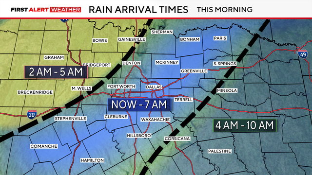
The main threats will be heavy rain, flooding, and ponding on roadways.