Cold front will increase severe weather threat Tuesday; cooler midweek expected for North Texas


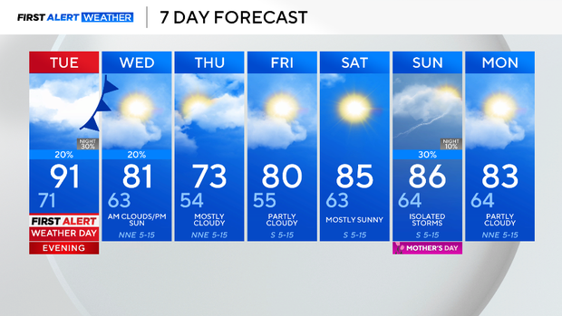
May the 4th be with you! It's been a lovely and dry Monday across North Texas. An isolated storm may fire up in the evening along the Red River, but most of the area will stay dry.
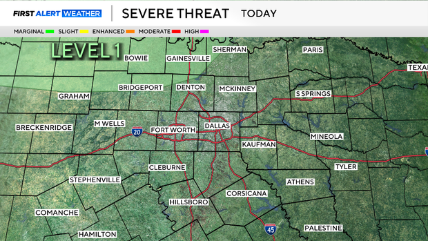
The risk for strong to severe storms is a level 1 out of 5 threat Monday night, according to the Storm Prediction Center.
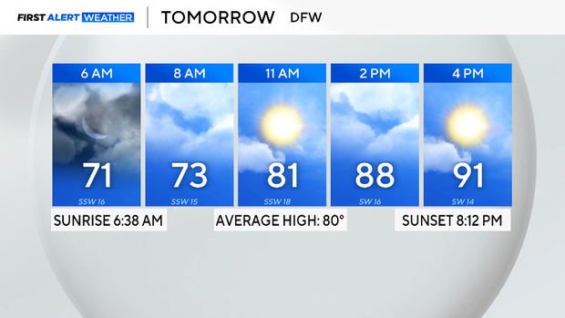
Tuesday, expect a cloudy and warm start to the day. Temperatures will be in the low 70s heading out the door and quickly climb into the 90s in the afternoon. Compressional heating will take place ahead of an approaching cold front.
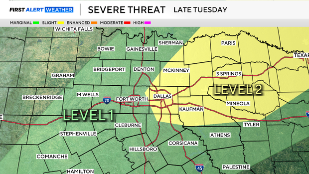
A First Alert Weather Day is in effect due to the potential of severe weather. The risk is conditional based on a capping inversion. However, considering the atmospheric conditions, if there are storms that ignite, they could be very strong, producing large hail, damaging winds and even a tornado.
The SPC has issued a level 2 out of 5 threat for Dallas and cities to the northeast. Now is the time to prepare.
The cold front will eventually stall over central Texas, creating another risk of severe weather on Wednesday. As of now, there is a scattered threat of severe weather to the east of I-35 and south of I-20 in the afternoon and evening.
After the front moves through, cooler temperatures will settle in. The rest of the week will be dry and warmer than normal. Next chance of rain is on Mother's Day.