Severe threat diminishing as rain and showers move east across DFW


Storms are gradually shifting south and southeast while weakening overnight. A few lingering showers and thunderstorms remain possible after midnight.
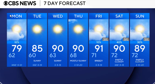
Monday
It will be a very pleasant day with decreasing clouds, lower humidity, and highs mainly in the mid to upper 70s. North northeast wind 5 to 10 mph.
Tuesday
Tuesday will be a beautiful day with seasonable temperatures. Sunny and pleasant with lower humidity early in the day, then a gradual return to southerly winds during the afternoon. Highs climb into the low 80s with comfortable morning temperatures in the upper 50s to low 60s.
Wednesday:
Much warmer with abundant sunshine and breezy south winds returning. Afternoon highs will climb into the upper 80s to near 90 degrees with humidity beginning to increase again.
Thursday- Sunday:
Lots of sunshine & dry conditions with highs in the upper 80s to low 90s.