Severe storm chances return to North Texas this week. What we're tracking


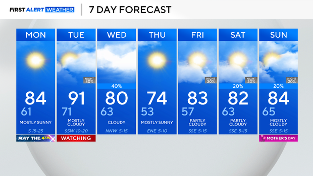
What a great early May weekend. Highs Sunday topped out in the low 80s with light winds and low humidity, along with sunshine. Some high clouds started coming in from the west at the close of the day, a sign that Saturday's high-pressure system overhead has moved off to the east. Expect partly cloudy skies both Monday and Tuesday.
Monday is the "May the 4th be with you" day in honor of Star Wars. Warm and windy that day is (as Yoda would say):

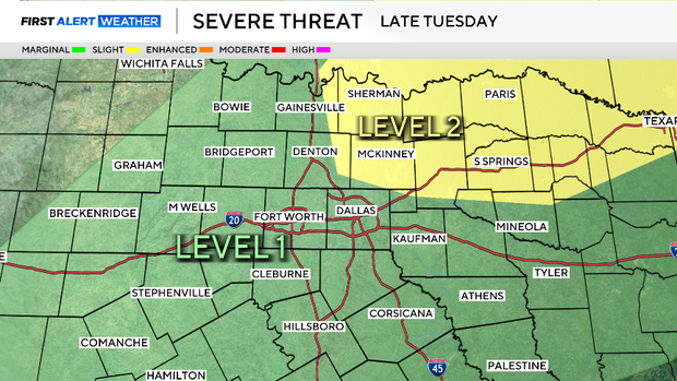
The next round of storms is in the forecast on Cinco de Mayo (Tuesday). A cold front arrives just as the day ends between 6 pm and 8pm, triggering a line of storms. These storms could produce large hail, damaging winds along with the risk of tornadoes. The threat is highest from DFW and east, especially in Collin and Hunt counties up to the Red River.
There is a very conditional chance that earlier in the afternoon the dryline to our west could also trigger some severe weather at the western edge of the area.
Storms could be around Wednesday morning and continue in the afternoon across our southeast counties. The next round of storms looks to show up on Mother's Day weekend.