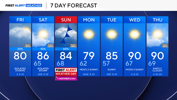
Chance of showers, storms increases Mother's Day weekend across North Texas


Some North Texans woke to thunderstorms Friday morning, mainly across Denton and Collin counties.
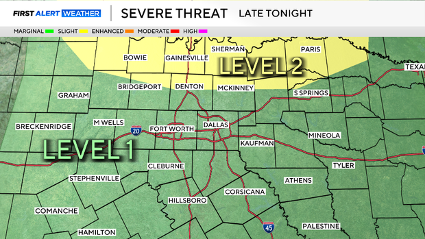
Rain chances decrease by Friday afternoon. However, attention shifts north into Oklahoma Friday evening, where thunderstorms are expected to develop along a stalled cold front.
Some of those storms may organize into a line and move south toward North Texas late Friday night. The strongest storms are expected to remain closer to Oklahoma, but a few isolated strong storms could survive into the northern counties, especially near and north of US-380.
The main concern with this activity would be damaging winds, although isolated hail cannot be ruled out. Storms are expected to weaken as they move farther south into weaker atmospheric support.
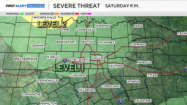
Looking ahead to Saturday, the morning starts with some clouds, then there will be sunshine in the afternoon. A few isolated storms may attempt to develop well west of North Texas near a dryline during the late afternoon and evening hours.
Most of that activity should remain west and north of the Dallas-Fort Worth Metroplex, although a stray shower or storm cannot be completely ruled out across our northwestern counties late in the day. Temperatures climb into the upper 80s, with warm, humid conditions returning.
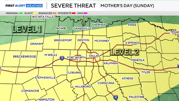
For Mother's Day (Sunday), a First Alert Weather Day is in effect due to an increased threat of severe weather. Most of the viewing area is under a level 2/5 risk for severe storms, with large hail being the main threat, along with damaging winds. The day will not be a washout.
The morning and midday should remain dry through the early afternoon. Brunch plans for mom will be just fine. By the afternoon and into the evening, a cold front will move in, increasing the chance for strong to severe storms areawide.
The storms push out of the area by midnight Monday, and it will be a dry and cooler start to the workweek. The humidity will drop, bringing a refreshing start on Tuesday morning in the 50s – before temperatures quickly heat up throughout the week.