Temperatures in the 80s and 90s return as a midweek warm up spreads across North Texas


After a wet Mother's Day with radar indicating some areas having picked up over 3" of rain, Monday started off much drier.
Monday night, expect mostly clear skies and cool temperatures with lows falling back to around 60 degrees. Winds will become light and calm overnight.
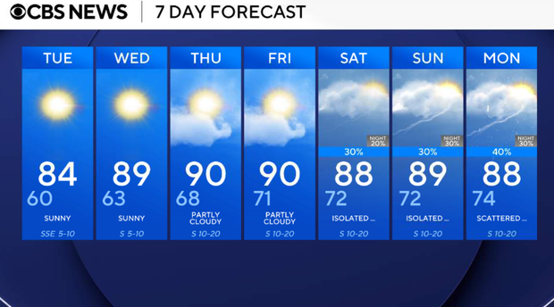
The below-average temperatures are short-lived, as they quickly climb back above average on Tuesday. Expect sunny and warmer weather with highs near 83 degrees. Winds gradually turn southerly during the afternoon as Gulf moisture slowly begins returning.
The 90s return on Wednesday, bringing back that summerlike warmth to the area. Humidity will increase throughout the week, but the workweek remains dry.
Thursday will be mostly sunny, breezy, and warmer with highs climbing into the low 90s. South winds increase to 5 to 15 mph with gusts approaching 20 mph at times.
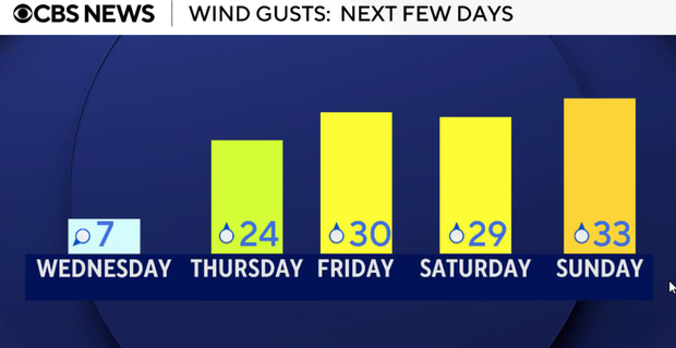
Friday will end out the week warm, breezy, and humid with highs around 90 degrees. South winds increase to 10 to 20 mph with gusts up to 30 mph.
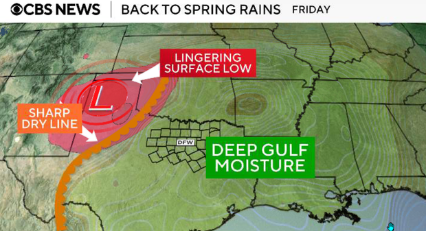
The next chance for scattered afternoon storms returns on Saturday, and the Storm Prediction Center has highlighted parts of North Texas under a slight risk of severe weather. While it is still too soon to nail down specifics and timing, it looks like a late afternoon/early evening timeframe for now.
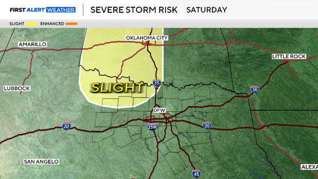
Right now, rain coverage appears isolated, with only around a 20% - 30% chance for showers and thunderstorms both days. Temperatures stay warm with highs in the upper 80s through the weekend.