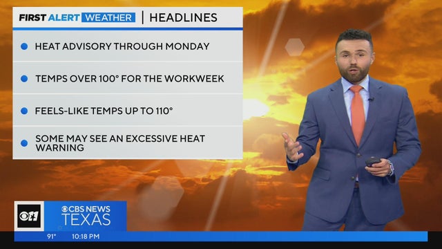
North Texas sees first 100°+ day amid heat advisory
More heat is on the way throughout this week. Temperatures are expected to stay at 100° or greater, so make sure you take precautions to avoid heat stroke or heat exhaustion.
Watch CBS News
More heat is on the way throughout this week. Temperatures are expected to stay at 100° or greater, so make sure you take precautions to avoid heat stroke or heat exhaustion.
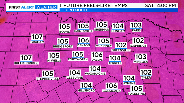
The heat advisory has been extended until 8:00 p.m. Sunday. That may be upgraded to an excessive heat warning as temperatures will feel closer to 115 degrees Sunday – Wednesday next week.
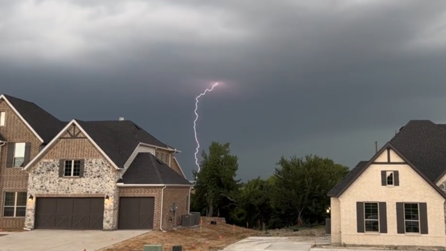
Storms are starting to develop over parts of North Texas. Gusty winds and small hail along with significant lightning are the main threats.

There is currently enough capacity to meet the forecasted demand, ERCOT says.

Four hours southeast of the tiny town of Matador, where a severe storm killed at least four people, the cleanup continues in Sanger.
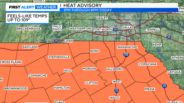
A heat advisory is in effect for counties south of I-20 Thursday from 1 p.m. until 8 p.m. CBS News Texas is also tracking a few isolated storms Thursday and Friday.
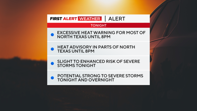
The heat alerts for North Texas are set to expire at 8 p.m., but we've got the chance for some strong-to-severe storms overnight into early Thursday morning.

At 5 p.m. Tuesday, DFW tied a record high heat index (feels like temperature) of 117°. The record was originally set on June 27, 1980.

Heading into Father's Day weekend not only do we have to be concerned with the heat and humidity, but the threat for severe storms looms once again for Saturday evening.

Strong to severe storms have kept North Texans on their toes this week, with large hail pelting some areas and a tornado claiming three people's lives in Perryton, about 115 miles northeast of Amarillo.

On Friday, we'll see mostly sunny skies and hot conditions. Highs will be in the mid-to-upper 90s but it will feel like the triple digits.

After nearly a week of severe weather in North Texas, the summer heat is set to arrive.

A new severe thunderstorm watch was issued for parts of North Texas, including all of Dallas-Fort Worth. The watch goes through 10 p.m. Wednesday.

Between 2 a.m. and 8 a.m., we have the potential of another round of strong to severe storms with large hail and damaging winds being the biggest concern.

The Better Business Bureau of North Central Texas said any weather event will bring about unscrupulous contractors.
Be weather aware as you are heading out. Severe Thunderstorms are possible around North Texas today.
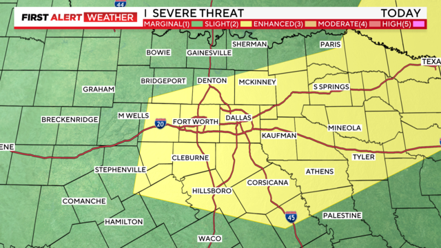
Several parts of North Texas saw severe storms Sunday evening.

In temperatures like this, heat exhaustion and heat strokes are real concerns.
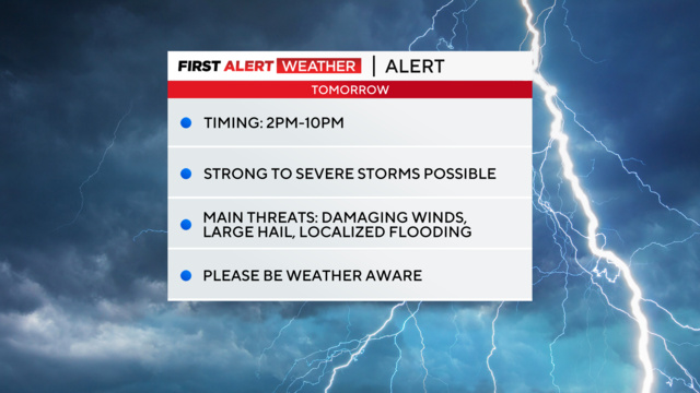
The Severe Thunderstorm Watch issued for Dallas and Tarrant counties has been dropped.
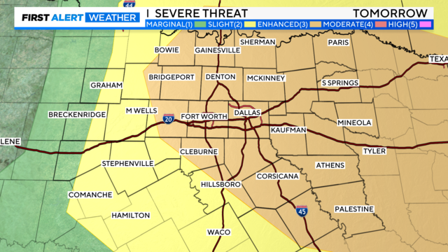
Large to very large hail, wind gusts of 65-plus mph, localized flooding/flash flooding and an isolated tornado are all possible.

An early round of storms building from West Texas could carry over Sunday afternoon and evening
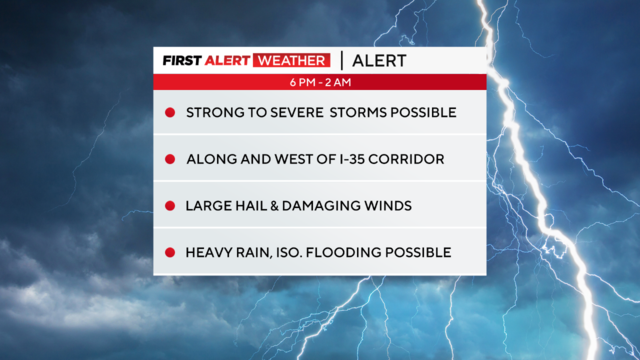
This evening, North Texas is under a weather alert for the threat of large hail and damaging winds. The tornado threat is small, but not zero.

Storms are starting to form west of the DFW Metroplex, and some are turning severe.

Storms that develop will be capable of producing large hail (egg or tennis ball-sized), damaging winds and an isolated tornado or two.
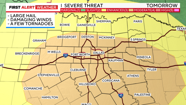
Stay aware of your plans for late afternoon – all modes of severe weather are possible including large hail and damaging winds.